

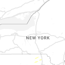
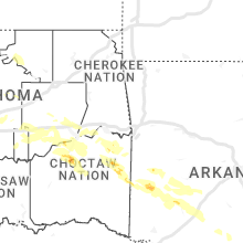
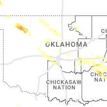
Hail Map for Monday, August 7, 2023

Number of Impacted Households on 8/7/2023
0
Impacted by 1" or Larger Hail
0
Impacted by 1.75" or Larger Hail
0
Impacted by 2.5" or Larger Hail
Square Miles of Populated Area Impacted on 8/7/2023
0
Impacted by 1" or Larger Hail
0
Impacted by 1.75" or Larger Hail
0
Impacted by 2.5" or Larger Hail


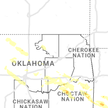


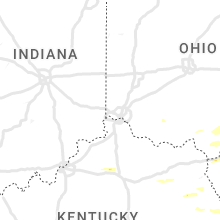


Cities Most Affected by Hail Storms of 8/7/2023
| Hail Size | Demographics of Zip Codes Affected | ||||||
|---|---|---|---|---|---|---|---|
| City | Count | Average | Largest | Pop Density | House Value | Income | Age |
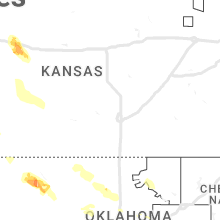
| Grinnell, KS | 8 | 1.91 | 2.50 | 1 | $45k | $40.4k | 50.2 |
| Bowling Green, VA | 5 | 3.00 | 4.75 | 15 | $98k | $35.9k | 43.7 |
| Colby, KS | 4 | 2.38 | 4.00 | 13 | $79k | $37.3k | 35.7 |
| Staunton, VA | 3 | 2.08 | 2.50 | 266 | $95k | $36.5k | 43.4 |
| Earlysville, VA | 3 | 2.00 | 2.50 | 136 | $195k | $64.9k | 47.7 |
| Leoti, KS | 3 | 1.75 | 1.75 | 2 | $56k | $33.3k | 39.7 |
| Gove, KS | 3 | 1.75 | 1.75 | 0 | $15k | $32.2k | 50.5 |
| Clear Spring, MD | 1 | 4.00 | 4.00 | 86 | $124k | $49.4k | 42.5 |
| Wallace, KS | 2 | 1.75 | 1.75 | 1 | $11k | $27.5k | 49.1 |
| Albright, WV | 2 | 1.75 | 1.75 | 27 | $56k | $26.0k | 43.0 |
| Chadron, NE | 2 | 1.75 | 1.75 | 8 | $62k | $37.4k | 28.6 |
| Swoope, VA | 1 | 3.00 | 3.00 | 26 | $115k | $32.1k | 47.2 |
| Oakley, KS | 1 | 2.75 | 2.75 | 5 | $57k | $32.4k | 45.3 |
| Palisade, NE | 1 | 2.75 | 2.75 | 2 | $33k | $24.9k | 48.5 |
| Mc Dowell, VA | 1 | 2.50 | 2.50 | 3 | $87k | $28.0k | 53.1 |
| Bird City, KS | 1 | 2.00 | 2.00 | 1 | $43k | $27.5k | 46.6 |
| Williamsport, MD | 1 | 2.00 | 2.00 | 308 | $116k | $42.1k | 43.8 |
| Burlington, CO | 1 | 2.00 | 2.00 | 6 | $85k | $34.7k | 38.4 |
| Smithsburg, MD | 1 | 2.00 | 2.00 | 191 | $130k | $48.4k | 39.9 |
| Waynesboro, VA | 1 | 2.00 | 2.00 | 436 | $97k | $37.5k | 41.0 |
| Monterey, VA | 1 | 2.00 | 2.00 | 6 | $85k | $30.6k | 52.8 |
| Fort Huachuca, AZ | 1 | 1.75 | 1.75 | 87 | $70k | $32.3k | 22.7 |
| Hyannis, NE | 1 | 1.75 | 1.75 | 0 | $33k | $31.8k | 49.9 |
| Ashby, NE | 1 | 1.75 | 1.75 | 0 | $29k | $47.2k | 46.2 |
| Dighton, KS | 1 | 1.75 | 1.75 | 0 | $46k | $35.1k | 47.3 |
| Weskan, KS | 1 | 1.75 | 1.75 | 1 | $52k | $32.9k | 34.3 |
| Saint Francis, KS | 1 | 1.75 | 1.75 | 2 | $50k | $31.4k | 51.1 |
| Spotsylvania, VA | 1 | 1.75 | 1.75 | 112 | $0k | $0.0k | 39.4 |
| Seymour, TX | 1 | 1.75 | 1.75 | 4 | $34k | $24.5k | 47.1 |
| Hagerstown, MD | 1 | 1.75 | 1.75 | 839 | $99k | $33.7k | 37.3 |
| Garden City, KS | 1 | 1.75 | 1.75 | 44 | $85k | $38.1k | 30.2 |
| Lakeside, NE | 1 | 1.75 | 1.75 | 0 | $33k | $30.8k | 39.9 |
| Mc Donald, KS | 1 | 1.75 | 1.75 | 1 | $23k | $30.6k | 52.6 |
Hail and Wind Damage Spotted on 8/7/2023
Filter by Report Type:Hail ReportsWind Reports
States Impacted
Tennessee, Ohio, West Virginia, Kentucky, Mississippi, Alabama, Maryland, Pennsylvania, Georgia, Wyoming, Virginia, North Carolina, New York, South Carolina, Arizona, Nebraska, Colorado, Kansas, District of Columbia, Delaware, New Mexico, Florida, New Jersey, South Dakota, Texas, Oklahoma, Utah, IdahoTennessee
| Local Time | Report Details |
|---|---|
| 9:18 AM CDT | Trained weather spotter estimated 65 mph wind in fayette county TN, 31.1 miles ENE of Memphis, TN |
| 12:09 PM EDT | A few trees dow in campbell county TN, 28.8 miles NW of Knoxville, TN |
| 11:36 AM CDT | Trees and numerous limbs dow in bedford county TN, 52.2 miles SE of Nashville, TN |
| 11:44 AM CDT | Tree down on a house at bond st. & hills chapel rd.... multiple trees down in other parts of the cit in coffee county TN, 52.4 miles NW of Chattanooga, TN |
| 11:44 AM CDT | *** 1 inj *** tree down on a vehicle at woodbury hwy/gnat hill r in coffee county TN, 53.9 miles SE of Nashville, TN |
| 12:49 PM EDT | A few trees dow in campbell county TN, 31.2 miles NNW of Knoxville, TN |
| 11:50 AM CDT | Tree down along mcferrin s in cannon county TN, 46.4 miles ESE of Nashville, TN |
| 11:58 AM CDT | Muultiple trees down at crisp springs rd/hwy 7 in warren county TN, 51.7 miles NNW of Chattanooga, TN |
| 11:58 AM CDT | Severe thunderstorm winds downed numerous trees and powerlines across warren county. about 60 reports of traffic hazards have been received with numerous power outages in warren county TN, 50.8 miles NNW of Chattanooga, TN |
| 11:58 AM CDT | Roof blown off of a barn on castle street near senator jerry cooper hwy just northwest of micminnville. no injuries. time is estimate in warren county TN, 54.7 miles NNW of Chattanooga, TN |
| 11:58 AM CDT | Tree fell on a house in the 1300 block of mike muncy road. house sustained heavy structural damage. no injuries. time estimate in warren county TN, 59.5 miles NNW of Chattanooga, TN |
| 12:02 PM CDT | Several trees down at skyline dr. and redbud trai in white county TN, 61.6 miles N of Chattanooga, TN |
| 12:13 PM CDT | Large number of trees down near fall creek falls state par in van buren county TN, 42.4 miles N of Chattanooga, TN |
| 1:25 PM EDT | A few trees dow in union county TN, 18.5 miles NNE of Knoxville, TN |
| 12:30 PM CDT | Numerous trees and power lines down across the count in sequatchie county TN, 23.4 miles N of Chattanooga, TN |
| 12:30 PM CDT | Numerous trees and power lines down countywid in bledsoe county TN, 39.3 miles N of Chattanooga, TN |
| 12:30 PM CDT | 53 knot gust measured at kcs in cumberland county TN, 62.7 miles W of Knoxville, TN |
| 1:30 PM EDT | Large tree dow in hamblen county TN, 31.2 miles ENE of Knoxville, TN |
| 1:31 PM EDT | Numerous trees down in morristow in hamblen county TN, 39.1 miles ENE of Knoxville, TN |
| 12:41 PM CDT | Tree dow in overton county TN, 71.8 miles WNW of Knoxville, TN |
| 12:42 PM CDT | Tree dow in overton county TN, 70.3 miles WNW of Knoxville, TN |
| 1:45 PM EDT | Numerous trees and power lines down across the southern portion of the count in morgan county TN, 35.9 miles W of Knoxville, TN |
| 1:45 PM EDT | Large tree dow in rhea county TN, 35.6 miles NNE of Chattanooga, TN |
| 12:49 PM CDT | 4420 customers without power in crossville and across mainly western cumberland c in cumberland county TN, 62.7 miles W of Knoxville, TN |
| 12:50 PM CDT | Power lines down... tree on top of a car near martha washington r in fentress county TN, 63.5 miles WNW of Knoxville, TN |
| 1:50 PM EDT | Several trees and power lines dow in knox county TN, 15.6 miles WSW of Knoxville, TN |
| 12:55 PM CDT | Multiple trees down in new hop in marion county TN, 20 miles W of Chattanooga, TN |
| 2:05 PM EDT | Multiple trees and power lines dow in mcminn county TN, 41.4 miles NE of Chattanooga, TN |
| 2:10 PM EDT | Multiple trees and power lines dow in mcminn county TN, 48.8 miles NE of Chattanooga, TN |
| 2:10 PM EDT | Multiple trees and power lines down. trees down on vehicles... and on home in jefferson county TN, 28.4 miles E of Knoxville, TN |
| 2:15 PM EDT | Tree and roof damage in the neighborhoods north and south of i-40 along lovell roa in knox county TN, 13.3 miles WSW of Knoxville, TN |
| 2:19 PM EDT | Asos station kcha chattanooga airpor in hamilton county TN, 6.3 miles E of Chattanooga, TN |
| 2:30 PM EDT | Numerous trees down along beals chapel road... reported roof damage as well. time estimated from rada in loudon county TN, 20 miles SW of Knoxville, TN |
| 2:30 PM EDT | Multiple trees and powerlines down across the county. time estimated from rada in greene county TN, 44.3 miles SW of Bristol, TN |
| 2:30 PM EDT | Multiple trees down in maryville/alcoa. time estimated from rada in blount county TN, 15.2 miles SSW of Knoxville, TN |
| 2:36 PM EDT | Asos station ktys knoxville mcghee tyso in blount county TN, 10.2 miles SSW of Knoxville, TN |
| 2:39 PM EDT | Several trees down mainly in south unicoi count in unicoi county TN, 43.3 miles SSW of Bristol, TN |
| 2:45 PM EDT | Multiple trees down across the county... and reported on house off green hill road. time estimated from rada in jefferson county TN, 25.5 miles E of Knoxville, TN |
| 2:46 PM EDT | Tree dow in union county TN, 27 miles N of Knoxville, TN |
| 2:47 PM EDT | Report from mping: trees uprooted or snapped; roof blown of in washington county TN, 33.8 miles SSW of Bristol, TN |
| 2:49 PM EDT | Numerous trees and power lines down in polk count in polk county TN, 52.6 miles ENE of Chattanooga, TN |
| 2:50 PM EDT | Tree on hous in sevier county TN, 28.7 miles ESE of Knoxville, TN |
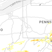
Ohio
| Local Time | Report Details |
|---|---|
| 11:11 AM EDT | Power lines down due to tree damag in athens county OH, 61.4 miles N of Charleston, WV |
| 11:17 AM EDT | Quarter sized hail reported near Coolville, OH, 61.3 miles N of Charleston, WV, trained spotter estimated hail sized up to one inch in diameter. |
| 2:00 PM EDT | Tree reported down covering half of state route 9 in lawrence county OH, 56.6 miles WNW of Charleston, WV |
| 2:20 PM EDT | Tree reported dow in lawrence county OH, 45.5 miles WNW of Charleston, WV |
| 2:30 PM EDT | Porch blown off a house. time estimated from rada in gallia county OH, 44 miles NW of Charleston, WV |
| 2:45 PM EDT | Powerline pole down near intersection of georges creek road and polecat roa in gallia county OH, 46 miles NW of Charleston, WV |
West Virginia
| Local Time | Report Details |
|---|---|
| 11:15 AM EDT | Multiple trees and downed power lines reported in the vienna are in wood county WV, 67.1 miles N of Charleston, WV |
| 11:40 AM EDT | Tree on power line in wood county WV, 65.1 miles N of Charleston, WV |
| 12:17 PM EDT | Tree dow in putnam county WV, 12.2 miles WNW of Charleston, WV |
| 12:35 PM EDT | Tree down on barrcut roa in roane county WV, 38.1 miles NNE of Charleston, WV |
| 12:42 PM EDT | Trees down and power ou in marion county WV, 40 miles NNW of Elkins, WV |
| 12:45 PM EDT | Tree down on vineyard ridge roa in roane county WV, 25 miles NE of Charleston, WV |
| 12:46 PM EDT | Trees down on fairmont rd in monongalia county WV, 46.6 miles NNW of Elkins, WV |
| 12:47 PM EDT | Several trees down in marion county WV, 49.5 miles NNW of Elkins, WV |
| 12:48 PM EDT | Several trees down in monongalia county WV, 52.4 miles S of Pittsburgh, PA |
| 1:02 PM EDT | Trees down in monongalia county WV, 43.2 miles NNW of Elkins, WV |
| 1:07 PM EDT | Tree fell and hit power lines on dogtown roa in preston county WV, 37.7 miles N of Elkins, WV |
| 1:07 PM EDT | Tree and power lines donw on q road and m roa in preston county WV, 39.1 miles N of Elkins, WV |
| 1:09 PM EDT | Trees down in preston county WV, 40.5 miles N of Elkins, WV |
| 1:10 PM EDT | Multiple trees down in preston county WV, 39.8 miles N of Elkins, WV |
| 1:10 PM EDT | Quarter sized hail reported near Berkeley Springs, WV, 85.8 miles SSW of State College, PA |
| 1:11 PM EDT | Trees down on gladesville road in preston county WV, 37.7 miles N of Elkins, WV |
| 1:11 PM EDT | Multiple trees down in preston county WV, 43.3 miles N of Elkins, WV |
| 1:15 PM EDT | Tree down obstructing roadwa in harrison county WV, 45.4 miles NW of Elkins, WV |
| 1:15 PM EDT | Quarter sized hail reported near Kingwood, WV, 38.2 miles N of Elkins, WV |
| 1:17 PM EDT | Tree down obstructing roadwa in harrison county WV, 41.4 miles NW of Elkins, WV |
| 1:18 PM EDT | Photos show downed trees that also caused minor roof damage to home near kingwood. time estimated based on rada in preston county WV, 38.7 miles NNE of Elkins, WV |
| 1:18 PM EDT | Ping Pong Ball sized hail reported near Kingwood, WV, 40.6 miles NNE of Elkins, WV |
| 1:20 PM EDT | Quarter sized hail reported near Walker, WV, 57.2 miles NNE of Charleston, WV, photo of quarter size hail. |
| 1:20 PM EDT | Multiple trees dow in preston county WV, 40.6 miles NNE of Elkins, WV |
| 1:22 PM EDT | Quarter sized hail reported near Gassaway, WV, 52 miles ENE of Charleston, WV, 1 inch hail observed in gassaway. |
| 1:22 PM EDT | Tree down obstructing roadwa in harrison county WV, 40.9 miles NW of Elkins, WV |
| 1:22 PM EDT | Ping Pong Ball sized hail reported near Albright, WV, 42.6 miles NNE of Elkins, WV, pictures provided. |
| 1:23 PM EDT | Ping Pong Ball sized hail reported near Albright, WV, 42.8 miles NNE of Elkins, WV, windows and vehicles damged by hail along coal lick road. pictures provided. |
| 1:23 PM EDT | Tree reported dow in braxton county WV, 50.7 miles WSW of Elkins, WV |
| 1:24 PM EDT | Half Dollar sized hail reported near Albright, WV, 44.3 miles NNE of Elkins, WV, pictures provided. |
| 1:24 PM EDT | Golf Ball sized hail reported near Albright, WV, 44.6 miles NNE of Elkins, WV |
| 1:25 PM EDT | Golf Ball sized hail reported near Albright, WV, 46.6 miles NNE of Elkins, WV |
| 1:36 PM EDT | Trees reported down on chapel r in braxton county WV, 52.3 miles WSW of Elkins, WV |
| 1:40 PM EDT | Several trees down with biggest concentration around centerville are in tyler county WV, 68.3 miles NW of Elkins, WV |
| 1:45 PM EDT | Trees down blocking both directions of bens run roa in braxton county WV, 44.4 miles WSW of Elkins, WV |
| 1:47 PM EDT | Power line dow in upshur county WV, 24.2 miles WSW of Elkins, WV |
| 1:50 PM EDT | Numerous trees down on all roads exiting frankli in pendleton county WV, 34 miles SE of Elkins, WV |
| 1:54 PM EDT | Photos show snapped and uprooted trees in the area. time estimated based on rada in preston county WV, 37.7 miles N of Elkins, WV |
| 1:55 PM EDT | Tree down near intersection of alexander rd. and reger run r in upshur county WV, 23.7 miles WSW of Elkins, WV |
| 1:59 PM EDT | Trees reported down blocking shelbyville roa in upshur county WV, 23.7 miles WSW of Elkins, WV |
| 2:00 PM EDT | Ping Pong Ball sized hail reported near Barboursville, WV, 35.5 miles W of Charleston, WV, trained spotter reported 1.5 inch hail. |
| 2:05 PM EDT | Quarter sized hail reported near Huntington, WV, 41.4 miles W of Charleston, WV, doh reports quarter sized hail. |
| 2:06 PM EDT | Half Dollar sized hail reported near Barboursville, WV, 36.1 miles W of Charleston, WV |
| 2:06 PM EDT | Tree down along union road. time estimated from rada in barbour county WV, 17.7 miles NW of Elkins, WV |
| 2:08 PM EDT | Ping Pong Ball sized hail reported near Ona, WV, 32.1 miles WNW of Charleston, WV |
| 2:12 PM EDT | Tree down on gladesville road. public report remarks time of even in preston county WV, 38.4 miles N of Elkins, WV |
| 2:15 PM EDT | Trees reported down along sr 219. time estimated from rada in randolph county WV, 15.9 miles SSW of Elkins, WV |
| 2:19 PM EDT | Tree reported down on vehicle. power lines down as wel in barbour county WV, 6.9 miles NW of Elkins, WV |
| 2:20 PM EDT | Tree dow in barbour county WV, 6.9 miles NW of Elkins, WV |
| 2:21 PM EDT | Tree down across point pleasant roa in barbour county WV, 8.4 miles NW of Elkins, WV |
| 2:23 PM EDT | Quarter sized hail reported near Hedgesville, WV, 78.8 miles WNW of Baltimore, MD |
| 2:24 PM EDT | Trees down in area of valley ben in randolph county WV, 10.4 miles SSW of Elkins, WV |
| 2:27 PM EDT | Multiple roads closed in short gap due to downed trees and power line in mineral county WV, 69.9 miles NE of Elkins, WV |
| 2:34 PM EDT | A couple trees and lines down in fort ashb in mineral county WV, 58.5 miles NE of Elkins, WV |
| 2:35 PM EDT | Tree reported down near the intersection of tuscarora pike and delmar orchard roa in berkeley county WV, 74.8 miles W of Baltimore, MD |
| 2:35 PM EDT | Trees down in roadway in the area in monongalia county WV, 49.7 miles N of Elkins, WV |
| 2:36 PM EDT | Tree down on power line on manilla creek roa in putnam county WV, 13.5 miles NW of Charleston, WV |
| 2:37 PM EDT | Quarter sized hail reported near Winfield, WV, 14.6 miles NW of Charleston, WV |
| 2:39 PM EDT | Tree down along cumberland road near springfield in hampshire county WV, 71.4 miles ENE of Elkins, WV |
| 2:39 PM EDT | Tree dow in putnam county WV, 13.7 miles NNW of Charleston, WV |
| 2:39 PM EDT | County em reporting multiple trees and wires down in the harper are in pendleton county WV, 34.4 miles SE of Elkins, WV |
| 2:40 PM EDT | Tree down on dewitt roa in kanawha county WV, 9.9 miles NW of Charleston, WV |
| 2:43 PM EDT | Trees down north of north fork highway in cabins resulting in closed road in grant county WV, 34.6 miles E of Elkins, WV |
| 2:45 PM EDT | Half Dollar sized hail reported near Falling Waters, WV, 71 miles WNW of Baltimore, MD, several public reports of quarter to dollar sized hail in falling waters... wv. time estimated from radar. |
| 2:47 PM EDT | Quarter sized hail reported near Fort Ashby, WV, 70 miles NE of Elkins, WV, public reports hail up to quarter size near fort ashby. time estimated from radar. |
| 2:48 PM EDT | Multiple trees down in harma in randolph county WV, 17.5 miles E of Elkins, WV |
| 2:49 PM EDT | Tree reported down on the 1000 block of jacobs roa in berkeley county WV, 69.7 miles WNW of Baltimore, MD |
| 2:50 PM EDT | Numerous trees down in frankli in pendleton county WV, 33.6 miles SE of Elkins, WV |
| 2:50 PM EDT | Tree down on alison roa in mason county WV, 43.5 miles NW of Charleston, WV |
| 2:53 PM EDT | Tree down 3 miles south of frankli in pendleton county WV, 34 miles SE of Elkins, WV |
| 2:54 PM EDT | Tree reported dow in kanawha county WV, 3.4 miles NW of Charleston, WV |
| 2:55 PM EDT | Half Dollar sized hail reported near Charleston, WV, 12.4 miles N of Charleston, WV, report received via social media picture. |
| 3:00 PM EDT | Utility company reports power outages due to tree damag in cabell county WV, 41 miles W of Charleston, WV |
| 3:06 PM EDT | A couple trees down on different parts of welton orchard road near the grant and hardy county line in hardy county WV, 42.5 miles E of Elkins, WV |
| 3:11 PM EDT | A couple trees down in elk garde in mineral county WV, 49.2 miles NE of Elkins, WV |
| 3:15 PM EDT | Wind gust of 53 knots measured at petersburg airpor in grant county WV, 38.2 miles E of Elkins, WV |
| 3:15 PM EDT | Multiple trees down on fort gay roa in wayne county WV, 50.4 miles WSW of Charleston, WV |
| 3:19 PM EDT | Trees down across from welton par in grant county WV, 41 miles E of Elkins, WV |
| 3:20 PM EDT | Ping Pong Ball sized hail reported near Clendenin, WV, 22.1 miles NE of Charleston, WV, report received via social media picture. |
| 3:25 PM EDT | Tree down along reynolds gap road in hardy county WV, 51.1 miles ENE of Elkins, WV |
| 3:35 PM EDT | Multiple trees down from lost creek to sale in harrison county WV, 37 miles NW of Elkins, WV |
| 3:35 PM EDT | Utility company reports power outages caused by tree damage along buck fork roa in clay county WV, 40.3 miles ENE of Charleston, WV |
| 3:40 PM EDT | Tree down reporte in kanawha county WV, 10.6 miles WNW of Charleston, WV |
| 3:42 PM EDT | Photos sent of tree damag in jackson county WV, 18.3 miles NNE of Charleston, WV |
| 3:43 PM EDT | Dozens of trees down in delray. multiple wires down and power poles down as wel in hampshire county WV, 69.4 miles ENE of Elkins, WV |
| 3:44 PM EDT | 2 power lines touching and trees across hinkle ridge roa in upshur county WV, 21.7 miles WSW of Elkins, WV |
| 3:48 PM EDT | Tree down along falls road near capon bridge in hampshire county WV, 80.1 miles ENE of Elkins, WV |
| 3:49 PM EDT | Tree reported down on the 600 block of back creek valley roa in berkeley county WV, 81.3 miles W of Baltimore, MD |
| 3:50 PM EDT | Power lines down in the roadway along 7th avenue in charlesto in kanawha county WV, 3.4 miles NW of Charleston, WV |
| 3:51 PM EDT | Tree reported dow in kanawha county WV, 4.9 miles W of Charleston, WV |
| 3:52 PM EDT | Tree reported dow in kanawha county WV, 2.8 miles W of Charleston, WV |
| 3:58 PM EDT | Tree reported down on the 600 block of s queen strea in berkeley county WV, 73.7 miles W of Baltimore, MD |
| 3:58 PM EDT | Tree reported dow in kanawha county WV, 1.5 miles NNE of Charleston, WV |
| 3:58 PM EDT | Power outage caused by tree damage reported by utility compan in lincoln county WV, 43.7 miles SW of Charleston, WV |
| 4:00 PM EDT | Tree reported down on the 200 block of centre stree in berkeley county WV, 73.2 miles W of Baltimore, MD |
| 4:01 PM EDT | Power lines reported down on the 2600 block of goldmiller roa in berkeley county WV, 79.9 miles W of Baltimore, MD |
| 4:01 PM EDT | Power lines reported down on virginia ave near bowers stree in berkeley county WV, 73.7 miles W of Baltimore, MD |
| 4:03 PM EDT | Tree and power lines reported down on runnymeade road near torytown roa in berkeley county WV, 78.8 miles W of Baltimore, MD |
| 4:04 PM EDT | Powers line reported down on the 800 block of froniier driv in berkeley county WV, 78.9 miles W of Baltimore, MD |
| 4:07 PM EDT | Power lines reported down on the 600 block of gosling marsh roa in berkeley county WV, 67.7 miles W of Baltimore, MD |
| 4:16 PM EDT | Tree dow in upshur county WV, 25.1 miles WSW of Elkins, WV |
| 4:30 PM EDT | Power pole fell along steward street in bi in boone county WV, 29.1 miles S of Charleston, WV |
| 4:45 PM EDT | Tree reported down near the town of clevelan in webster county WV, 33.2 miles WSW of Elkins, WV |
| 5:21 PM EDT | Tree down in the roadwa in raleigh county WV, 41.8 miles SSE of Charleston, WV |
| 5:33 PM EDT | Numerous trees down on all roads exiting frankli in pendleton county WV, 34 miles SE of Elkins, WV |
| 5:36 PM EDT | Tree limb fell and knocked a power line down across the roadway. power pole is slanted... and another pole is on the ground. time estimated from rada in raleigh county WV, 51 miles SSE of Charleston, WV |
| 5:36 PM EDT | Tree down along power lines. power out in the are in raleigh county WV, 38.6 miles SSE of Charleston, WV |
| 5:36 PM EDT | Tree across saye lane. power lines are down. time estimated from rada in raleigh county WV, 53.3 miles SSE of Charleston, WV |
| 5:42 PM EDT | Tree down on lines. time estimated from rada in raleigh county WV, 51 miles SSE of Charleston, WV |
| 5:50 PM EDT | Multiple trees were blown down in the community of jumping branch by thunderstorm winds. some of the trees were blown down along highway in summers county WV, 60.5 miles SE of Charleston, WV |
| 5:55 PM EDT | Multiple trees were blown down in the community of bellepoint by thunderstorm wind in summers county WV, 57.9 miles WNW of Roanoke, VA |
| 5:56 PM EDT | Trees and limbs down. powerline snapped on beech run road near hinto in summers county WV, 59.8 miles WNW of Roanoke, VA |
| 6:00 PM EDT | Multiple trees were blown down by thunderstorm winds near the intersection of highway 3 and highway 1 in summers county WV, 54.1 miles WNW of Roanoke, VA |
| 6:02 PM EDT | Thunderstorm winds blew one wrist-size branch and other smaller branches dow in summers county WV, 53.2 miles WNW of Roanoke, VA |
| 6:03 PM EDT | Thunderstorm winds blew at least ten trees down at residence of spotte in summers county WV, 52.4 miles WNW of Roanoke, VA |
| 6:10 PM EDT | A large tree fell across davis street in alderson... partially landing on a hous in greenbrier county WV, 50.2 miles NW of Roanoke, VA |
| 6:21 PM EDT | A 75 foot tree was blown down... landing on an 8 by 10 trailer... carport and vehicle. time estimated from rada in greenbrier county WV, 43.7 miles NW of Roanoke, VA |
| 6:21 PM EDT | A few trees were blown down by thunderstorm winds in the hillsdale are in monroe county WV, 38.6 miles NW of Roanoke, VA |
| 6:23 PM EDT | Multiple trees were blown down by thunderstorm winds along doss shaver roa in monroe county WV, 35.6 miles NW of Roanoke, VA |
| 6:28 PM EDT | Corrects previous tstm wnd dmg report from 2 wnw gap mills. multiple trees were blown down by thunderstorm winds along doss shaver roa in monroe county WV, 35.6 miles NW of Roanoke, VA |
Kentucky
| Local Time | Report Details |
|---|---|
| 11:32 AM EDT | Quarter sized hail reported near Frankfort, KY, 54 miles ENE of Louisville, KY, mping report of quarter sized hail. |
| 11:39 AM EDT | Quarter sized hail reported near Georgetown, KY, 53.1 miles NW of Irvine, KY, another mping report of quarter sized hail. |
| 11:49 AM EDT | Trees down near the intersection of old delaplain road and anderson road. time estimated by rada in scott county KY, 49.3 miles NW of Irvine, KY |
| 12:16 PM EDT | Whitley county dispatch reported a tree down near the intersection of mckeehan crossing rd and cumberland falls hwy. time estimated from rada in whitley county KY, 56.2 miles S of Irvine, KY |
| 12:16 PM EDT | Whitley county dispatch reported a tree knocked down powerlines which in turn pulled powerlines off a house causing damage to the house. time estimated from rada in whitley county KY, 56.8 miles S of Irvine, KY |
| 12:42 PM EDT | Quarter sized hail reported near Bimble, KY, 57.2 miles S of Irvine, KY, public report of 1 inch hail was relayed via social media. time estimated from radar. |
| 1:54 PM EDT | Trees down with one tree across state route 134. time estimated off of rada in magoffin county KY, 42 miles E of Irvine, KY |
| 1:55 PM EDT | Magoffin county dispatch reported a couple down trees near the 1640 block of johnson fork near salyersville. time estimated from rada in magoffin county KY, 41.9 miles E of Irvine, KY |
| 2:18 PM EDT | Tree down across state route 2. phone and cable lines involved as wel in greenup county KY, 66.9 miles WNW of Charleston, WV |
| 2:20 PM EDT | Quarter sized hail reported near Staffordsville, KY, 62.8 miles E of Irvine, KY, quarter size hail at staffordsville at 2:20-2:25 pm. has stopped at 2:30. report from social media. |
| 2:20 PM EDT | Downed tree reported on leadingham road off state route 20 in greenup county KY, 65 miles W of Charleston, WV |
| 2:26 PM EDT | Quarter sized hail reported near Staffordsville, KY, 62.8 miles E of Irvine, KY, corrects previous hail report from staffordsville. quarter size hail at staffordsville. time estimated from radar. |
| 2:30 PM EDT | Multiple trees down in old town are in greenup county KY, 68.8 miles W of Charleston, WV |
| 3:00 PM EDT | Trees down on rt 3 in the fallsburg are in lawrence county KY, 57.3 miles WSW of Charleston, WV |
| 3:00 PM EDT | Adds to previous tstm wnd dmg report from 2 se yatesville lake state park. tree down on a house on cottonwood lane. additional house damaged... two tractor trailers tur in lawrence county KY, 58.1 miles WSW of Charleston, WV |
| 3:50 PM EDT | 911 call center had a report of a tree down over buffalo horn rd. near the intersection of rockcastle rd. time estimated via the logged call and rada in martin county KY, 55.5 miles WSW of Charleston, WV |
Mississippi
| Local Time | Report Details |
|---|---|
| 11:55 AM CDT | Tree fell on mobile home. time estimated by rada in lafayette county MS, 57.2 miles SSE of Memphis, TN |
| 12:50 PM CDT | A home lost part of its roof and sustained damage to the balcony. power lines were down in the area as wel in lee county MS, 62.9 miles WSW of Florence, AL |
| 1:40 PM CDT | Trees and power lines down on old hwy 6 near cason roa in monroe county MS, 45.1 miles NNE of Starkville, MS |
Alabama
| Local Time | Report Details |
|---|---|
| 12:22 PM CDT | Quarter sized hail reported near Huntsville, AL, 65.3 miles E of Florence, AL, report from mping: quarter (1.00 in.). |
| 12:32 PM CDT | Report from mping: 3-inch tree limbs broken; power poles broke in madison county AL, 62.8 miles E of Florence, AL |
| 12:58 PM CDT | A tree was knocked down at mp 317 on natchez trace parkway. time estimated by rada in colbert county AL, 21.3 miles WSW of Florence, AL |
| 1:09 PM CDT | Social media report of a tree down on a power line at a residenc in marion county AL, 47.9 miles SSW of Florence, AL |
| 1:10 PM CDT | A power pole was knocked down or leaning at 2295 river road. time estimate in colbert county AL, 5.5 miles E of Florence, AL |
| 1:11 PM CDT | A large tree was knocked down onto a home at 6350 willow road. time estimated by rada in dekalb county AL, 30.8 miles SW of Chattanooga, TN |
| 1:12 PM CDT | Tree down on power lines in the sardis area. winds estimated to be sub-severe. time estimated from rada in etowah county AL, 59.9 miles NE of Birmingham, AL |
| 1:14 PM CDT | A tree was knocked down on posey loop at highway 247. time estimated by rada in colbert county AL, 14.3 miles SW of Florence, AL |
| 1:40 PM CDT | Trees down on cornwall ave and highway 273 in cedar bluf in cherokee county AL, 59.5 miles SSW of Chattanooga, TN |
| 1:52 PM CDT | Reports of trees down around the ashridge communit in winston county AL, 39.5 miles SSE of Florence, AL |
| 2:12 PM CDT | Numerous trees down in the addison and arley areas. time estimated via rada in winston county AL, 50.1 miles SE of Florence, AL |
| 2:27 PM CDT | Trees were knocked down at 437 day gap road. time estimated by rada in cullman county AL, 40.1 miles N of Birmingham, AL |
| 2:27 PM CDT | Trees were knocked down at 1030 u.s. highway 278 west. time estimated by rada in cullman county AL, 45.8 miles N of Birmingham, AL |
| 2:27 PM CDT | Trees and a barn were knocked down at new cut road at rb orr road. time estimated by rada in morgan county AL, 46 miles SE of Florence, AL |
| 2:29 PM CDT | Several trees down on glennwood rd near morri in jefferson county AL, 14.5 miles N of Birmingham, AL |
| 2:30 PM CDT | Windows were blown out in the public library... with damage to shelves and books inside. time estimated by rada in cullman county AL, 45.5 miles N of Birmingham, AL |
| 2:30 PM CDT | Trees were knocked down at 112 veterans drive. time estimated by rada in cullman county AL, 44.1 miles N of Birmingham, AL |
| 2:30 PM CDT | Around 11500 without power due to outages from the thunderstorm in cullman county AL, 46.9 miles N of Birmingham, AL |
| 2:30 PM CDT | Large trees uprooted at highway 157 at st. joseph drive. time estimated by rada in cullman county AL, 47.7 miles N of Birmingham, AL |
| 2:35 PM CDT | Tree down on county highway in blount county AL, 32.3 miles NNE of Birmingham, AL |
| 2:36 PM CDT | Trees down on highway 69 between jasper and cullman county line. time estimate in walker county AL, 31.9 miles NW of Birmingham, AL |
| 2:36 PM CDT | Trees were knocked down at 3820 cr 509. time estimated by rada in cullman county AL, 32.5 miles N of Birmingham, AL |
| 2:36 PM CDT | Trees were knocked down at 5688 cr 1435. time estimated by rada in cullman county AL, 52.4 miles N of Birmingham, AL |
| 2:38 PM CDT | Trees were knocked down at 1425 cr 110. time estimated by rada in cullman county AL, 34.3 miles NNW of Birmingham, AL |
| 2:46 PM CDT | Tree down on miller rd near snea in blount county AL, 49.4 miles NNE of Birmingham, AL |
| 2:46 PM CDT | Tree down on high rock rd. time estimated via rada in blount county AL, 32 miles NNE of Birmingham, AL |
| 2:47 PM CDT | A social media report/photo of a tree damaging a vehicle off of highway 231 in south arab. time estimated by rada in marshall county AL, 57.3 miles NNE of Birmingham, AL |
| 2:50 PM CDT | Tree down on power lines on old walker r in blount county AL, 32.9 miles NNE of Birmingham, AL |
| 2:51 PM CDT | Tree down on greens chapel rd. time estimated via rada in blount county AL, 32.9 miles NNE of Birmingham, AL |
| 2:53 PM CDT | Trees were knocked down onto the road along thompson falls road. time estimated by rada in marshall county AL, 58.7 miles NNE of Birmingham, AL |
| 2:53 PM CDT | A tree was knocked down on the road at 4570 pleasant hill road.time estimated by rada in marshall county AL, 58.1 miles NNE of Birmingham, AL |
| 2:55 PM CDT | Several trees down on roadways in the gaylesville and broomtown areas. time estimated via rada in cherokee county AL, 51.4 miles SSW of Chattanooga, TN |
| 2:55 PM CDT | Trees were knocked down across the road along askia road. time estimated by rada in marshall county AL, 56.5 miles NNE of Birmingham, AL |
| 2:55 PM CDT | Trees and powerlines were knocked down at frygap mountain road and warrenton road. time estimated by rada in marshall county AL, 57.2 miles NNE of Birmingham, AL |
| 2:55 PM CDT | A tree was knocked down on the road at pleasant grove road and kelley drive. time estimated by rada in marshall county AL, 60.1 miles NNE of Birmingham, AL |
| 2:57 PM CDT | Trees were knocked down with total blockage at 4570 pleasant hill road. time estimated by rada in marshall county AL, 58.1 miles NNE of Birmingham, AL |
| 2:59 PM CDT | Trees and power lines down on multiple roads in the sardis city are in etowah county AL, 60.8 miles NE of Birmingham, AL |
| 3:01 PM CDT | Tree down on holliday drive in the highland lake are in blount county AL, 34.9 miles NE of Birmingham, AL |
| 3:02 PM CDT | Trees were knocked down into the roadway along baltimore avenue. time estimated by rada in marshall county AL, 61.9 miles NE of Birmingham, AL |
| 3:02 PM CDT | A tree was knocked down on the road at martling road and wright road. time estimated by rada in marshall county AL, 64 miles NNE of Birmingham, AL |
| 3:02 PM CDT | Trees and powerlines were knocked down on wyeth lane. time estimated by rada in marshall county AL, 63.1 miles NNE of Birmingham, AL |
| 3:02 PM CDT | A tree was knocked down onto red barn road and highway 205. time estimated by rada in marshall county AL, 61.2 miles NNE of Birmingham, AL |
| 3:04 PM CDT | A tree was knocked down on the road at 662 kykendall road. time estimated by rada in marshall county AL, 63.3 miles NE of Birmingham, AL |
| 3:06 PM CDT | Trees and power lines down around ashvill in st. clair county AL, 38.7 miles NE of Birmingham, AL |
| 3:06 PM CDT | Trees and power lines down in the steele area. time estimated via rada in st. clair county AL, 45.6 miles NE of Birmingham, AL |
| 3:06 PM CDT | Multiple trees were knocked down on the road at 753 davis road. time estimated by rada in marshall county AL, 65.3 miles NE of Birmingham, AL |
| 3:08 PM CDT | Several reports of trees and power lines down in the springville area. time estimated via rada in st. clair county AL, 26.1 miles NE of Birmingham, AL |
| 3:08 PM CDT | Large tree down at mt. olive first baptis in jefferson county AL, 11.5 miles NNW of Birmingham, AL |
| 3:08 PM CDT | Tree on highway 411 at slacklan in cherokee county AL, 68.3 miles SSW of Chattanooga, TN |
| 3:08 PM CDT | Trees were knocked down on the bridge along hustleville road. time estimated by rada in marshall county AL, 65.4 miles NNE of Birmingham, AL |
| 3:08 PM CDT | A tree was knocked down on the road alabama highway 68 at arley lacey road. time estimated by rada in marshall county AL, 66.3 miles NE of Birmingham, AL |
| 3:08 PM CDT | Trees knocked down blocking road at bakers chapel and mcdonald roa in marshall county AL, 69.2 miles SW of Chattanooga, TN |
| 3:12 PM CDT | Structural damage and roof was blown off of a mobile home on the 300 block of cr 124. time estimated by rada in dekalb county AL, 66.3 miles NE of Birmingham, AL |
| 3:14 PM CDT | Reports of trees in roadways on the north side of pell city. time estimated via rada in st. clair county AL, 32 miles ENE of Birmingham, AL |
| 3:15 PM CDT | Trees were knocked down at highway 68 at cr 24. time estimated by rada in dekalb county AL, 65.9 miles SW of Chattanooga, TN |
| 3:18 PM CDT | Trees were knocked down across the road at cr 34 at cr 9. time estimated by rada in dekalb county AL, 64.9 miles SW of Chattanooga, TN |
| 3:19 PM CDT | Social media report of numerous trees down at a residence in cropwel in st. clair county AL, 31.3 miles E of Birmingham, AL |
| 3:30 PM CDT | Multiple trees and power lines down in the jacksonville are in calhoun county AL, 63.8 miles ENE of Birmingham, AL |
| 3:38 PM CDT | Multiple trees and power lines down in the piedmont are in calhoun county AL, 71.1 miles W of Atlanta, GA |
| 3:38 PM CDT | Tree in roadway on highway 411 at county road 1 in cherokee county AL, 66.3 miles WNW of Atlanta, GA |
| 3:40 PM CDT | A tree was knocked down onto a house and car on cr 104. time estimated by rada in dekalb county AL, 48.6 miles SW of Chattanooga, TN |
| 3:50 PM CDT | Tree on house on highway 68 near sand rock. time estimated via rada in cherokee county AL, 62.5 miles SSW of Chattanooga, TN |
| 3:53 PM CDT | Several reports of trees and power lines down in hefli in cleburne county AL, 69.4 miles W of Atlanta, GA |
| 3:57 PM CDT | Several trees down in the piney woods are in cleburne county AL, 60 miles W of Atlanta, GA |
| 4:04 PM CDT | Reports of trees down in the abernathy area near the state line. time estimated via rada in cleburne county AL, 59.1 miles W of Atlanta, GA |
| 4:13 PM CDT | Trees down in the area of county road 82 and highway 431. winds estimated to be sub-sever in randolph county AL, 56.1 miles N of Auburn, AL |
Maryland
| Local Time | Report Details |
|---|---|
| 1:38 PM EDT | Multiple trees down on friendsville road. road close in garrett county MD, 53.8 miles NNE of Elkins, WV |
| 1:43 PM EDT | Trees and power lines down on gravelly run roa in garrett county MD, 50.4 miles NNE of Elkins, WV |
| 1:43 PM EDT | Trees down on foster roa in garrett county MD, 46 miles NNE of Elkins, WV |
| 1:48 PM EDT | Quarter sized hail reported near Clear Spring, MD, 75.8 miles WNW of Baltimore, MD |
| 1:48 PM EDT | Multiple trees and wires down in accident. roads close in garrett county MD, 56.2 miles NNE of Elkins, WV |
| 1:48 PM EDT | Dung hill road closed due to downed tree in garrett county MD, 58.5 miles NNE of Elkins, WV |
| 1:48 PM EDT | Ping Pong Ball sized hail reported near Swanton, MD, 51 miles NE of Elkins, WV, a couple of public reports of half dollar to ping pong ball sized hail in the north glade area of swanton... md. time estimated from radar. |
| 1:50 PM EDT | Quarter sized hail reported near Clear Spring, MD, 75.8 miles WNW of Baltimore, MD |
| 1:52 PM EDT | Numerous trees down in mchenry and friendsvill in garrett county MD, 51.3 miles NNE of Elkins, WV |
| 1:53 PM EDT | Half Dollar sized hail reported near Clear Spring, MD, 75.8 miles WNW of Baltimore, MD |
| 1:54 PM EDT | Grapefruit sized hail reported near Clear Spring, MD, 75.3 miles WNW of Baltimore, MD, public reported and sent image of approximately 4 inch hail north of clear spring... md. time estimated from radar. |
| 2:02 PM EDT | Multiple trees... wires... and considerable tree damage in the vicinity of md-135 between swanton and luke. multiple side roads closed due to downed trees and wire in garrett county MD, 55.2 miles NE of Elkins, WV |
| 2:04 PM EDT | Savage river road closed due to multiple downed tree in garrett county MD, 59 miles NE of Elkins, WV |
| 2:12 PM EDT | Considerable tree damage in lonaconing. many roads impassibl in allegany county MD, 64.3 miles NE of Elkins, WV |
| 2:18 PM EDT | Several roads closed between mount savage and frostburg toward the garrett county lin in allegany county MD, 74.4 miles NE of Elkins, WV |
| 2:20 PM EDT | Downed trees near the intersection of millstone rd and big spring roa in washington county MD, 79 miles WNW of Baltimore, MD |
| 2:23 PM EDT | Multiple reports of downed trees in la val in allegany county MD, 74.8 miles NE of Elkins, WV |
| 2:25 PM EDT | Quarter sized hail reported near Hagerstown, MD, 66.5 miles WNW of Baltimore, MD, quarter sized hail observed at hagerstown regional airport. |
| 2:27 PM EDT | Multiple trees... wires... and branches down in cumberland resulting in road closure in allegany county MD, 76.7 miles NE of Elkins, WV |
| 2:55 PM EDT | Reports of trees down between flintstone and oldtown. several roads close in allegany county MD, 80.2 miles NE of Elkins, WV |
| 2:58 PM EDT | Multiple roads closed in brandywine due to downed tree in prince georges county MD, 42.7 miles SSW of Baltimore, MD |
| 3:00 PM EDT | Hen Egg sized hail reported near Williamsport, MD, 68.2 miles WNW of Baltimore, MD, public reports 2 inch hail in williamsport. time estimated from radar. |
| 3:08 PM EDT | Trees down in little orleans. roads close in allegany county MD, 85 miles SSW of State College, PA |
| 3:14 PM EDT | Quarter sized hail reported near Hagerstown, MD, 64.8 miles WNW of Baltimore, MD |
| 3:14 PM EDT | Golf Ball sized hail reported near Hagerstown, MD, 61.4 miles WNW of Baltimore, MD |
| 3:15 PM EDT | Quarter sized hail reported near Hagerstown, MD, 64.3 miles WNW of Baltimore, MD |
| 3:17 PM EDT | Quarter sized hail reported near Hagerstown, MD, 65.4 miles WNW of Baltimore, MD |
| 3:20 PM EDT | Ping Pong Ball sized hail reported near Hagerstown, MD, 58.9 miles WNW of Baltimore, MD |
| 3:20 PM EDT | Tree down on mapleville road near interstate 7 in washington county MD, 58.9 miles WNW of Baltimore, MD |
| 3:32 PM EDT | Hen Egg sized hail reported near Smithsburg, MD, 57.8 miles WNW of Baltimore, MD, public reports 2 inch hail near smithsburg... and stated the hail had melted some before being measured. time estimated from radar. |
| 3:51 PM EDT | One tree down due to thunderstorm winds at the intersection of apple church road and carol stree in frederick county MD, 48.3 miles WNW of Baltimore, MD |
| 3:55 PM EDT | Dozens of reports of downed trees... power lines... and power poles in clear spring. many roads impassibl in washington county MD, 75.1 miles WNW of Baltimore, MD |
| 4:03 PM EDT | Several reports of downed trees... power lines... and branches in between hagerstown... clear spring... and williamspor in washington county MD, 65.4 miles WNW of Baltimore, MD |
| 4:26 PM EDT | Storm damage reported in frederick county MD, 52.3 miles WNW of Baltimore, MD |
| 4:28 PM EDT | Trees down onto roadway near the intersection of md 76 and mumma ford roa in frederick county MD, 44.6 miles WNW of Baltimore, MD |
| 4:28 PM EDT | Tree down on a powerline at 3900 block of wistman l in frederick county MD, 51.5 miles WNW of Baltimore, MD |
| 4:31 PM EDT | Trees down on jefferson pike near us-1 in frederick county MD, 49.5 miles W of Baltimore, MD |
| 4:34 PM EDT | One tree down due to thunderstorm winds along the 6700 block of oakridge roa in frederick county MD, 38 miles WNW of Baltimore, MD |
| 4:34 PM EDT | One tree down due to thunderstorm winds at the intersection of rt. 550 and graceham roa in frederick county MD, 45.3 miles WNW of Baltimore, MD |
| 4:34 PM EDT | Frederick county md summary: 66 calls for roadway hazards... 53 calls for trees in roadway... 24 calls for wires dow in frederick county MD, 42.4 miles WNW of Baltimore, MD |
| 4:39 PM EDT | Multiple trees down in woodsboro. power lines also dow in frederick county MD, 41 miles WNW of Baltimore, MD |
| 4:42 PM EDT | One tree down onto a house due to thunderstorm winds along the 6700 block of oakridge roa in frederick county MD, 38 miles WNW of Baltimore, MD |
| 4:45 PM EDT | Multiple trees down due thunderstorm winds at the interection of ed mcclain road and md-7 in frederick county MD, 35.8 miles W of Baltimore, MD |
| 4:48 PM EDT | Dozens of trees down in and around middlebur in carroll county MD, 38.2 miles WNW of Baltimore, MD |
| 4:48 PM EDT | Trees and wires down due to thunderstorm winds along the 200 block of springdale roa in carroll county MD, 32.6 miles NW of Baltimore, MD |
| 4:49 PM EDT | Transformer and wires down due to thunderstorm winds along the 2400 block of marston roa in frederick county MD, 44.5 miles WNW of Baltimore, MD |
| 4:51 PM EDT | Trees down on littlestown pik in carroll county MD, 35 miles NW of Baltimore, MD |
| 4:52 PM EDT | Several large trees down due to thunderstorm winds at the intersection of md-97 and mayberry roa in carroll county MD, 35.7 miles NW of Baltimore, MD |
| 4:56 PM EDT | Utility pole down near the intersection of maryland 140 and maryland 97 in carroll county MD, 26.8 miles NW of Baltimore, MD |
| 4:57 PM EDT | Tree down near carroll community colleg in carroll county MD, 27 miles WNW of Baltimore, MD |
| 4:57 PM EDT | Multiple power line poles down onto md rt 140 near gorsuch roa in carroll county MD, 27.6 miles NW of Baltimore, MD |
| 4:57 PM EDT | Multiple trees down in manchester. some onto car in carroll county MD, 29.6 miles NNW of Baltimore, MD |
| 4:57 PM EDT | Large tree onto roadway near the 24000 block of river roa in montgomery county MD, 49.1 miles WSW of Baltimore, MD |
| 4:58 PM EDT | Several trees down due to thunderstorm winds along md-97 at the carroll and howard county lin in carroll county MD, 22.5 miles WNW of Baltimore, MD |
| 4:58 PM EDT | Numerous trees down near the intersection of white oak court and ebbvale road in carroll county MD, 31.6 miles NNW of Baltimore, MD |
| 4:59 PM EDT | Tree down across frederick road near intersection with state route 9 in howard county MD, 22.1 miles W of Baltimore, MD |
| 4:59 PM EDT | Powerline polw down onto tree near the intersection of ralph dell road and cape horn roa in carroll county MD, 28.4 miles NNW of Baltimore, MD |
| 5:01 PM EDT | Several trees and wires down due to thunderstorm winds across the manchester are in carroll county MD, 29.3 miles NNW of Baltimore, MD |
| 5:01 PM EDT | A line of one dozen 100 foot pine trees snapped halfway u in carroll county MD, 31.6 miles NNW of Baltimore, MD |
| 5:01 PM EDT | Tree onto a hous in carroll county MD, 20.6 miles WNW of Baltimore, MD |
| 5:01 PM EDT | Multiple trees down in eldersburg. wires also down. roads remain closed due to considerable tree debri in carroll county MD, 29.3 miles NW of Baltimore, MD |
| 5:01 PM EDT | Tree down on house on the 19000 block of york road in baltimore county MD, 25.6 miles N of Baltimore, MD |
| 5:02 PM EDT | *** 1 inj *** a large tree fell onto a home injuring one person. time estimated from rada in carroll county MD, 26.2 miles NNW of Baltimore, MD |
| 5:04 PM EDT | Multiple trees down in finksburg. wires also dow in carroll county MD, 20.4 miles NW of Baltimore, MD |
| 5:04 PM EDT | Bachmans valley road closed due to multiple downed trees. nearby roads also closed due to downed tree in carroll county MD, 31.6 miles NNW of Baltimore, MD |
| 5:04 PM EDT | Dozens of trees down in the lineboro area along the state lin in carroll county MD, 34 miles NNW of Baltimore, MD |
| 5:06 PM EDT | *** 2 inj *** multiple trees down causing multiple injuries in the area of md-97 and md-140 in westminste in carroll county MD, 29 miles NW of Baltimore, MD |
| 5:07 PM EDT | Dozens of reports of downed trees in hampstead. many roads close in carroll county MD, 26.4 miles NNW of Baltimore, MD |
| 5:07 PM EDT | Tree down on liberty road to the west of lyons mill roa in baltimore county MD, 14.6 miles WNW of Baltimore, MD |
| 5:09 PM EDT | Multiple trees down in glenwood and lisbo in howard county MD, 23.6 miles W of Baltimore, MD |
| 5:09 PM EDT | Storm damage reported in carroll county MD, 31.3 miles NNW of Baltimore, MD |
| 5:12 PM EDT | Multiple trees down along with considerable tree damage in freelan in baltimore county MD, 28.4 miles N of Baltimore, MD |
| 5:12 PM EDT | Tree and wires down on old hundred road at peach roa in montgomery county MD, 43.8 miles WSW of Baltimore, MD |
| 5:19 PM EDT | A couple trees down onto a house. several other trees and wires down nearb in harford county MD, 22.9 miles N of Baltimore, MD |
| 5:19 PM EDT | Report of tree down onto a car on southbound exit 36 off i-83 onto old york roa in baltimore county MD, 29 miles N of Baltimore, MD |
| 5:20 PM EDT | *** 1 inj *** large tree down on a home in the 2900 block of troyer roa in harford county MD, 23.8 miles N of Baltimore, MD |
| 5:23 PM EDT | Large tree down onto structure near the 12300 block of timber grove road in baltimore county MD, 15.2 miles NW of Baltimore, MD |
| 5:25 PM EDT | Tree onto home in the 900 block of grandin avenu in montgomery county MD, 32.4 miles WSW of Baltimore, MD |
| 5:25 PM EDT | Several trees down near the intersection of mcdonogh road and winands roa in baltimore county MD, 11.5 miles WNW of Baltimore, MD |
| 5:27 PM EDT | Tree down on sharon road at rock spring roa in harford county MD, 25.1 miles NNE of Baltimore, MD |
| 5:30 PM EDT | Tree down onto structure near the 1300 block of sudvale roa in baltimore county MD, 8.5 miles NW of Baltimore, MD |
| 5:33 PM EDT | Large tree down on a home on glendale lan in harford county MD, 23.9 miles NE of Baltimore, MD |
| 5:38 PM EDT | Powerline pole down onto roadway near the intersection of md 543 and prospect mill roa in harford county MD, 24.4 miles NE of Baltimore, MD |
| 5:38 PM EDT | Tree down onto roadway near the intersection of md 543 and doyle roa in harford county MD, 29.3 miles NNE of Baltimore, MD |
| 5:44 PM EDT | Several trees down onto roadway near the intersection of md 136 and northern dancer driv in harford county MD, 27.9 miles NE of Baltimore, MD |
| 5:49 PM EDT | Trees down along york rd in northern baltimore count in baltimore county MD, 26.3 miles N of Baltimore, MD |
| 5:50 PM EDT | Couple of trees uprooted and lots of limbs down in cecil county MD, 38.5 miles NE of Baltimore, MD |
| 5:55 PM EDT | A couple trees down in midland per trained spotte in allegany county MD, 66.4 miles NE of Elkins, WV |
| 5:59 PM EDT | Reports of trees down on md-273 in northern cecil between rising sun to fair hill. trees reported down on nearby roads as wel in cecil county MD, 47.3 miles ENE of Baltimore, MD |
| 6:04 PM EDT | Tree down onto roadway near the intersection of md 7 and mechanics valley roa in cecil county MD, 41.7 miles ENE of Baltimore, MD |
| 6:07 PM EDT | Tree down onto roadway near the intersection of md 273 and appleton roa in cecil county MD, 51.2 miles NE of Baltimore, MD |
| 6:17 PM EDT | Trees down in davidsonville on multiple roads. power lines down as wel in anne arundel county MD, 25.6 miles S of Baltimore, MD |
| 6:33 PM EDT | Trees down in chestertown... md. time estimated from rada in kent county MD, 29.5 miles E of Baltimore, MD |
| 6:40 PM EDT | Trees down in millington. time estimated from rada in kent county MD, 41.3 miles E of Baltimore, MD |
| 6:54 PM EDT | Wires down crows nest road. time estimated from rada in queen anne's county MD, 33.8 miles SE of Baltimore, MD |
| 7:20 PM EDT | Trees down on dean road. time estimated from rada in queen anne's county MD, 39.6 miles ESE of Baltimore, MD |
| 7:45 PM EDT | Abundance of trees and wires down in bozman... md. time estimated from rada in talbot county MD, 40.3 miles SSE of Baltimore, MD |
Pennsylvania
| Local Time | Report Details |
|---|---|
| 1:52 PM EDT | Quarter sized hail reported near Fort Loudon, PA, 60.3 miles S of State College, PA, spotter reports 1 inch hail. |
| 1:54 PM EDT | Fire department reports power poles and trees down across the roa in franklin county PA, 60.3 miles S of State College, PA |
| 2:10 PM EDT | Tree down over the roa in centre county PA, 9.5 miles W of State College, PA |
| 2:16 PM EDT | Multiple trees down in meyersdale. time estimated by rada in somerset county PA, 67.1 miles SE of Pittsburgh, PA |
| 2:18 PM EDT | Large tree reported down by ham operato in centre county PA, 2.2 miles SW of State College, PA |
| 2:40 PM EDT | Multiple trees down along anthony highwa in franklin county PA, 62.2 miles NW of Baltimore, MD |
| 2:42 PM EDT | Quarter sized hail reported near Centre Hall, PA, 9.8 miles ENE of State College, PA |
| 2:56 PM EDT | 911 center reports multiple trees down across southern parts of the count in bedford county PA, 66.4 miles SSW of State College, PA |
| 3:09 PM EDT | 911 center reports trees down on mallard run roa in fulton county PA, 74.2 miles SSW of State College, PA |
| 3:10 PM EDT | Report of a road sign being blown across i-70 at mile marker 15 in fulton county PA, 71.6 miles SSW of State College, PA |
| 3:31 PM EDT | Tree limbs broken off and destroyed a chicken coo in mifflin county PA, 14.2 miles ESE of State College, PA |
| 3:50 PM EDT | Trees and wires down throughout hamilton tw in franklin county PA, 58.9 miles S of State College, PA |
| 3:50 PM EDT | Corrects previous tstm wnd dmg report from 2 sse new oxford. tree down across red hill rd. time estimated by rada in adams county PA, 44.3 miles NNW of Baltimore, MD |
| 4:10 PM EDT | Union county em reports trees down on 305 amish roa in union county PA, 51.9 miles E of State College, PA |
| 4:45 PM EDT | Trees down on route 15. time estimated by rada in adams county PA, 47.2 miles NW of Baltimore, MD |
| 4:55 PM EDT | Tree and wires down. transformer on fir in susquehanna county PA, 43.1 miles NNW of Scranton, PA |
| 5:00 PM EDT | Trees down on roa in susquehanna county PA, 36.8 miles NNW of Scranton, PA |
| 5:02 PM EDT | Tree down blocking baltimore pik in york county PA, 36.5 miles NNW of Baltimore, MD |
| 5:04 PM EDT | Numerous trees and powerlines reported dow in york county PA, 33.1 miles NNW of Baltimore, MD |
| 5:05 PM EDT | Tree down across red hill r in adams county PA, 44.3 miles NNW of Baltimore, MD |
| 5:12 PM EDT | Columbia co 911 confirms numerous trees dow in columbia county PA, 51.8 miles WSW of Scranton, PA |
| 5:14 PM EDT | Report of trees down on wire in northumberland county PA, 59.5 miles SW of Scranton, PA |
| 5:17 PM EDT | *** 1 inj *** york ema reports trees down within shrewsbury. one tree is on a car and caused an injur in york county PA, 33.3 miles N of Baltimore, MD |
| 5:18 PM EDT | High tension power lines down. time estimate in york county PA, 34.5 miles N of Baltimore, MD |
| 5:18 PM EDT | Damage to pole barn. roof off. garage door blown in. time estimated from rada in york county PA, 34.7 miles N of Baltimore, MD |
| 5:20 PM EDT | Numerous reports of trees down and widespread damage in stewartstow in york county PA, 31.7 miles N of Baltimore, MD |
| 5:20 PM EDT | Several trees and large diamter limbs dow in york county PA, 42.5 miles NNW of Baltimore, MD |
| 5:20 PM EDT | 3-inch tree limbs broken. power poles broke in york county PA, 39.2 miles NNW of Baltimore, MD |
| 5:23 PM EDT | 14000 block of sally ann road significant structure damage reporte in york county PA, 35.2 miles N of Baltimore, MD |
| 5:27 PM EDT | Multiple roads closed due to trees down blocking the road in york county PA, 33.4 miles NNE of Baltimore, MD |
| 5:31 PM EDT | Tree down completely blocking park st between brighton drive and ness court. time estimated by rada in york county PA, 39 miles N of Baltimore, MD |
| 5:38 PM EDT | Reports of multiple roofs off of house in lancaster county PA, 41.8 miles NNE of Baltimore, MD |
| 5:40 PM EDT | Reports of multiple trees down blocking roads in springfield townshi in york county PA, 40.1 miles NNW of Baltimore, MD |
| 5:40 PM EDT | Lancaster county em reports tree down on house and damage to a bar in lancaster county PA, 46.7 miles NNE of Baltimore, MD |
| 5:41 PM EDT | Limbs broken. power poles broke in columbia county PA, 50.4 miles SW of Scranton, PA |
| 5:43 PM EDT | Multiple trees dow in susquehanna county PA, 38.8 miles N of Scranton, PA |
| 5:57 PM EDT | Report of multiple large trees down in oxford... pa on social media. time estimated via rada in chester county PA, 48.1 miles NE of Baltimore, MD |
| 6:04 PM EDT | Report on social media of trees down and power outages in cochranville. time estimated via rada in chester county PA, 55.4 miles NE of Baltimore, MD |
| 6:11 PM EDT | 911 call center received multiple reports of down trees in kennet square and new garden township. time estimated from rada in chester county PA, 61.6 miles NE of Baltimore, MD |
| 6:18 PM EDT | Trees/wires down stevens point road possible tornado time estimated from rada in susquehanna county PA, 38.5 miles N of Scranton, PA |
| 6:23 PM EDT | Report of trees and wires down around governor markham drive in concord township. time estimated from rada in delaware county PA, 71.8 miles NE of Baltimore, MD |
| 6:28 PM EDT | Report of multiple trees snapped in glen mills on social media. times estimated via rada in delaware county PA, 73.9 miles NE of Baltimore, MD |
| 6:30 PM EDT | Tree limbs down on hansell roa in delaware county PA, 81.4 miles NE of Baltimore, MD |
| 6:36 PM EDT | Tree down into house. time estimated from rada in berks county PA, 77.4 miles SSW of Scranton, PA |
| 6:43 PM EDT | Report of multiple trees down across drexel hill on social media. time estimated via rada in delaware county PA, 83.4 miles ENE of Baltimore, MD |
| 6:43 PM EDT | Report of multiple trees down in haverford on social media. photo on social media of a tree down on a car. time estimated via rada in montgomery county PA, 83.6 miles SW of Brooklyn, NY |
| 6:46 PM EDT | Large tree down on i-76 eastbound with a lane blockage. time estimated from rada in montgomery county PA, 84.2 miles WSW of Brooklyn, NY |
| 6:49 PM EDT | Corrects previous tstm wnd dmg report from roxborough. report of tree down in roxborough on social media. power outages also being reported. time estimated via rada in philadelphia county PA, 80.6 miles SW of Brooklyn, NY |
| 6:49 PM EDT | Report of tree down on 2nd and morris street in south philadelphia on social media. photo included. time based on rada in philadelphia county PA, 80.7 miles SW of Brooklyn, NY |
| 6:49 PM EDT | New hanover road closed due to downed power lines. time estimated via rada in montgomery county PA, 77.5 miles S of Scranton, PA |
| 6:50 PM EDT | Corrects previous non-tstm wnd dmg report from 1 nnw manayunk. trees down in the upper roxborough section of philadelphi in philadelphia county PA, 79 miles SW of Brooklyn, NY |
| 6:55 PM EDT | Trees and wires down in the lyons and rockland township are in berks county PA, 65 miles S of Scranton, PA |
| 6:56 PM EDT | Cheltenham road at keenan street closed due to downed trees. time estimated from rada in montgomery county PA, 74.3 miles SW of Brooklyn, NY |
| 7:00 PM EDT | Video shared on social media with trees down in breinigsville. time estimated via rada in lehigh county PA, 60.1 miles S of Scranton, PA |
| 7:00 PM EDT | Davis grove road at park road closed due to downed tree. time estimated from rada in montgomery county PA, 71 miles WSW of Brooklyn, NY |
| 7:08 PM EDT | 911 call center received reports of downed trees on wires in penn forest township. time estimated from rada in carbon county PA, 33.1 miles S of Scranton, PA |
| 7:12 PM EDT | Report of tree down in upper milford twp on social media. time estimated via rada in lehigh county PA, 64.6 miles S of Scranton, PA |
| 7:15 PM EDT | Weather station blew over. trained spotter estimated 60-70 mph gust in lehigh county PA, 60.1 miles S of Scranton, PA |
| 7:20 PM EDT | Large tree fell on a house with some structural damage. no injuries. report via social media... with photo in bucks county PA, 67.9 miles S of Scranton, PA |
| 7:43 PM EDT | 911 call center received multiple reports of down trees in hamilton township... pa. time estimated from rada in monroe county PA, 37.6 miles SSE of Scranton, PA |
| 7:46 PM EDT | Report of tree down in roxborough on social media. power outages also being reporte in philadelphia county PA, 80.6 miles SW of Brooklyn, NY |
| 7:46 PM EDT | 911 call center received multiple reports of down trees in stroud township. time estimated from rada in monroe county PA, 37 miles SE of Scranton, PA |
| 7:51 PM EDT | 911 call center received multiple reports of down trees in pocono township. time estimated from rada in monroe county PA, 29.4 miles SE of Scranton, PA |
Georgia
| Local Time | Report Details |
|---|---|
| 1:57 PM EDT | A tree and power lines were downed on scratch ankle roa in dade county GA, 13 miles WSW of Chattanooga, TN |
| 1:59 PM EDT | A tree was reported down on hales gap rd at murphy hollow r in dade county GA, 13.5 miles WSW of Chattanooga, TN |
| 2:01 PM EDT | Powerlines down on i-59n near i-2 in dade county GA, 9.6 miles WSW of Chattanooga, TN |
| 2:02 PM EDT | A tree was downed on hooker cemetery roa in dade county GA, 8.2 miles SW of Chattanooga, TN |
| 2:03 PM EDT | A tree was downed on scenic hwy near the lookout mountain flight par in dade county GA, 12.9 miles SW of Chattanooga, TN |
| 2:09 PM EDT | Trees down in dade county with concentration across i-59 and i-24 interchang in dade county GA, 9.6 miles WSW of Chattanooga, TN |
| 2:20 PM EDT | Trees down in chickamauga battelfiel in catoosa county GA, 7.9 miles SSE of Chattanooga, TN |
| 2:21 PM EDT | Several trees reported down in the chickamauga battlefiel in catoosa county GA, 9.2 miles SSE of Chattanooga, TN |
| 2:34 PM EDT | Emergency manager reports a tree down at the intersection of cleveland hwy and barnard r in whitfield county GA, 22.2 miles ESE of Chattanooga, TN |
| 2:35 PM EDT | Emergency manager reported trees down on vehicles on broadrick dr near the intersection with professional blv in whitfield county GA, 25.3 miles SE of Chattanooga, TN |
| 2:35 PM EDT | A tree was downed onto a home in the 500 block of davidson drive. no injurie in whitfield county GA, 25.8 miles SE of Chattanooga, TN |
| 2:37 PM EDT | Emergency manager reports damage to a carport... with parts of the carport being blown into the roadway... on cleveland hwy near the intersection with maple grove rd nw in whitfield county GA, 23.8 miles ESE of Chattanooga, TN |
| 2:37 PM EDT | Emergency manager reported trees down on vehicles near northstar schoo in whitfield county GA, 27.5 miles SE of Chattanooga, TN |
| 2:37 PM EDT | Emergency manager reports a tree down on a carport and cars on the 400 block of moore s in whitfield county GA, 26.6 miles SE of Chattanooga, TN |
| 2:38 PM EDT | Emergency manager reported tree down on a vehicle on autumn c in whitfield county GA, 26.1 miles SE of Chattanooga, TN |
| 2:39 PM EDT | Mesonet station dw2659 dalto in whitfield county GA, 24 miles SE of Chattanooga, TN |
| 2:41 PM EDT | Emergency manager reported two trees down on the road on waring rd to the south of rauschenberg r in whitfield county GA, 22.7 miles SE of Chattanooga, TN |
| 2:53 PM EDT | Emergency managers report tree down on power lines on the 200 block of lower dug gap r in whitfield county GA, 28.9 miles SE of Chattanooga, TN |
| 2:55 PM EDT | A tree and power lines were reported down on cherokee lan in fannin county GA, 52.4 miles E of Chattanooga, TN |
| 2:55 PM EDT | A tree was downed near the intersection of batesville rd and sugar pike r in cherokee county GA, 27.7 miles N of Atlanta, GA |
| 3:02 PM EDT | Emergency manager reports a large tree down on the road and on power lines on hurricane rd near the intersection with rhine r in whitfield county GA, 27.8 miles SSE of Chattanooga, TN |
| 3:03 PM EDT | Emergency manager reports a tree down on power lines and a truck on skylark p in whitfield county GA, 26.2 miles SE of Chattanooga, TN |
| 3:05 PM EDT | A tree was reported down on mineral springs rd in blue ridg in fannin county GA, 57.6 miles ESE of Chattanooga, TN |
| 3:07 PM EDT | A tree was reported down on forge mill r in fannin county GA, 61.6 miles E of Chattanooga, TN |
| 3:07 PM EDT | A tree was downed on ridgeview r in fannin county GA, 61.5 miles E of Chattanooga, TN |
| 3:15 PM EDT | Mesonet station uga50 blue ridg in fannin county GA, 56.1 miles E of Chattanooga, TN |
| 3:23 PM EDT | A tree was reported down in the 11000 block of aska r in fannin county GA, 63.9 miles ESE of Chattanooga, TN |
| 3:30 PM EDT | Mesonet station 0637w 2.2 ne cumming (weatherstem in forsyth county GA, 36.3 miles NNE of Atlanta, GA |
| 3:35 PM EDT | Multiple trees were reported down in the area of knox bridge road at fields landing roa in cherokee county GA, 33.1 miles NNW of Atlanta, GA |
| 3:54 PM EDT | A tree fell onto power lines on myra branch rd at mcconnell rd and caught fir in white county GA, 65.8 miles W of Greenville, SC |
| 4:03 PM EDT | A tree fell into the roadway on duncan bridge rd near mt. yonah elementary schoo in white county GA, 63.7 miles W of Greenville, SC |
| 4:07 PM EDT | A tree was downed at highway 129 and appalachian pkw in white county GA, 67.8 miles NNE of Atlanta, GA |
| 4:07 PM EDT | A tree was downed at duncan bridge rd at primrose d in white county GA, 63.4 miles WSW of Greenville, SC |
| 4:09 PM EDT | A tree was downed on hood acres r in white county GA, 66.1 miles NE of Atlanta, GA |
| 4:10 PM EDT | 911 communications reports numerous trees and powerlines down across rabun county. a few trees blocked roadway in rabun county GA, 45.6 miles W of Greenville, SC |
| 4:15 PM EDT | A utility line was blown dow in chattooga county GA, 39.8 miles S of Chattanooga, TN |
| 4:18 PM EDT | 911 call center reports tree down on house near augusta r in franklin county GA, 40.1 miles SW of Greenville, SC |
| 4:20 PM EDT | 911 call center reports numerous trees and powerlines down across franklin count in franklin county GA, 46.5 miles SW of Greenville, SC |
| 4:30 PM EDT | 911 communications reports tree blocking roadway near apple mountain resor in habersham county GA, 50.7 miles WSW of Greenville, SC |
| 4:30 PM EDT | 911 call center reports numerous trees down in hart count in hart county GA, 35.9 miles SW of Greenville, SC |
| 4:35 PM EDT | 911 communications reports multiple trees down on roadway and house near the intersection of ayersville rd and winchester r in habersham county GA, 50.5 miles WSW of Greenville, SC |
| 4:38 PM EDT | A tree was reported down on fairfield rd n in fulton county GA, 7.8 miles N of Atlanta, GA |
| 4:40 PM EDT | 911 call center reports trees and powerline down in tocco in stephens county GA, 45 miles WSW of Greenville, SC |
| 4:40 PM EDT | A tree was reported down at carroll dr nw at marietta blvd n in fulton county GA, 4.5 miles NW of Atlanta, GA |
| 4:45 PM EDT | Asos station kpdk peachtree dekal in dekalb county GA, 10.5 miles NNE of Atlanta, GA |
| 4:45 PM EDT | 911 call center reports tree on house on john w jordan r in hart county GA, 41.3 miles SSW of Greenville, SC |
| 4:45 PM EDT | 911 call center reports tree on house on john w jordan r in hart county GA, 41.3 miles SSW of Greenville, SC |
| 4:45 PM EDT | A tree was downed in the 100 block of woods s in chattooga county GA, 39.1 miles S of Chattanooga, TN |
| 4:48 PM EDT | Asos station kpdk peachtree dekal in dekalb county GA, 10.5 miles NNE of Atlanta, GA |
| 4:50 PM EDT | A tree was reported down on terry mill rd s in dekalb county GA, 4.1 miles E of Atlanta, GA |
| 4:50 PM EDT | A tree fell into the outside lane of hwy 27 on taylors ridg in chattooga county GA, 39.7 miles S of Chattanooga, TN |
| 4:50 PM EDT | 911 call center reports numerous trees and powerlines down in eastanolle in stephens county GA, 42.8 miles WSW of Greenville, SC |
| 4:50 PM EDT | 911 call center reports tree on house near seymour r in elbert county GA, 53.2 miles SSW of Greenville, SC |
| 4:53 PM EDT | Asos station kpdk peachtree dekal in dekalb county GA, 10.5 miles NNE of Atlanta, GA |
| 4:55 PM EDT | 911 call center reports a roof blown off of a bar in elbert county GA, 40.3 miles SSW of Greenville, SC |
| 4:55 PM EDT | 911 call center reports numerous trees and powerlines down in marti in stephens county GA, 41 miles SW of Greenville, SC |
| 4:56 PM EDT | A tree and power lines were downed onto a vehicle on old cedartown r in floyd county GA, 53.5 miles WNW of Atlanta, GA |
| 5:02 PM EDT | Emergency manager reports a tree down near the intersection of bakers bridge rd and sweetwater church r in paulding county GA, 23.1 miles W of Atlanta, GA |
| 5:06 PM EDT | Emergency manager reported power lines down in the road on hannah spur near the intersection with baskin r in paulding county GA, 34.7 miles W of Atlanta, GA |
| 5:09 PM EDT | Emergency manager reported power lines down on the 300 block of quail mountain pat in paulding county GA, 39.6 miles WNW of Atlanta, GA |
| 5:09 PM EDT | Emergency manager reports a tree down in the roadway on the 8000 block of hwy 101 in paulding county GA, 37.7 miles WNW of Atlanta, GA |
| 5:10 PM EDT | 911 call center reports numerous trees down across elbert count in elbert county GA, 51.9 miles SSW of Greenville, SC |
| 5:12 PM EDT | A tree was reported down in the 400 block of goodwyn r in coweta county GA, 33.6 miles SSW of Atlanta, GA |
| 5:12 PM EDT | Two instances of power lines reported down along billy bullock rd between buchanan hwy and haddonstone d in paulding county GA, 32.4 miles WNW of Atlanta, GA |
| 5:12 PM EDT | Emergency manager reports a tree down in the road at the 1500 block of crossroads church r in paulding county GA, 38.3 miles WNW of Atlanta, GA |
| 5:13 PM EDT | Emergency manager reports a tree and powerlines down on the 100 block of old mountain rd... north of the intersection with browntown r in paulding county GA, 38 miles WNW of Atlanta, GA |
| 5:14 PM EDT | A power pole was blown over onto a restaurant and multiple trees were downed onto power lines at the intersection of rome st. and hwy 11 in carroll county GA, 36.8 miles W of Atlanta, GA |
| 5:15 PM EDT | Tree snapped... causing damage to a roof to a home near the intersection of fox ridge dr and briandwood d in coweta county GA, 32.5 miles SW of Atlanta, GA |
| 5:15 PM EDT | Emergency manager reported power lines down on the 400 block of bone ci in paulding county GA, 27.6 miles NW of Atlanta, GA |
| 5:18 PM EDT | Emergency manager reported a tree down in the road on mt. tabor church rd north of the intersection with mae d in paulding county GA, 25.4 miles WNW of Atlanta, GA |
| 5:18 PM EDT | A tree was reported down near the intersection of reese rd and mcintosh trai in coweta county GA, 30.5 miles SSW of Atlanta, GA |
| 5:18 PM EDT | Tree and powerlines brought down... causing a fire at the intersection of nebo rd and country view pat in paulding county GA, 28 miles W of Atlanta, GA |
| 5:18 PM EDT | Emergency manager reports a tree and powerlines down at the intersection of due west rd and hiram acworth hw in paulding county GA, 25.6 miles NW of Atlanta, GA |
| 5:20 PM EDT | Emergency manager reported a tree down on sam alexander rd due east of the intersection with clarice r in paulding county GA, 25.9 miles WNW of Atlanta, GA |
| 5:20 PM EDT | 911 call center reports tree on fire due to lightning near bells ferry r in elbert county GA, 58.2 miles S of Greenville, SC |
| 5:22 PM EDT | Emergency manager reported a tree down on a porch... bringing down power lines... on the 400 block of ivy crest d in paulding county GA, 27.9 miles WNW of Atlanta, GA |
| 5:23 PM EDT | Emergency manager reports power lines on the 200 block of mckeown rd near the intersection with millertown r in paulding county GA, 31.8 miles W of Atlanta, GA |
| 5:24 PM EDT | Emergency manager reports power lines down on willow pointe d in paulding county GA, 24.3 miles WNW of Atlanta, GA |
| 5:25 PM EDT | Emergency manager reports a tree in the road on the 200 block of trace rd... near the intersection of hillside d in paulding county GA, 25.4 miles WNW of Atlanta, GA |
| 5:25 PM EDT | Corrects previous tstm wnd dmg report from 1 n bonaire. multiple trees and powerlines reported down across the town of bonair in houston county GA, 84.4 miles NNW of Douglas, GA |
| 5:25 PM EDT | A tree was snapped on patina poin in fayette county GA, 28.1 miles SSW of Atlanta, GA |
| 5:26 PM EDT | Power line reported down on mason creek rd at franklin forest d in douglas county GA, 24.8 miles W of Atlanta, GA |
| 5:26 PM EDT | Emergency manager reported a tree down on ridge rd near the intersection with chandler ridge d in paulding county GA, 24.6 miles WNW of Atlanta, GA |
| 5:28 PM EDT | Power lines reported down on bright star r in douglas county GA, 22.5 miles W of Atlanta, GA |
| 5:28 PM EDT | Power lines were reported down in the 5000 block of fairburn r in douglas county GA, 18.9 miles W of Atlanta, GA |
| 5:29 PM EDT | Power lines were reported down on timber ridge driv in douglas county GA, 19.5 miles W of Atlanta, GA |
| 5:30 PM EDT | Power lines were downed on executive drive at courtney driv in douglas county GA, 23.1 miles W of Atlanta, GA |
| 5:32 PM EDT | A large pine tree was reported down on ga-400 northbound just south of holcomb bridge roa in fulton county GA, 18.4 miles N of Atlanta, GA |
| 5:33 PM EDT | A tree was downed onto terrell mill r in cobb county GA, 12 miles NNW of Atlanta, GA |
| 5:40 PM EDT | A tree was reported down near the intersection of austin rd and welcome sargent r in coweta county GA, 36.6 miles SW of Atlanta, GA |
| 5:40 PM EDT | A tree was reported down near the intersection of bud davis rd and mount carmel r in coweta county GA, 41.5 miles SW of Atlanta, GA |
| 5:45 PM EDT | A tree was downed on utility lines on genessee ave s in fulton county GA, 2.2 miles SSW of Atlanta, GA |
| 5:50 PM EDT | A large tree was uprooted at the corner of elvira st se and eric st s in fulton county GA, 2.3 miles SSE of Atlanta, GA |
| 5:51 PM EDT | Nws employee reports 2 tree down on rivertown rd at the intersection of tell r in fulton county GA, 17.1 miles SW of Atlanta, GA |
| 5:51 PM EDT | A tree was downed at the intersection of lyle ave and college s in fulton county GA, 6.4 miles SSW of Atlanta, GA |
| 5:55 PM EDT | A pine tree fell across the right lane of i-20 at the exit to gresham r in dekalb county GA, 5.1 miles ESE of Atlanta, GA |
| 5:55 PM EDT | A tree was downed on guy wa in dekalb county GA, 7.6 miles E of Atlanta, GA |
| 5:55 PM EDT | A tree was downed on guy wa in dekalb county GA, 7.6 miles E of Atlanta, GA |
| 5:55 PM EDT | A large tree was downed across memorial drive near hooper alexander driv in dekalb county GA, 7 miles E of Atlanta, GA |
| 5:58 PM EDT | Emergency manager reported a tree down on the intersection of norwood rd and ralls r in troup county GA, 47.2 miles SW of Atlanta, GA |
| 6:00 PM EDT | Sheet metal roofing panels were removed from an outbuildin in troup county GA, 48.8 miles SW of Atlanta, GA |
| 6:07 PM EDT | A tree fell onto power lines in the 3500 block of miller bottom roa in rockdale county GA, 26.6 miles E of Atlanta, GA |
| 6:10 PM EDT | Numerous trees and powerpoles down in the area between randy poynter reservoir and walnut grov in walton county GA, 28.3 miles E of Atlanta, GA |
| 6:12 PM EDT | Two trees down in the bay creek rd area of loganville... between ga78 and bay creek church r in walton county GA, 30.1 miles ENE of Atlanta, GA |
| 6:15 PM EDT | A tree was downed on brown bridge rd near the intersection of hwy 21 in newton county GA, 25.4 miles ESE of Atlanta, GA |
| 6:15 PM EDT | Several trees were downed onto power lines alongside hwy 2 in newton county GA, 25.7 miles SE of Atlanta, GA |
| 6:15 PM EDT | Multiple trees and powerlines reported down across the town of bonair in houston county GA, 84.4 miles NNW of Douglas, GA |
| 6:16 PM EDT | Tree down at s cross lane rd and double springs rd s in walton county GA, 34.6 miles ENE of Atlanta, GA |
| 6:17 PM EDT | A tree was downed on stark rd at scout island r in butts county GA, 42.6 miles SE of Atlanta, GA |
| 6:18 PM EDT | A tree was downed on shoal creek roa in walton county GA, 41.5 miles ENE of Atlanta, GA |
| 6:20 PM EDT | Multiple trees and powerlines down just west of monroe between ga78 and ga13 in walton county GA, 36.4 miles E of Atlanta, GA |
| 6:23 PM EDT | Two trees down along hwy 78 between mt vernon rd nw and unisia d in walton county GA, 42.4 miles E of Atlanta, GA |
| 6:23 PM EDT | Tree down on residence and vehicle at navaho trail and ga8 in walton county GA, 43.4 miles E of Atlanta, GA |
| 6:28 PM EDT | Emergency manager reported a tree down on the 400 block of scott r in troup county GA, 37.1 miles NE of Auburn, AL |
| 6:35 PM EDT | Ten trees and numerous power lines were downed along buckeye roa in peach county GA, 90.3 miles NW of Douglas, GA |
| 6:35 PM EDT | A large tree was downed on zeta s in washington county GA, 61.4 miles SW of Augusta, GA |
| 6:37 PM EDT | A tree was downed on logtown rd near bentley r in upson county GA, 60.6 miles SSE of Atlanta, GA |
| 6:40 PM EDT | Emergency manager reports a tree down at the state botanical gardens of georgi in clarke county GA, 59.1 miles E of Atlanta, GA |
| 6:41 PM EDT | A tree was down in 7000 block of ga-24 between sandersville and davisbor in washington county GA, 54.7 miles SW of Augusta, GA |
| 6:42 PM EDT | Trees were downed near the intersection of wrightsville riddleville rd and news bridge r in washington county GA, 60.6 miles SW of Augusta, GA |
| 6:42 PM EDT | Emergency manager reports a tree down on county line church rd near the intersection of wright r in troup county GA, 42.2 miles NE of Auburn, AL |
| 6:42 PM EDT | Emergency manager reported a tree down near the intersection of hooper st and e campus rd... which fell on two vehicle in clarke county GA, 60.3 miles ENE of Atlanta, GA |
| 6:49 PM EDT | Tree down on buttermilk rd at bay branch r in screven county GA, 47.1 miles SSE of Augusta, GA |
| 7:00 PM EDT | Several large limbs down on rocky ford rd near woodclif in screven county GA, 52.4 miles SSE of Augusta, GA |
| 7:01 PM EDT | Large tree down on rocky ford rd near indian trail r in screven county GA, 52.2 miles SSE of Augusta, GA |
| 7:02 PM EDT | A tree was downed at the intersection of carolyn ct and sinclair marina r in baldwin county GA, 75.2 miles ESE of Atlanta, GA |
| 7:02 PM EDT | A tree was downed at the intersection of carolyn ct and sinclair marina r in baldwin county GA, 75.2 miles ESE of Atlanta, GA |
| 7:02 PM EDT | A tree was reported down at the intersection of meriwether rd and stewart d in baldwin county GA, 74.9 miles ESE of Atlanta, GA |
| 7:10 PM EDT | Tree down on water station rd near millen hw in screven county GA, 52 miles SSE of Augusta, GA |
| 7:17 PM EDT | Power lines and a transformer down on mock s in screven county GA, 54.5 miles SSE of Augusta, GA |
| 7:18 PM EDT | A tree was downed at intersection of covey rd sw and grace weaver rd s in baldwin county GA, 80.6 miles SE of Atlanta, GA |
| 7:22 PM EDT | Tree down across roadway on 600 block of ethridge r in jones county GA, 72.2 miles SE of Atlanta, GA |
| 7:28 PM EDT | Tree down on newington hwy at buck creek r in screven county GA, 52.5 miles NNW of Savannah, GA |
| 7:50 PM EDT | Trees and powerline reported down near the intersection of lake joy rd and n. lake driv in houston county GA, 85 miles NW of Douglas, GA |
| 7:50 PM EDT | Tree reported down near the intersection of buckeye rd and todd r in houston county GA, 87.6 miles NW of Douglas, GA |
| 7:54 PM EDT | A tree was downed in the 500 block of johnston cochran r in washington county GA, 64 miles SW of Augusta, GA |
| 7:55 PM EDT | Tree down near the intersection of s houston lake rd and cohen walker r in houston county GA, 86.3 miles NNW of Douglas, GA |
| 8:14 PM EDT | Tree and power line down on west ogeechee s in screven county GA, 54.3 miles SSE of Augusta, GA |
| 8:15 PM EDT | Tree down on plum st in sylvani in screven county GA, 54.5 miles SSE of Augusta, GA |
| 8:16 PM EDT | A tree and power lines down at cherry and pine st in sylvani in screven county GA, 54.3 miles SSE of Augusta, GA |
Wyoming
| Local Time | Report Details |
|---|---|
| 12:32 PM MDT | Mesonet station wy27 14.5 sw bosler (wydot in albany county WY, 13.5 miles WNW of Laramie, WY |
| 1:06 PM MDT | Mesonet station kvdw vedauwoo (wydot in albany county WY, 14.4 miles SE of Laramie, WY |
| 1:30 PM MDT | Mesonet station up226 10.5 nw natural fort (upr in laramie county WY, 32.8 miles ESE of Laramie, WY |
| 6:59 PM MDT | Quarter sized hail reported near Shoshoni, WY, 20.2 miles NE of Riverton, WY |
Virginia
| Local Time | Report Details |
|---|---|
| 2:47 PM EDT | Hen Egg sized hail reported near Monterey, VA, 41.8 miles SSE of Elkins, WV, whsv photo of two inch hail. |
| 2:55 PM EDT | Tennis Ball sized hail reported near Mc Dowell, VA, 44.6 miles SSE of Elkins, WV, wdbj photo relayed of tennis ball sized hail. |
| 3:15 PM EDT | Multiple reports of trees down across county. reported tree down across roadway off of whites mill roa in washington county VA, 17.3 miles NE of Bristol, TN |
| 3:16 PM EDT | Tree down on powerlines near the intersection of bare ridge road and hopkins gap road in rockingham county VA, 53.9 miles ESE of Elkins, WV |
| 3:23 PM EDT | Half Dollar sized hail reported near Dugspur, VA, 46.6 miles SW of Roanoke, VA, quarter to half-dollar sized hail was observed at the intersection of highway 221 and indian valley road. |
| 3:25 PM EDT | Quarter sized hail reported near Willis, VA, 41.2 miles SW of Roanoke, VA |
| 3:33 PM EDT | Tree down on the 400 block of west springbrook road in rockingham county VA, 59.9 miles ESE of Elkins, WV |
| 3:35 PM EDT | Tree down on powerlines near the 300 block of cross junction road in frederick county VA, 87.9 miles ENE of Elkins, WV |
| 3:37 PM EDT | Metal roof blown off a barn in broadwa in rockingham county VA, 62.4 miles ESE of Elkins, WV |
| 3:39 PM EDT | Tree down on the 400 block of south main street in rockingham county VA, 60.7 miles ESE of Elkins, WV |
| 3:45 PM EDT | Multiple trees down in new market per whsv. photos provide in rockingham county VA, 62.4 miles ESE of Elkins, WV |
| 3:48 PM EDT | Multiple trees down in craigsville per whsv. photos provide in augusta county VA, 63.4 miles SSE of Elkins, WV |
| 3:48 PM EDT | Tree down near the intersection of south page valley road and egypt bend road in page county VA, 74.2 miles ESE of Elkins, WV |
| 3:51 PM EDT | Tree down on powerlines near the 200 block of aspen trail in frederick county VA, 83.6 miles ENE of Elkins, WV |
| 3:53 PM EDT | Tree down near the 100 block of dogwood drive in frederick county VA, 85.6 miles ENE of Elkins, WV |
| 4:00 PM EDT | Trees down on indian hollow road. road close in frederick county VA, 88.1 miles W of Baltimore, MD |
| 4:01 PM EDT | Trees down on wardensville grade road... singhass road... dicks hollow road... and us-5 in frederick county VA, 84.1 miles W of Baltimore, MD |
| 4:02 PM EDT | A couple calls for downed trees and wires in cross junctio in frederick county VA, 84.1 miles W of Baltimore, MD |
| 4:03 PM EDT | Multiple reports of downed trees in gainesbor in frederick county VA, 88.5 miles W of Baltimore, MD |
| 4:03 PM EDT | Tree down on the 400 block of grove hill river road in page county VA, 72.5 miles ESE of Elkins, WV |
| 4:03 PM EDT | Tree down along 10th street in page county VA, 72.6 miles ESE of Elkins, WV |
| 4:04 PM EDT | Numerous trees down near battle creek road and north view driv in page county VA, 71.6 miles ESE of Elkins, WV |
| 4:05 PM EDT | Tree down on the 400 block of 3rd street in page county VA, 72.6 miles ESE of Elkins, WV |
| 4:08 PM EDT | Tree down on the 1100 block of ridge view lane in page county VA, 72.8 miles ESE of Elkins, WV |
| 4:08 PM EDT | Tree down near the intersection of crooked run road and comertown road in page county VA, 74.1 miles ESE of Elkins, WV |
| 4:09 PM EDT | Tea Cup sized hail reported near Swoope, VA, 64.1 miles SSE of Elkins, WV |
| 4:14 PM EDT | Tree down on the 400 block of blainesville road in page county VA, 78.4 miles ESE of Elkins, WV |
| 4:15 PM EDT | Hen Egg sized hail reported near Staunton, VA, 69.3 miles SE of Elkins, WV |
| 4:15 PM EDT | Numerous trees down in shenandoa in page county VA, 72.6 miles ESE of Elkins, WV |
| 4:15 PM EDT | Golf Ball sized hail reported near Staunton, VA, 67.9 miles SE of Elkins, WV, golf ball sized hail measured near staunton. |
| 4:16 PM EDT | Three trees down near the 4000 block of remount road in warren county VA, 87 miles WSW of Baltimore, MD |
| 4:19 PM EDT | Multiple trees down along fodderstack road in rappahannock county VA, 89.3 miles NNW of Richmond, VA |
| 4:22 PM EDT | Tennis Ball sized hail reported near Staunton, VA, 69.3 miles SE of Elkins, WV |
| 4:23 PM EDT | Numerous trees down along weakley hollow road in madison county VA, 69 miles NNW of Richmond, VA |
| 4:25 PM EDT | Ping Pong Ball sized hail reported near Fishersville, VA, 73.7 miles SE of Elkins, WV |
| 4:26 PM EDT | Multiple calls for downed trees and wires in berryvill in clarke county VA, 74.2 miles W of Baltimore, MD |
| 4:29 PM EDT | Quarter sized hail reported near Shenandoah, VA, 74.6 miles ESE of Elkins, WV, media relayed report of quarter sized hail on grindstone mountain road in comertown... va. time estimated from radar. |
| 4:29 PM EDT | Several trees down in loudoun height in loudoun county VA, 59.5 miles W of Baltimore, MD |
| 4:29 PM EDT | Hen Egg sized hail reported near Waynesboro, VA, 75.9 miles SE of Elkins, WV |
| 4:37 PM EDT | Tree down near the intersection of sperryville pike and yancy road in rappahannock county VA, 81.6 miles NNW of Richmond, VA |
| 4:38 PM EDT | Multiple trees were blown down in the community of claudville by thunderstorm wind in patrick county VA, 54 miles SSW of Roanoke, VA |
| 4:39 PM EDT | Multiple trees down in the upperville. several wires down as wel in fauquier county VA, 71.8 miles WSW of Baltimore, MD |
| 4:41 PM EDT | Tree down near the intersection of richmond road and campground lane in rappahannock county VA, 80.2 miles NNW of Richmond, VA |
| 4:44 PM EDT | Tree down on powerlines near the intersection of dodson road and starwood drive in rappahannock county VA, 87.7 miles NNW of Richmond, VA |
| 4:44 PM EDT | Tree down near the intersection of view town road and barn view lane in rappahannock county VA, 81.7 miles NNW of Richmond, VA |
| 4:46 PM EDT | Tree down near the intersection of garth road and yule farm in albemarle county VA, 67.5 miles NW of Richmond, VA |
| 4:48 PM EDT | Trees down on rixleyville road. wires also down in a couple location in culpeper county VA, 76.4 miles NNW of Richmond, VA |
| 4:48 PM EDT | A couple trees down on waterford roa in culpeper county VA, 79.9 miles NNW of Richmond, VA |
| 4:49 PM EDT | Tree down along quail ridge drive in culpeper county VA, 80.2 miles NNW of Richmond, VA |
| 4:49 PM EDT | Tree down near the intersection of 7 ponds road and view town road in rappahannock county VA, 82.1 miles NNW of Richmond, VA |
| 4:54 PM EDT | Multiple trees were blown down across the southern end of the community of stuart by thunderstorm wind in patrick county VA, 50 miles SSW of Roanoke, VA |
| 5:02 PM EDT | Tennis Ball sized hail reported near Earlysville, VA, 64.1 miles NW of Richmond, VA |
| 5:04 PM EDT | At least 6 trees down within a block of an nws employees home in ashbur in loudoun county VA, 50.8 miles WSW of Baltimore, MD |
| 5:04 PM EDT | Multiple trees... power lines... and branches down in earlysville. several roads close in albemarle county VA, 64.1 miles NW of Richmond, VA |
| 5:05 PM EDT | One tree and several large tree limbs downed along us-15 between waldrop and gordonsvill in louisa county VA, 52.3 miles NW of Richmond, VA |
| 5:08 PM EDT | Golf Ball sized hail reported near Earlysville, VA, 66 miles NW of Richmond, VA |
| 5:09 PM EDT | A couple trees down on furnace mountain roa in loudoun county VA, 52.1 miles W of Baltimore, MD |
| 5:10 PM EDT | Golf Ball sized hail reported near Earlysville, VA, 63.7 miles NW of Richmond, VA, golf ball sized hail observed near earlysville. |
| 5:12 PM EDT | Thunderstorm winds blew a tree down along route 58... approximately four miles west of spencer. report in twitte in patrick county VA, 46.9 miles S of Roanoke, VA |
| 5:14 PM EDT | Wind gust of 50 knots measured at nova loudon cmapus sterlin in loudoun county VA, 45.4 miles WSW of Baltimore, MD |
| 5:16 PM EDT | Multiple trees were blown down along penn store road by thunderstorm wind in henry county VA, 47.4 miles S of Roanoke, VA |
| 5:17 PM EDT | A large tree was blown down across a power line along marigold road by thunderstorm winds. power is out in the local are in henry county VA, 43.6 miles S of Roanoke, VA |
| 5:17 PM EDT | Tree down along hazel river road in culpeper county VA, 77.7 miles NNW of Richmond, VA |
| 5:18 PM EDT | Several trees down along lesters fork road. time estimated from rada in buchanan county VA, 58.2 miles N of Bristol, TN |
| 5:19 PM EDT | A tree was blown down onto a home along old well road by thunderstorm winds... trapping a resident inside the hom in henry county VA, 45.8 miles S of Roanoke, VA |
| 5:19 PM EDT | Multiple large tree branches down on the 7500 block of alleghany roa in prince william county VA, 58.2 miles SW of Baltimore, MD |
| 5:20 PM EDT | A large tree was blown down by thunderstorm winds near the intersection of highway 58 and soapstone roa in henry county VA, 44.2 miles S of Roanoke, VA |
| 5:24 PM EDT | 51kt measured at manassas arpt in prince william county VA, 62.9 miles SW of Baltimore, MD |
| 5:29 PM EDT | Tree down onto parked car on south penderbrook drive at the intersection with iverness roa in fairfax county VA, 49.7 miles SW of Baltimore, MD |
| 5:30 PM EDT | Tree down in 11500 block of valley roa in fairfax county VA, 48.8 miles SW of Baltimore, MD |
| 5:32 PM EDT | Tree down near the intersection of kettle club road and north james madison highway in culpeper county VA, 67.2 miles NNW of Richmond, VA |
| 5:32 PM EDT | Tree down on judicial drive near yorktown cour in fairfax county VA, 48.4 miles SW of Baltimore, MD |
| 5:33 PM EDT | Tree down in nokesvill in prince william county VA, 66.2 miles SW of Baltimore, MD |
| 5:36 PM EDT | Large tree down onto chase commons cour in fairfax county VA, 50.7 miles SW of Baltimore, MD |
| 5:38 PM EDT | Tree down at intersection of forum dr and gov't center pkwy in fairfax county VA, 50.5 miles SW of Baltimore, MD |
| 5:48 PM EDT | Trees down on monrovia road near shady grove lane. wires down as wel in orange county VA, 52.4 miles NNW of Richmond, VA |
| 5:51 PM EDT | Multiple trees down in coal landin in stafford county VA, 67.4 miles NNE of Richmond, VA |
| 6:07 PM EDT | Golf Ball sized hail reported near Spotsylvania, VA, 44.1 miles NNW of Richmond, VA, trained spotter reports golf ball sized hail near lake anna state park. time estimated from radar. |
| 6:10 PM EDT | Golf Ball sized hail reported near Bowling Green, VA, 47.4 miles NNE of Richmond, VA, golf ball sized hail reported near fort ap hill. |
| 6:40 PM EDT | Golf Ball sized hail reported near Bowling Green, VA, 47.4 miles NNE of Richmond, VA, corrects previous hail report from 1 nnw fort a.p. hill. golf ball sized hail reported near fort ap hill. |
| 7:05 PM EDT | Grapefruit sized hail reported near Bowling Green, VA, 46.1 miles NNE of Richmond, VA, time estimated from radar. hail stone was measured approximately 15 minutes after the hail core passed over this location. |
| 7:05 PM EDT | Softball sized hail reported near Bowling Green, VA, 46.1 miles NNE of Richmond, VA, corrects previous hail report from 1 ssw fort a.p. hill. time estimated from radar. hail stone was measured approximately 15 minutes after the hail core passed over thi |
| 7:20 PM EDT | Baseball sized hail reported near Bowling Green, VA, 50 miles NNE of Richmond, VA |
| 9:01 PM EDT | Multiple reports of downed trees near gore toward the west virginia state lin in frederick county VA, 84.6 miles ENE of Elkins, WV |
North Carolina
| Local Time | Report Details |
|---|---|
| 2:57 PM EDT | Corrects previous tstm wnd dmg report from 3 nnw burnsville for updated location and time. the report actually occurred at 36.0151... -82.2965 or 4 ene ramseytown. yanc in yancey county NC, 43.9 miles S of Bristol, TN |
| 2:59 PM EDT | Tree dow in cherokee county NC, 59 miles E of Chattanooga, TN |
| 3:00 PM EDT | Tree down on power lin in graham county NC, 45.3 miles SSE of Knoxville, TN |
| 3:07 PM EDT | Yancey county emergency manager reported numerous trees down within and near the double island community. time estimated from rada in yancey county NC, 43.6 miles S of Bristol, TN |
| 3:09 PM EDT | Corrected for report source. mitchell county 911 call center reported a tree down on a business on s mitchell ave in bakersville. the business has been condemned until in mitchell county NC, 40.3 miles S of Bristol, TN |
| 3:10 PM EDT | Mitchell county 911 call center reported a tree down causing partial damage to a home on cascading creek xing. time estimated from rada in mitchell county NC, 40.3 miles S of Bristol, TN |
| 3:10 PM EDT | Mitchell county 911 call center observed nickel to quarter-sized hail in bakersville. time estimated from rada in mitchell county NC, 39.6 miles S of Bristol, TN |
| 3:10 PM EDT | Mitchell county 911 call center reported a large tree down at the 2200 block of nc 80... closing the roadway. time estimated from rada in mitchell county NC, 41.6 miles S of Bristol, TN |
| 3:10 PM EDT | Quarter sized hail reported near Bakersville, NC, 39.6 miles S of Bristol, TN, corrects previous tstm wnd dmg report from bakersville for incorrect event type. mitchell county 911 call center observed nickel to quarter-sized hail in bakersville. t |
| 3:11 PM EDT | Trees down on power lines/utility equipment in bryson cit in swain county NC, 44.9 miles SE of Knoxville, TN |
| 3:12 PM EDT | Mitchell county 911 call center reported numerous trees and powerlines down across the northern half of mitchell county... including near the bakersville and ledger com in mitchell county NC, 40.5 miles S of Bristol, TN |
| 3:15 PM EDT | Mitchell county 911 call center reported a large tree down at nc 226 in the ledger community... blocking the roadway. time estimated from rada in mitchell county NC, 43.2 miles S of Bristol, TN |
| 3:15 PM EDT | Yancey county emergency manager reported about 7-10 large trees down within a quarter-acre area near jacks creek rd. time estimated from rada in yancey county NC, 43.9 miles S of Bristol, TN |
| 3:15 PM EDT | Trees down around whittie in jackson county NC, 48.3 miles SE of Knoxville, TN |
| 3:20 PM EDT | At least 5 different trees down across the qualla boundary. a couple up near nps land and others in cherokee down across roads. no structures impacted at this time. tim in swain county NC, 47.3 miles SE of Knoxville, TN |
| 3:20 PM EDT | Duke energy reports over 60 customers without power along campbell creek rd due to fallen trees damaging power equipment. time estimated from rada in haywood county NC, 55 miles NNW of Greenville, SC |
| 3:25 PM EDT | Avery county 911 call center reported a few trees and powerlines down in the ingalls community. duke energy confirms about 80 customers are without power. time estimate in avery county NC, 44.5 miles SSE of Bristol, TN |
| 3:25 PM EDT | Avery county 911 call center reported a few trees and powerlines down in the plumtree community. duke energy confirms about 130 customers are without power. time estima in avery county NC, 40.5 miles SSE of Bristol, TN |
| 3:25 PM EDT | Madison county 911 call center reported numerous trees down in and near the spring creek community. time estimated from rada in madison county NC, 60.1 miles E of Knoxville, TN |
| 3:25 PM EDT | Madison county 911 call center reported several trees and a few powerlines down from marshall to hot springs. time estimated from rada in madison county NC, 58.2 miles SSW of Bristol, TN |
| 3:25 PM EDT | Haywood county 911 call center reported scattered downed trees across the county. no significant impacts were reported. time estimated from rada in haywood county NC, 50.5 miles NNW of Greenville, SC |
| 3:25 PM EDT | Tree down in savannah communit in jackson county NC, 49.9 miles NW of Greenville, SC |
| 3:30 PM EDT | Tree down across road north of andrews in cherokee county. time estimated from rada in cherokee county NC, 51.4 miles S of Knoxville, TN |
| 3:30 PM EDT | Large tree down on us 221 north of ashford. time estimated from rada in mcdowell county NC, 46.3 miles SSE of Bristol, TN |
| 3:30 PM EDT | Trees down on powerline in buncombe county NC, 58.9 miles N of Greenville, SC |
| 3:30 PM EDT | Madison county 911 call center reported several trees down in the vicinity of mars hill. time estimated from rada in madison county NC, 54.8 miles SSW of Bristol, TN |
| 3:30 PM EDT | Duke energy reports fallen trees leading to power outages in alark in swain county NC, 50 miles SSE of Knoxville, TN |
| 3:30 PM EDT | Mitchell county 911 call center reported a few downed trees in southern mitchell county closer to spruce pine with no known impacts to roads or powerlines. time estimat in mitchell county NC, 47.2 miles S of Bristol, TN |
| 3:33 PM EDT | Tree down in balsam communit in jackson county NC, 49.4 miles NNW of Greenville, SC |
| 3:35 PM EDT | Trees down around cullowhee on locust creek rd and old settlement r in jackson county NC, 46.6 miles NW of Greenville, SC |
| 3:36 PM EDT | Tree down on roadwa in mcdowell county NC, 53.2 miles SSE of Bristol, TN |
| 3:40 PM EDT | Duke energy reports 80 customers without power near browning branch rd and springbook farm rd due to fallen trees damaging power equipment. time estimated from rada in haywood county NC, 48.3 miles NNW of Greenville, SC |
| 3:50 PM EDT | Reports of trees and power lines down on pounding mill terrace road provided by ham radio. time estimated from rada in clay county NC, 63.4 miles WNW of Greenville, SC |
| 3:54 PM EDT | Trees down on roadwa in burke county NC, 63.3 miles SSE of Bristol, TN |
| 4:00 PM EDT | Large tree down on outbuildin in burke county NC, 61.9 miles WNW of Charlotte, NC |
| 4:00 PM EDT | Billboard blown over on highwa in caldwell county NC, 57.7 miles NW of Charlotte, NC |
| 4:07 PM EDT | Numerous reports of trees down across the morganton area. time estimated from rada in burke county NC, 60.3 miles NW of Charlotte, NC |
| 4:09 PM EDT | Numerous trees and power lines down around highland in macon county NC, 37.5 miles WNW of Greenville, SC |
| 4:10 PM EDT | Duke energy reports multiple locations with fallen trees leading to power outages across buncombe count in buncombe county NC, 49.5 miles NNE of Greenville, SC |
| 4:17 PM EDT | Report of tree on power lines in sawmills. time estimated from rada in caldwell county NC, 54.8 miles NW of Charlotte, NC |
| 4:18 PM EDT | Trees blocking roadwa in alexander county NC, 52.6 miles NNW of Charlotte, NC |
| 4:24 PM EDT | Quarter sized hail reported near Morganton, NC, 56.5 miles SSE of Bristol, TN, small branches down as well. |
| 4:24 PM EDT | Social media report of tree down on hom in burke county NC, 48.1 miles NW of Charlotte, NC |
| 4:25 PM EDT | Power lines down on roadwa in alexander county NC, 53.6 miles NNW of Charlotte, NC |
| 4:25 PM EDT | Social media image of tree down in roadwa in catawba county NC, 43.8 miles NW of Charlotte, NC |
| 4:27 PM EDT | Social media report of multiple trees down in the baker springs area behind mountain view elementary schoo in catawba county NC, 43.4 miles NW of Charlotte, NC |
| 4:28 PM EDT | Large tree on truck on pitts town and wagon wheel road in hickor in catawba county NC, 41.4 miles NW of Charlotte, NC |
| 4:28 PM EDT | Social media report of multiple trees and power lines down on zion church r in catawba county NC, 42.8 miles NW of Charlotte, NC |
| 4:28 PM EDT | Social media report of multiple trees and power lines down on river roa in catawba county NC, 41.1 miles NW of Charlotte, NC |
| 4:30 PM EDT | Multiple reports of trees down in the sandy mush area. trees on houses and power lines down. time estimated from rada in rutherford county NC, 53.5 miles NE of Greenville, SC |
| 4:30 PM EDT | Structural damage to alexander county fairground in alexander county NC, 50.1 miles NNW of Charlotte, NC |
| 4:30 PM EDT | Power lines down on roadwa in alexander county NC, 49.7 miles NNW of Charlotte, NC |
| 4:30 PM EDT | Tree blocking roadwa in alexander county NC, 51.8 miles NNW of Charlotte, NC |
| 4:30 PM EDT | Tree blocking roadwa in alexander county NC, 49.5 miles NNW of Charlotte, NC |
| 4:30 PM EDT | Tree down on roadwa in alexander county NC, 47.9 miles NNW of Charlotte, NC |
| 4:30 PM EDT | 8-inch diameter limbs sheared off tree in alexander county NC, 48.3 miles NNW of Charlotte, NC |
| 4:30 PM EDT | Tree blocking roadwa in alexander county NC, 49 miles NNW of Charlotte, NC |
| 4:30 PM EDT | Social media report of a tree down across cat square rd in the henry communit in lincoln county NC, 40.7 miles NW of Charlotte, NC |
| 4:30 PM EDT | Social media pictures of a destroyed carport and shed along with multiple trees downed in the forest city are in rutherford county NC, 54.3 miles NE of Greenville, SC |
| 4:32 PM EDT | Power lines and trees dow in alexander county NC, 47.4 miles NNW of Charlotte, NC |
| 4:33 PM EDT | *** 1 inj *** multiple trees down in the vale area. one person struck by lightnin in lincoln county NC, 38.6 miles NW of Charlotte, NC |
| 4:33 PM EDT | Multiple trees down along with powerlines down on startown rd and hwy 321. time estimated from rada in catawba county NC, 41.7 miles NW of Charlotte, NC |
| 4:35 PM EDT | Power lines and trees on roadwa in alexander county NC, 46.4 miles NNW of Charlotte, NC |
| 4:35 PM EDT | Powerlines dow in alexander county NC, 48.2 miles NNW of Charlotte, NC |
| 4:36 PM EDT | Social media image of tree blocking roadwa in lincoln county NC, 39 miles NW of Charlotte, NC |
| 4:37 PM EDT | Trees down along county home r in catawba county NC, 41.7 miles NNW of Charlotte, NC |
| 4:37 PM EDT | Social media picture of a large tree blown down along herman sipe r in catawba county NC, 42.3 miles NNW of Charlotte, NC |
| 4:37 PM EDT | Social media report of trees down on power lines along flora d in catawba county NC, 38.6 miles NW of Charlotte, NC |
| 4:39 PM EDT | Social media picture of a greenhouse destroyed in conove in catawba county NC, 39.9 miles NNW of Charlotte, NC |
| 4:39 PM EDT | Social media report of trees down along hwy 70 near the fairground in catawba county NC, 40.3 miles NW of Charlotte, NC |
| 4:39 PM EDT | Trees down on reepsville r in lincoln county NC, 37.3 miles NW of Charlotte, NC |
| 4:40 PM EDT | Significant roof damage to lions club buildin in alexander county NC, 50.1 miles NNW of Charlotte, NC |
| 4:40 PM EDT | Multiple social media reports of numerous trees and power lines down across maide in catawba county NC, 32.4 miles NW of Charlotte, NC |
| 4:40 PM EDT | Power lines down on roadwa in alexander county NC, 47.2 miles NNW of Charlotte, NC |
| 4:45 PM EDT | Trees down on roadwa in lincoln county NC, 30.8 miles WNW of Charlotte, NC |
| 4:45 PM EDT | Social media picture of trees down on i-40 in claremon in catawba county NC, 38.6 miles NNW of Charlotte, NC |
| 4:45 PM EDT | Numerous trees down in conove in catawba county NC, 38.8 miles NNW of Charlotte, NC |
| 4:45 PM EDT | Social media report of multiple trees and power lines down in the rock barn are in catawba county NC, 40.6 miles NNW of Charlotte, NC |
| 4:46 PM EDT | Social media report of trees down on bethany rd and claremont r in catawba county NC, 35.2 miles NNW of Charlotte, NC |
| 4:48 PM EDT | Trees down on roadwa in lincoln county NC, 23.4 miles NW of Charlotte, NC |
| 4:48 PM EDT | Social media photo of tree on roadwa in lincoln county NC, 19.1 miles NNW of Charlotte, NC |
| 4:48 PM EDT | Road closure due to live powerlines on roadwa in gaston county NC, 29.4 miles WNW of Charlotte, NC |
| 4:48 PM EDT | Trees down on roadwa in lincoln county NC, 26.7 miles NW of Charlotte, NC |
| 4:48 PM EDT | Social media picture of trees down along millstone d in catawba county NC, 33.7 miles NNW of Charlotte, NC |
| 4:48 PM EDT | Auto body shop severely damaged on balls creek rd near hwy 10. trees down around murrays mil in catawba county NC, 35.1 miles NNW of Charlotte, NC |
| 5:00 PM EDT | Social media report of severe gus in iredell county NC, 24.2 miles N of Charlotte, NC |
| 5:00 PM EDT | Report of a roof blown off house on fern haven ln... and fern hill rd. blocked due to trees dow in iredell county NC, 27.8 miles N of Charlotte, NC |
| 5:05 PM EDT | Power lines down in ranlo. time estimated from rada in gaston county NC, 17.2 miles WNW of Charlotte, NC |
| 5:06 PM EDT | Social media video of numerous trees down blocking mcneely street... some on adjacent home in iredell county NC, 25.4 miles N of Charlotte, NC |
| 5:12 PM EDT | Trees down on roadwa in mecklenburg county NC, 15 miles N of Charlotte, NC |
| 5:15 PM EDT | Report of a roof blown off a house on cooriher grange rd. also lots of trees down along hwy 152 between unity church rd and millbridge rd. time estimated from rada in rowan county NC, 25.8 miles NNE of Charlotte, NC |
| 5:18 PM EDT | Tree through roof on hom in cabarrus county NC, 19.4 miles NE of Charlotte, NC |
| 5:18 PM EDT | Multiple large trees down in landis. time estimated from rada in rowan county NC, 26 miles NNE of Charlotte, NC |
| 5:19 PM EDT | Power lines down on hart roa in mecklenburg county NC, 10.1 miles NW of Charlotte, NC |
| 5:20 PM EDT | Trees down on home... residents trappe in iredell county NC, 25.4 miles N of Charlotte, NC |
| 5:20 PM EDT | Trees on home... residents trappe in iredell county NC, 25.6 miles N of Charlotte, NC |
| 5:20 PM EDT | Trees down on hom in iredell county NC, 24.6 miles N of Charlotte, NC |
| 5:22 PM EDT | Tree fell on house on pensfold d in mecklenburg county NC, 6.4 miles NNE of Charlotte, NC |
| 5:22 PM EDT | Report of numerous trees down across davie county. time estimated from rada in davie county NC, 49.3 miles NNE of Charlotte, NC |
| 5:22 PM EDT | Social media picture of trees down in northwest cabarrus count in cabarrus county NC, 18.8 miles NNE of Charlotte, NC |
| 5:27 PM EDT | Report of multiple trees down in concord. time estimated from rada in cabarrus county NC, 19.5 miles NE of Charlotte, NC |
| 5:30 PM EDT | Multiple trees down in harrisbur in cabarrus county NC, 12.1 miles NE of Charlotte, NC |
| 5:30 PM EDT | Several social media pictures of trees and power lines down in the salisbury are in rowan county NC, 37.2 miles NNE of Charlotte, NC |
| 5:30 PM EDT | Tree fell on hous in mecklenburg county NC, 2.7 miles WNW of Charlotte, NC |
| 5:30 PM EDT | Emergency manager reports tree down on powerlin in mecklenburg county NC, 10.7 miles NNE of Charlotte, NC |
| 5:32 PM EDT | Tree fell on hous in mecklenburg county NC, 3 miles S of Charlotte, NC |
| 5:32 PM EDT | Large tree down on a mobile home... occupants trappe in mecklenburg county NC, 4.2 miles NE of Charlotte, NC |
| 5:35 PM EDT | Tree fell on hous in mecklenburg county NC, 9.1 miles ENE of Charlotte, NC |
| 5:35 PM EDT | Large tree down on a structure... possible trapped resident in mecklenburg county NC, 3.8 miles E of Charlotte, NC |
| 5:35 PM EDT | Tree down on roo in mecklenburg county NC, 3.3 miles E of Charlotte, NC |
| 5:36 PM EDT | Tree down on ca in mecklenburg county NC, 6 miles ESE of Charlotte, NC |
| 5:36 PM EDT | Tree down on hous in mecklenburg county NC, 2.7 miles E of Charlotte, NC |
| 5:36 PM EDT | Tree down on hous in mecklenburg county NC, 6.4 miles ENE of Charlotte, NC |
| 5:37 PM EDT | Tree fell on hous in mecklenburg county NC, 3.8 miles E of Charlotte, NC |
| 5:40 PM EDT | Tree on house. no injuries reporte in forsyth county NC, 67.4 miles NNE of Charlotte, NC |
| 5:40 PM EDT | Multiple trees down across the county. including areas of lexington and southmon in davidson county NC, 53.7 miles NE of Charlotte, NC |
| 5:40 PM EDT | Trees down across the county especially near high rock lak in davidson county NC, 44.5 miles NE of Charlotte, NC |
| 5:45 PM EDT | Emergency manager reports powerlines on fir in mecklenburg county NC, 1.6 miles S of Charlotte, NC |
| 5:45 PM EDT | Trees down all over the county including a tree down on an apartment building in albermarl in stanly county NC, 37.1 miles ENE of Charlotte, NC |
| 5:50 PM EDT | Emergency manager reports tree and powerlines on fir in mecklenburg county NC, 2.7 miles E of Charlotte, NC |
| 5:50 PM EDT | Emergency manager reports tree down on powerlin in mecklenburg county NC, 4.5 miles ENE of Charlotte, NC |
| 5:50 PM EDT | Emergency manager reports trees down on roadwa in mecklenburg county NC, 10.2 miles NNE of Charlotte, NC |
| 5:50 PM EDT | Emergency manager reports trees down on roadwa in mecklenburg county NC, 5.6 miles NNE of Charlotte, NC |
| 5:50 PM EDT | Emergency manager reports tree fell on hom in mecklenburg county NC, 2.9 miles NNW of Charlotte, NC |
| 5:55 PM EDT | Emergency manager reports trees down on powerline in mecklenburg county NC, 6 miles SSW of Charlotte, NC |
| 5:55 PM EDT | Emergency manager reports a tree through the roof of a hous in mecklenburg county NC, 2.6 miles NW of Charlotte, NC |
| 6:00 PM EDT | Many trees reported down across montgomery count in montgomery county NC, 48.7 miles ENE of Charlotte, NC |
| 6:00 PM EDT | Emergency manager reports tree down across roadwa in mecklenburg county NC, 5.7 miles S of Charlotte, NC |
| 6:10 PM EDT | Trees down on old lexington r in randolph county NC, 65.3 miles ENE of Charlotte, NC |
| 6:14 PM EDT | Trees down on fox s in randolph county NC, 64.5 miles W of Raleigh, NC |
| 6:19 PM EDT | Social media report of trees and power lines down in waxha in union county NC, 21.6 miles SSE of Charlotte, NC |
| 6:23 PM EDT | Trees and power lines down countywid in anson county NC, 42 miles ESE of Charlotte, NC |
| 6:25 PM EDT | Trees/power lines down countywid in guilford county NC, 61 miles WNW of Raleigh, NC |
| 6:25 PM EDT | Numerous reports of trees down across the county... including two on houses in monro in union county NC, 23.3 miles SE of Charlotte, NC |
| 6:40 PM EDT | Trees/power lines down at silk hope rd & george hudson r in chatham county NC, 40.9 miles W of Raleigh, NC |
| 6:45 PM EDT | A few hundred power outages due to trees down on equipmen in moore county NC, 62.4 miles WSW of Raleigh, NC |
| 6:45 PM EDT | Fallen trees or limbs damaged power equipment. hundreds are without power. time estimated by rada in richmond county NC, 64.6 miles ESE of Charlotte, NC |
| 6:55 PM EDT | Trees/power lines down at launis st and circle d in chatham county NC, 30.4 miles W of Raleigh, NC |
| 6:58 PM EDT | Tree reported down on car and truck at intersection of knight road and pittman roa in harnett county NC, 33.2 miles SW of Raleigh, NC |
| 7:00 PM EDT | Multiple trees reported down near us-1 and sanfor in lee county NC, 37.4 miles WSW of Raleigh, NC |
| 7:10 PM EDT | Over a thousand power outages reported due to fallen trees on equipmen in scotland county NC, 82.1 miles ESE of Charlotte, NC |
| 7:17 PM EDT | A few hundred power outages due to fallen trees on equipmen in hoke county NC, 64.1 miles SSW of Raleigh, NC |
| 7:21 PM EDT | Several thousand power outages reported due to trees down on equipmen in durham county NC, 20.7 miles NW of Raleigh, NC |
| 7:25 PM EDT | Tree blocking portion of bass lake road in holly springs near gooseberry roa in wake county NC, 13.4 miles SW of Raleigh, NC |
| 7:25 PM EDT | 20 foot pine tree down and powerlines down at simpkins road and racetrack rd. near lake wheele in wake county NC, 6.3 miles SSW of Raleigh, NC |
| 7:34 PM EDT | Asos station kfay fayettevill in cumberland county NC, 57.1 miles SSW of Raleigh, NC |
| 7:34 PM EDT | Tree down blocking shaw mill rd. near the intersection with dean rd. east of st. pauls... nc. time estimated based on rada in robeson county NC, 69.5 miles SSW of Raleigh, NC |
| 7:37 PM EDT | Power pole and power line reproted down at 4400 wake forest road in raleig in wake county NC, 4.2 miles NNE of Raleigh, NC |
| 7:40 PM EDT | Volunteer firefighter reports powerline down in street at 101 w. main street in benso in johnston county NC, 28.4 miles S of Raleigh, NC |
| 7:50 PM EDT | Volunteer firefighter reports tree across the road at hannah creek and morgan road in benson... n in johnston county NC, 29.1 miles SSE of Raleigh, NC |
| 7:57 PM EDT | Fallen trees or limbs damaged power equipment. time estimated by rada in sampson county NC, 45 miles SSE of Raleigh, NC |
| 7:57 PM EDT | Em reports tree down on a house in bunn... n in franklin county NC, 24.6 miles ENE of Raleigh, NC |
| 8:06 PM EDT | Report from em that tree was down on a house in spring hope... n in nash county NC, 32 miles ENE of Raleigh, NC |
| 8:15 PM EDT | Em reports large tree down blocking both travel lanes... us 701 south... 1 mile south of clinto in sampson county NC, 54.5 miles NNW of Wilmington, NC |
| 8:15 PM EDT | Franklin county em reports a plethora of trees down across the count in franklin county NC, 30.8 miles NE of Raleigh, NC |
| 8:23 PM EDT | Tree down on emmett jackson rd north of faiso in duplin county NC, 52.5 miles SSE of Raleigh, NC |
| 8:28 PM EDT | Tree down on us hwy 117 n of calyps in duplin county NC, 52 miles SE of Raleigh, NC |
| 8:35 PM EDT | Snapped tree and shingles removed from roof of residence along joe brown hwy s. just north of the intersection with hubert white rd. time provided by reporte in columbus county NC, 50.1 miles W of Wilmington, NC |
| 8:37 PM EDT | Tree down on ivey r in duplin county NC, 59.7 miles N of Wilmington, NC |
| 8:39 PM EDT | Multiple trees reported down in enfield... n in halifax county NC, 61.4 miles ENE of Raleigh, NC |
| 8:39 PM EDT | Power outage caused by down trees causing damage to equipmen in wayne county NC, 54.6 miles SE of Raleigh, NC |
| 8:54 PM EDT | Several trees down around farmvill in pitt county NC, 60.6 miles ESE of Raleigh, NC |
| 8:57 PM EDT | Tree down on n queen st in kinsto in lenoir county NC, 68.9 miles ESE of Raleigh, NC |
| 9:00 PM EDT | 911 call center reported a tree down on church street in lewiston... north carolin in bertie county NC, 76.3 miles SW of Virginia Beach, VA |
| 9:10 PM EDT | Pitt county 911 reported trees down on allen dr. in ayden. time based on rada in pitt county NC, 72.4 miles ESE of Raleigh, NC |
| 9:11 PM EDT | Tree down on nc 11 in grifto in lenoir county NC, 72.8 miles ESE of Raleigh, NC |
| 9:13 PM EDT | Multiple trees reported down in scotland neck... n in halifax county NC, 72 miles ENE of Raleigh, NC |
| 9:35 PM EDT | Cape fear pilot site at 66 feet elevation in brunswick county NC, 22.1 miles S of Wilmington, NC |
| 9:41 PM EDT | Storm damage reported in new hanover county NC, 19 miles S of Wilmington, NC |
New York
| Local Time | Report Details |
|---|---|
| 3:15 PM EDT | Multiple reports of trees and wires dow in ontario county NY, 55.1 miles W of Syracuse, NY |
| 3:24 PM EDT | Trees and wires dow in wayne county NY, 58.4 miles W of Syracuse, NY |
| 3:42 PM EDT | Trees and wires dow in wayne county NY, 54.2 miles WNW of Syracuse, NY |
| 4:05 PM EDT | Wires dow in oswego county NY, 30.9 miles N of Syracuse, NY |
| 5:12 PM EDT | Trees and wires dow in wayne county NY, 48.2 miles W of Syracuse, NY |
| 5:12 PM EDT | Trees and wires dow in wayne county NY, 47.8 miles W of Syracuse, NY |
| 5:20 PM EDT | Trees and wires dow in wayne county NY, 42.7 miles W of Syracuse, NY |
| 5:25 PM EDT | Spotter observed tree damage occurrin in cortland county NY, 36.6 miles S of Syracuse, NY |
| 6:12 PM EDT | Multiple trees snapped and fallen ove in jefferson county NY, 49.6 miles S of Ogdensburg, NY |
| 6:35 PM EDT | Trees down and damage to a hom in broome county NY, 48.5 miles N of Scranton, PA |
| 6:40 PM EDT | Trees and wires down on road. boat flipped upside dow in madison county NY, 28.2 miles ESE of Syracuse, NY |
| 6:48 PM EDT | Trees and wires dow in oswego county NY, 16.3 miles NNE of Syracuse, NY |
| 6:50 PM EDT | Tree down... house damag in madison county NY, 29.7 miles ESE of Syracuse, NY |
| 7:28 PM EDT | Trees on wires along north osceola roa in lewis county NY, 41.6 miles NNE of Syracuse, NY |
| 7:38 PM EDT | Multiple trees dow in lewis county NY, 43.3 miles NE of Syracuse, NY |
| 8:10 PM EDT | Tree in roo in lewis county NY, 54.8 miles NE of Syracuse, NY |
| 8:12 PM EDT | Significant damage to business on state route 26 north of turin. sheriffs department is on scen in lewis county NY, 55.3 miles NE of Syracuse, NY |
South Carolina
| Local Time | Report Details |
|---|---|
| 3:50 PM EDT | 911 call center reports widespread trees and powerlines down across pickens count in pickens county SC, 7 miles NW of Greenville, SC |
| 4:00 PM EDT | Trees down on roadwa in anderson county SC, 18.3 miles S of Greenville, SC |
| 4:00 PM EDT | Trees down on roadwa in anderson county SC, 18.4 miles SSW of Greenville, SC |
| 4:24 PM EDT | Social media image of large limbs down in yar in greenville county SC, 23.1 miles ENE of Greenville, SC |
| 4:25 PM EDT | Tree falls on hous in greenville county SC, 21.6 miles ENE of Greenville, SC |
| 4:30 PM EDT | 911 communications reports numerous trees and powerlines down across oconee count in oconee county SC, 36.8 miles W of Greenville, SC |
| 4:30 PM EDT | 911 communications reports multiple trees down on roadwa in oconee county SC, 22.4 miles SW of Greenville, SC |
| 4:33 PM EDT | Report of trees down with one on a house. time estimated from rada in anderson county SC, 15.6 miles SW of Greenville, SC |
| 4:36 PM EDT | 3-inch limbs and trees dow in spartanburg county SC, 27.1 miles E of Greenville, SC |
| 4:36 PM EDT | Corrects previous tstm wnd dmg report from 3 e fountain inn. trees blocking hunts bridge rd. also... tree on power lines on stewart r in laurens county SC, 27.4 miles ESE of Greenville, SC |
| 4:36 PM EDT | Tree down on powerline in laurens county SC, 27.9 miles ESE of Greenville, SC |
| 4:36 PM EDT | Tree limbs and power lines down in centerville. time estimated from rada in anderson county SC, 21.5 miles SSW of Greenville, SC |
| 4:40 PM EDT | Corrects previous tstm wnd dmg report from 4 nnw anderson. trees down on roadwa in anderson county SC, 18.3 miles S of Greenville, SC |
| 4:42 PM EDT | Report of numerous trees down in parkins mill area. time estimated from rada in greenville county SC, 13.1 miles E of Greenville, SC |
| 4:45 PM EDT | Several fences blown down in the brockman farms neighborhoo in spartanburg county SC, 26.8 miles E of Greenville, SC |
| 4:45 PM EDT | Emergency manager reports large tree on hous in greenville county SC, 12.1 miles E of Greenville, SC |
| 4:45 PM EDT | Corrects previous tstm wnd dmg report from 4 nnw anderson. trees down on roadwa in anderson county SC, 18.4 miles SSW of Greenville, SC |
| 4:46 PM EDT | Trees down in intersectio in spartanburg county SC, 29.4 miles E of Greenville, SC |
| 4:48 PM EDT | Trees down on roadwa in spartanburg county SC, 34.8 miles E of Greenville, SC |
| 4:48 PM EDT | Trees down on roadwa in spartanburg county SC, 39.5 miles E of Greenville, SC |
| 4:49 PM EDT | Trees on roadwa in spartanburg county SC, 45.7 miles ENE of Greenville, SC |
| 4:55 PM EDT | Numerous trees down across spartanbur in spartanburg county SC, 40.8 miles E of Greenville, SC |
| 4:55 PM EDT | Multiple trees down in roebuck. time estimated from rada in spartanburg county SC, 37.8 miles E of Greenville, SC |
| 4:55 PM EDT | 911 communications reports trees down on roadwa in oconee county SC, 19 miles WSW of Greenville, SC |
| 5:00 PM EDT | Tree on powerlin in greenville county SC, 25 miles ESE of Greenville, SC |
| 5:00 PM EDT | 911 communications reports multiple trees blocking roadway on farris bridge r in pickens county SC, 5.7 miles NE of Greenville, SC |
| 5:06 PM EDT | Power lines down in pacolet. time estimated from rada in spartanburg county SC, 48 miles E of Greenville, SC |
| 5:06 PM EDT | Large tree blocking entire road on hunts bridge road at chapman road. time estimated from rada in laurens county SC, 27.1 miles ESE of Greenville, SC |
| 5:08 PM EDT | Trees down on roadwa in spartanburg county SC, 33.1 miles E of Greenville, SC |
| 5:20 PM EDT | 911 call center reports trees down on roadway near means r in union county SC, 49.6 miles E of Greenville, SC |
| 5:20 PM EDT | 911 call center reports tree on house near w fleming st in ware shoal in greenwood county SC, 35.8 miles SE of Greenville, SC |
| 5:23 PM EDT | 911 call center reports tree on house near craig r in cherokee county SC, 40.5 miles W of Charlotte, NC |
| 5:24 PM EDT | Tree on warrior creek rd. time estimated from rada in laurens county SC, 36.5 miles ESE of Greenville, SC |
| 5:25 PM EDT | 911 call center reports trees down on roadway near goldmine r in union county SC, 46.8 miles E of Greenville, SC |
| 5:25 PM EDT | Tree on power line in lauren in laurens county SC, 40.6 miles SE of Greenville, SC |
| 5:30 PM EDT | 911 call center reports multiple trees down on gowdeysville r in cherokee county SC, 47 miles WSW of Charlotte, NC |
| 5:30 PM EDT | Tree on a house and roadway blocke in anderson county SC, 18.3 miles S of Greenville, SC |
| 5:35 PM EDT | 911 call center reports numerous trees and powerlines down across abbeville count in abbeville county SC, 49.3 miles SSE of Greenville, SC |
| 5:35 PM EDT | 911 call center reports trees down on whitmire hw in union county SC, 57.2 miles E of Greenville, SC |
| 5:37 PM EDT | Saluda county dispatch reported trees down on highway 23 near ridge sprin in saluda county SC, 30.7 miles NNE of Augusta, GA |
| 5:38 PM EDT | Reports of trees down around anderso in anderson county SC, 23 miles S of Greenville, SC |
| 5:42 PM EDT | Tree through roo in york county SC, 26.5 miles SW of Charlotte, NC |
| 5:50 PM EDT | Tree down on roadway on madeline dr and kenbridge l in york county SC, 22.5 miles SW of Charlotte, NC |
| 5:50 PM EDT | 911 call center reports powerline down on epting av in greenwood county SC, 48.7 miles NNW of Augusta, GA |
| 5:50 PM EDT | 911 call center reports powerline down on epting av in greenwood county SC, 48.7 miles NNW of Augusta, GA |
| 5:50 PM EDT | 911 call center reports tree on roadway near prospect corner r in union county SC, 50.6 miles ESE of Greenville, SC |
| 5:55 PM EDT | 911 call center reports trees and powerlines down across all of chester count in chester county SC, 45.2 miles SW of Charlotte, NC |
| 5:56 PM EDT | Newberry county dispatch reports trees down near the intersection of belfast rd and hwy 56. time estimated from rada in newberry county SC, 56.3 miles SE of Greenville, SC |
| 6:00 PM EDT | 911 call center reports sporadic tree damage across greenwood count in greenwood county SC, 42.9 miles NNW of Augusta, GA |
| 6:00 PM EDT | 911 call center reports numerous trees down across union count in union county SC, 60.4 miles ESE of Greenville, SC |
| 6:00 PM EDT | Emergency manager reports numerous downed trees and powerlines across all of york count in york county SC, 23 miles SSW of Charlotte, NC |
| 6:02 PM EDT | Social media picture of a tree down across a fence in rock hil in york county SC, 24.8 miles SSW of Charlotte, NC |
| 6:04 PM EDT | Social media picture of trees and power lines down in richbur in chester county SC, 36.2 miles SSW of Charlotte, NC |
| 6:05 PM EDT | Newberry county dispatch reports trees down on macedonia church rd near prosperity. time estimated from rada in newberry county SC, 56.2 miles NNE of Augusta, GA |
| 6:07 PM EDT | Facebook report of damage at the vfw in pelion. photos confirm a divider wall on the property was destroyed... a flagpole there was bent and at least two trees in the a in lexington county SC, 47.6 miles ENE of Augusta, GA |
| 6:08 PM EDT | Newberry county dispatch reports trees down on i-26 eastbound near mile marker 73. time estimated from rada in newberry county SC, 62.5 miles NNE of Augusta, GA |
| 6:08 PM EDT | Newberry county dispatch reports trees down near the intersection of beth eden rd and old whitmire hwy. time estimated from rada in newberry county SC, 63.4 miles NNE of Augusta, GA |
| 6:08 PM EDT | Newberry county dispatch reports trees down near the intersection of belfast rd and henry longshore rd. time estimated from rada in newberry county SC, 56.5 miles NNE of Augusta, GA |
| 6:09 PM EDT | Newberry county dispatch reports trees down in silverstreet on highway 34. time estimated from rada in newberry county SC, 53.1 miles NNE of Augusta, GA |
| 6:09 PM EDT | Newberry county dispatch reports trees down near the intersection of wighway 34 and hillbrook ln. time estimated from rada in newberry county SC, 61.6 miles NNE of Augusta, GA |
| 6:15 PM EDT | 911 call center reports numerous trees and powerlines down across richbur in chester county SC, 36 miles SSW of Charlotte, NC |
| 6:17 PM EDT | Power lines down on columbia highway between ivory key and long roa in saluda county SC, 40.3 miles NNE of Augusta, GA |
| 6:18 PM EDT | Newberry county dispatch reports a tree down on a house near the intersection of park dr and chapman dr. no injuries reported. time estimated from rada in newberry county SC, 59.7 miles NNE of Augusta, GA |
| 6:19 PM EDT | Facebook pictures show the top of a large tree down on property near this location. time estimated by the person who provided the picture in lexington county SC, 56.9 miles NE of Augusta, GA |
| 6:20 PM EDT | 911 call center reports numerous trees and powerlines down across fort law in chester county SC, 36.2 miles S of Charlotte, NC |
| 6:23 PM EDT | Spotter reported trees down blocking roadway at cartin road at basil roa in lexington county SC, 55.8 miles ENE of Augusta, GA |
| 6:25 PM EDT | Nws employee relayed report of a large tree down in the woods near chapin middle school and broad river road. time estimated by employe in lexington county SC, 58.4 miles NE of Augusta, GA |
| 6:25 PM EDT | Local fd reported tree on power line at 4310 camp creek road in lancaster count in lancaster county SC, 32.1 miles SSE of Charlotte, NC |
| 6:26 PM EDT | Facebook picture shows trees and power lines down at the entrance to rapids subdivision. time estimated by rada in aiken county SC, 2.8 miles N of Augusta, GA |
| 6:26 PM EDT | Tree on power line on clear lake roa in saluda county SC, 48.1 miles NNE of Augusta, GA |
| 6:26 PM EDT | Orangeburg county dispatch reported trees down at the intersection of drake dr and fanning rd. time estimated based on rada in orangeburg county SC, 51.7 miles E of Augusta, GA |
| 6:27 PM EDT | Newberry county dispatch reports trees down near the intersection of nursery rd and highway 76. time estimated from rada in newberry county SC, 60 miles NE of Augusta, GA |
| 6:30 PM EDT | Calhoun county dispatch reported trees down on sweetwater road at murph mill road. tree reported down on old state roa in calhoun county SC, 60.5 miles WNW of Charleston, SC |
| 6:30 PM EDT | Facebook picture shows a tree down on the side of the road on old brickyard road in irmo. time estimated by rada in richland county SC, 65.1 miles NE of Augusta, GA |
| 6:40 PM EDT | Kershaw county dispatch reported trees down at the intersection of humphries rd and shivers green rd. time estimated based on rada in kershaw county SC, 64.3 miles S of Charlotte, NC |
| 6:43 PM EDT | Kershaw county dispatch reported trees down along mcbee hwy. time estimated based on rada in kershaw county SC, 48.5 miles SSE of Charlotte, NC |
| 6:45 PM EDT | Tree on power line on woodspur roa in richland county SC, 63.5 miles NE of Augusta, GA |
| 6:45 PM EDT | Tree on power line sid sites road near kennerly roa in richland county SC, 62.9 miles NE of Augusta, GA |
| 6:45 PM EDT | Tree/power line down with fire arborvine cour in richland county SC, 63.9 miles NE of Augusta, GA |
| 6:45 PM EDT | Kershaw county dispatch reported trees down at beaver creek road at john g. richards roa in kershaw county SC, 54.8 miles S of Charlotte, NC |
| 6:50 PM EDT | Kershaw county dispatch reported widespread trees and powerlines down in the county. time estimated based on rada in kershaw county SC, 68.4 miles SSE of Charlotte, NC |
| 6:51 PM EDT | Orangeburg county dispatch reported trees down at the intersection of four holes rd and wild hearts rd. time estimated based on rada in orangeburg county SC, 44.1 miles WNW of Charleston, SC |
| 6:53 PM EDT | Kershaw county dispatch reported trees down at mount pisgah road and jones roa in kershaw county SC, 50.9 miles SSE of Charlotte, NC |
| 6:53 PM EDT | Corrects previous tstm wnd dmg report from 5 sw jefferson. kershaw county dispatch reported trees down along mcbee hwy. time estimated based on rada in kershaw county SC, 48.5 miles SSE of Charlotte, NC |
| 6:55 PM EDT | Orangeburg county dispatch reported trees down along racetrack road near elloree. time estimated based on rada in orangeburg county SC, 39.5 miles NW of Charleston, SC |
| 7:00 PM EDT | Power line down on great north roa in richland county SC, 73.8 miles NE of Augusta, GA |
| 7:00 PM EDT | Chesterfield county dispatch reported trees and power lines down at sandy run creek road and raley roa in chesterfield county SC, 53.7 miles SSE of Charlotte, NC |
| 7:10 PM EDT | Corrects previous tstm wnd dmg report from mcbee. 911 call center reported multiple trees down on powerlines along 8th street in mcbee. time estimate in chesterfield county SC, 61.7 miles SSE of Charlotte, NC |
| 7:19 PM EDT | Orangeburg county dispatch reported trees down along fire tower rd. time estimated based on rada in orangeburg county SC, 41.5 miles E of Augusta, GA |
| 7:20 PM EDT | Trees and power lines down off main st. exact location unknow in marlboro county SC, 77.3 miles ESE of Charlotte, NC |
| 7:22 PM EDT | 911 call center reported multiple trees down on highway 52 south and north. time estimate in chesterfield county SC, 64.3 miles ESE of Charlotte, NC |
| 7:25 PM EDT | Chesterfield county dispatch reported trees and power lines down with fire at drucilla church road at old ridge roa in chesterfield county SC, 58.3 miles SE of Charlotte, NC |
| 7:38 PM EDT | Tree down on joe miley r in hampton county SC, 59.3 miles N of Savannah, GA |
| 7:46 PM EDT | Tree down on bells hwy blocking both lane in colleton county SC, 54.2 miles WSW of Charleston, SC |
| 7:59 PM EDT | Power lines down at the intersection of us-52 and mclaughlin rd. south of florence... s in florence county SC, 63.7 miles NNE of Charleston, SC |
| 7:59 PM EDT | Tree down blocking both lanes of the 3400 block of williams road. time estimated based on rada in colleton county SC, 49.3 miles WSW of Charleston, SC |
| 8:04 PM EDT | Tree down blocking one lane of bells hw in colleton county SC, 52.3 miles WSW of Charleston, SC |
| 8:10 PM EDT | Tree down on scuffletown rd blocking both lane in colleton county SC, 51.7 miles WSW of Charleston, SC |
| 8:11 PM EDT | Tree down blocking both lanes of sniders hw in colleton county SC, 50.1 miles WSW of Charleston, SC |
| 8:11 PM EDT | Tree down blocking one land of the 5200 block of hudson mill road near ruffin. time estimated based on rada in colleton county SC, 50.6 miles WSW of Charleston, SC |
| 8:11 PM EDT | Tree down blocking one land of the 5200 block of hudson mill road near ruffin. time estimated based on rada in colleton county SC, 50.6 miles WSW of Charleston, SC |
| 8:17 PM EDT | Power lines down in the town of marion... sc. time estimated based on rada in marion county SC, 76.4 miles NNE of Charleston, SC |
| 8:18 PM EDT | Power lines down in the town of gresham... sc. time estimated based on rada in marion county SC, 61.4 miles NE of Charleston, SC |
| 8:33 PM EDT | Tree down on hendersonville hwy blocking one lan in colleton county SC, 48.8 miles SW of Charleston, SC |
| 8:36 PM EDT | Tree down on black creek rd blocking both lane in colleton county SC, 49.8 miles WSW of Charleston, SC |
| 8:36 PM EDT | Tree down blocking both lanes at 3726 hendersonville hw in colleton county SC, 46.9 miles WSW of Charleston, SC |
| 8:41 PM EDT | Colleton county emergency management reported a tree and power lines down near 3000 ritter road. the tree was blocking one lane of the roa in colleton county SC, 48.6 miles SW of Charleston, SC |
| 8:53 PM EDT | Tree down at 11500 green pond hw in colleton county SC, 47.3 miles SW of Charleston, SC |
| 8:54 PM EDT | Fence partially blown down and minor damage to a couple homes on country pine drive east of us-501 northwest of myrtle beach... sc. time provided by reporte in horry county SC, 65 miles WSW of Wilmington, NC |
| 8:56 PM EDT | Tree down along wood road blocking one lane. a backhoe was needed to remove the tree. time estimated based on rada in colleton county SC, 46 miles SW of Charleston, SC |
| 9:02 PM EDT | Tree down in the backyard of a residence in the bridgewater community off of sc-90. time provided by reporte in horry county SC, 66.6 miles WSW of Wilmington, NC |
| 9:07 PM EDT | Emergency manager reported a tree down along the 3000 block of wiggins rd. time was estimated via radar dat in colleton county SC, 46.5 miles NE of Savannah, GA |
Arizona
| Local Time | Report Details |
|---|---|
| 1:05 PM MST | Quarter sized hail reported near Sierra Vista, AZ, 42.3 miles WNW of Douglas, AZ, quarter sized hail. |
| 1:09 PM MST | Quarter sized hail reported near Sierra Vista, AZ, 43.2 miles WNW of Douglas, AZ, quarter sized hail and 1in of rain in 45 minutes. |
| 1:15 PM MST | Golf Ball sized hail reported near Fort Huachuca, AZ, 47.9 miles WNW of Douglas, AZ, photo of hail sent via social media. |
| 3:30 PM MST | Quarter sized hail reported near Safford, AZ, 82.4 miles W of Silver City, NM, quarter size hail reported 10mi south of safford. |
Nebraska
| Local Time | Report Details |
|---|---|
| 2:30 PM MDT | Quarter sized hail reported near Benkelman, NE, 58 miles NNW of Colby, KS, reported via social media. |
| 3:50 PM CDT | Quarter sized hail reported near Stratton, NE, 57.8 miles NNW of Colby, KS, quarter sized hail observed in a field. |
| 3:50 PM CDT | Ping Pong Ball sized hail reported near Stratton, NE, 56.8 miles NNW of Colby, KS, spotter measured up to ping pong ball sized hail. most of the hail was quarter in size. |
| 4:15 PM CDT | Baseball sized hail reported near Palisade, NE, 59.3 miles SSW of North Platte, NE, delayed report of golf ball to baseball sized hail a the junction of highways 6 and 25. |
| 4:35 PM CDT | Quarter sized hail reported near Culbertson, NE, 55.1 miles S of North Platte, NE, reported via social media. dime to quarter sized hail. time estimated via radar. |
| 4:29 PM MDT | Ping Pong Ball sized hail reported near Lakeside, NE, 62.1 miles ENE of Scottsbluff, NE, public reports ping pong sized hail with hail covering the ground. |
| 4:30 PM MDT | Golf Ball sized hail reported near Lakeside, NE, 62.5 miles ENE of Scottsbluff, NE, public estimates golf ball sized hail nearly the entire ground being covered. |
| 4:50 PM MDT | Golf Ball sized hail reported near Ashby, NE, 85.9 miles NW of North Platte, NE, public reports golf ball or smaller sized hail... ground white with hail and very heavy rainfall... over 1.5 inches in the matter of 30 to 40 mins... time of hail estim |
| 5:53 PM CDT | Ping Pong Ball sized hail reported near Indianola, NE, 65.1 miles SSE of North Platte, NE, ping pong ball size hail in indianola at 4:53 pm mdt. |
| 4:55 PM MDT | Quarter sized hail reported near Hyannis, NE, 81.7 miles NW of North Platte, NE, public reports heavy rain with penny to quarter sized hail... time estimated by radar. |
| 5:00 PM MDT | Golf Ball sized hail reported near Hyannis, NE, 80.9 miles NW of North Platte, NE, public reports golf ball hail that was oblong... at the time hail had occurred for over 10 or more minutes. |
| 5:29 PM MDT | Quarter sized hail reported near Ellsworth, NE, 70.5 miles ENE of Scottsbluff, NE, peas... quarters and some slightly larger hail. |
| 6:00 PM MDT | Quarter sized hail reported near Whitman, NE, 55.7 miles NW of North Platte, NE, quarter inch hail and pea sized hail; 0.50 inches of precip. |
| 6:35 PM MDT | Golf Ball sized hail reported near Chadron, NE, 72.2 miles NNE of Scottsbluff, NE, trained spotter reports slightly larger than golf ball size hail. |
| 6:41 PM MDT | Quarter sized hail reported near Hay Springs, NE, 83.7 miles NE of Scottsbluff, NE, corrects previous hail report from 8 nne hay springs. public reports brief spurt of quarter sized hail with heavy rainfall. |
| 6:42 PM MDT | Golf Ball sized hail reported near Chadron, NE, 69.3 miles NNE of Scottsbluff, NE, picture from social media showing golf ball size hail. |
| 7:01 PM MDT | Quarter sized hail reported near Hay Springs, NE, 83.7 miles NE of Scottsbluff, NE, public reports brief spurt of quarter sized hail with heavy rainfall. |
| 7:04 PM MDT | Half Dollar sized hail reported near Rushville, NE, 80 miles NE of Scottsbluff, NE, public reports quarter to half dollar sized hail... time estimate based on radar. |
| 7:09 PM MDT | Quarter sized hail reported near Rushville, NE, 81.9 miles NE of Scottsbluff, NE, public reports brief quarter sized hail... time estimated by radar. |
| 7:30 PM MDT | 60+ mph thunderstorm wind gust in keith county NE, 34 miles W of North Platte, NE |
| 7:30 PM MDT | 60+ mph thunderstorm wind gust in keith county NE, 34.9 miles W of North Platte, NE |
| 7:52 PM MDT | Quarter sized hail reported near Elsie, NE, 32.5 miles WSW of North Platte, NE, was out during the storm. arrived back to see quarter size hail still on the ground. time from radar. |
Colorado
| Local Time | Report Details |
|---|---|
| 2:40 PM MDT | Half Dollar sized hail reported near Stoneham, CO, 62.1 miles NW of Yuma, CO |
| 4:00 PM MDT | Half Dollar sized hail reported near Yuma, CO, 5.4 miles S of Yuma, CO, delayed report via social media. hail stripped the corn in a field. location estimated. |
| 4:01 PM MDT | Half Dollar sized hail reported near Otis, CO, 12.7 miles W of Yuma, CO |
| 4:50 PM MDT | Storm damage reported in yuma county CO, 24.3 miles ESE of Yuma, CO |
| 5:15 PM MDT | Ping Pong Ball sized hail reported near Burlington, CO, 44.3 miles SE of Yuma, CO, reported via social media. location and time estimated. |
| 5:23 PM MDT | Hen Egg sized hail reported near Burlington, CO, 43.7 miles SE of Yuma, CO, estimated 2 inch hail reported at location. |
| 5:49 PM MDT | Quarter sized hail reported near Burlington, CO, 49.3 miles SSE of Yuma, CO, report from mping: quarter (1.00 in.). |
Kansas
| Local Time | Report Details |
|---|---|
| 4:19 PM CDT | Quarter sized hail reported near Bird City, KS, 37.4 miles NW of Colby, KS, sporadic quarter sized hail observed on highway 161. |
| 4:32 PM CDT | Ping Pong Ball sized hail reported near Bird City, KS, 38.5 miles NW of Colby, KS, delayed report. |
| 4:45 PM CDT | Hen Egg sized hail reported near Bird City, KS, 40 miles NW of Colby, KS, social media report with picture of near 2 inch hail 6 miles north of bird city. |
| 4:47 PM CDT | Quarter sized hail reported near Mc Donald, KS, 27.3 miles NNW of Colby, KS, spotter reported ongoing dime to quarter sized hail that has been falling for 10 minutes as of 3:57 pm mt. |
| 4:55 PM CDT | Golf Ball sized hail reported near Saint Francis, KS, 52.5 miles E of Yuma, CO, spotter reported golf ball size hail on road 17 around 1 mile south of the ks/ne border at 355 pm mdt. |
| 5:10 PM CDT | Ping Pong Ball sized hail reported near Mc Donald, KS, 32.8 miles NW of Colby, KS, social media report with picture of ping pong ball sized hail stones. |
| 5:15 PM CDT | Off-duty nws employee reported a measured 58 mph with handheld davis anemometer at 8 ft hig in rawlins county KS, 24.6 miles NW of Colby, KS |
| 5:22 PM CDT | Half Dollar sized hail reported near Colby, KS, 18.3 miles NNW of Colby, KS, delayed report via social media. hail ranging in size from pea to slightly larger than quarter sized. most of the hail was dime to nickel in size. |
| 5:22 PM CDT | Half Dollar sized hail reported near Mc Donald, KS, 20.2 miles NNW of Colby, KS, broken windshields on vehicle. |
| 5:28 PM CDT | Grapefruit sized hail reported near Colby, KS, 16.5 miles NNW of Colby, KS, spotter reported hail that busted out windshield of car. did also observe a rapidly rotating wall cloud. |
| 5:49 PM CDT | Hen Egg sized hail reported near Colby, KS, 3.7 miles N of Colby, KS, corrects previous hail report from 4 n colby. ping pong to golf ball size hail 4 miles n of colby at 4:49 pm mdt. egg sized hail observed at 4:53 pm mdt and still ongoi |
| 6:00 PM CDT | Golf Ball sized hail reported near Mc Donald, KS, 25 miles NW of Colby, KS, hail lasted about 5 minutes. |
| 6:01 PM CDT | Quarter sized hail reported near Gem, KS, 8.6 miles ENE of Colby, KS, social media report of mostly pea sized hail... but with a picture of a few quarter sized hail. time estimated from radar. |
| 6:04 PM CDT | Quarter sized hail reported near Colby, KS, 0.6 miles SSW of Colby, KS, quarter size hail reported in colby at 5:04 pm mdt. |
| 6:08 PM CDT | Golf Ball sized hail reported near Colby, KS, 5 miles N of Colby, KS, social media report with picture of golf ball sized hail. time estimated from radar. |
| 6:08 PM CDT | Quarter sized hail reported near Colby, KS, 0.6 miles SSE of Colby, KS, social media report of quarter sized hail on cherokee drive in colby. time estimated from radar. |
| 6:08 PM CDT | Golf Ball sized hail reported near Colby, KS, 2.6 miles NNW of Colby, KS, social media report of golf ball sized hail 3 miles north of colby. time estimated from radar. |
| 6:34 PM CDT | Quarter sized hail reported near Bird City, KS, 35.5 miles NW of Colby, KS, reported via social media. dime to quarter sized hail. ended at 5:39 pm mdt. |
| 5:45 PM MDT | Ping Pong Ball sized hail reported near Goodland, KS, 35.7 miles W of Colby, KS, social media report with picture of hail to ping pong ball in size. |
| 5:45 PM MDT | Quarter sized hail reported near Goodland, KS, 35.7 miles W of Colby, KS |
| 5:46 PM MDT | Quarter sized hail reported near Goodland, KS, 35.1 miles W of Colby, KS, quarter sized hail reports at nws goodland office. |
| 5:48 PM MDT | Quarter sized hail reported near Goodland, KS, 36.3 miles W of Colby, KS, off-duty employee reported quarters in town. |
| 6:51 PM CDT | Baseball sized hail reported near Oakley, KS, 22.6 miles SE of Colby, KS, social media report with picture of hail up to baseball sized covering the ground. time estimated from radar. |
| 6:53 PM CDT | Golf Ball sized hail reported near Grinnell, KS, 23 miles SE of Colby, KS |
| 6:55 PM CDT | Tennis Ball sized hail reported near Grinnell, KS, 25.6 miles SE of Colby, KS, reported via social media. ping pong to tennis ball sized hail observed. damage to a pickup truck and the entire east side of the house. time estimated via radar. |
| 6:55 PM CDT | Mesonet station kkscolby3 in thomas county KS, 11.9 miles SSW of Colby, KS |
| 6:57 PM CDT | Mesonet station kkscolby2 in thomas county KS, 13.7 miles SSW of Colby, KS |
| 6:59 PM CDT | Golf Ball sized hail reported near Grinnell, KS, 29.3 miles SE of Colby, KS, social media report with picture of hail to the size of golf balls. time estimated from radar. |
| 7:00 PM CDT | Hen Egg sized hail reported near Grinnell, KS, 29.3 miles SE of Colby, KS, reported via social media. golf ball to tennis ball sized hail observed. |
| 7:00 PM CDT | Golf Ball sized hail reported near Grinnell, KS, 29.3 miles SE of Colby, KS, report from mping: golf ball (1.75 in.). |
| 7:03 PM CDT | Hen Egg sized hail reported near Grinnell, KS, 29.3 miles SE of Colby, KS, report from mping: hen egg (2.00 in.). |
| 6:09 PM MDT | Ping Pong Ball sized hail reported near Goodland, KS, 35.1 miles W of Colby, KS, corrects previous hail report from 1 nne goodland. |
| 6:09 PM MDT | Asos station kgld goodlan in sherman county KS, 35.1 miles W of Colby, KS |
| 7:18 PM CDT | Quarter sized hail reported near Oakley, KS, 20.9 miles SSE of Colby, KS, report from mping: quarter (1.00 in.). |
| 6:20 PM MDT | Quarter sized hail reported near Goodland, KS, 41.8 miles W of Colby, KS, social media report of pea to quarter sized hail. time estimated from radar. |
| 6:22 PM MDT | Half Dollar sized hail reported near Goodland, KS, 37.7 miles W of Colby, KS, dime to half dollar sized hail observed. |
| 7:22 PM CDT | Quarter sized hail reported near Oakley, KS, 21.2 miles SSE of Colby, KS, reported via social media. |
| 7:24 PM CDT | Quarter sized hail reported near Oakley, KS, 19.6 miles SSE of Colby, KS, ongoing quarter sized hail. |
| 7:24 PM CDT | Quarter sized hail reported near Oakley, KS, 20.9 miles SSE of Colby, KS, report from mping: quarter (1.00 in.). |
| 6:27 PM MDT | Storm damage reported in wallace county KS, 48.2 miles WSW of Colby, KS |
| 7:30 PM CDT | Golf Ball sized hail reported near Grinnell, KS, 23.4 miles SE of Colby, KS, delayed report via social media of golf ball... and slightly larger... hail that fell around 7:30 pm cdt. around 3 inches of rain were also reported from the storms. tr |
| 7:34 PM CDT | Golf Ball sized hail reported near Gove, KS, 42 miles SE of Colby, KS, spotter reported lots of golf ball sized hail. time estimated from radar. |
| 7:34 PM CDT | Golf Ball sized hail reported near Gove, KS, 42.4 miles SE of Colby, KS, emergency manager reported damage to nearly all buildings in town on the north-facing side. windows on the north-facing side are all busted out. |
| 7:35 PM CDT | Golf Ball sized hail reported near Gove, KS, 42 miles SE of Colby, KS, delayed report. accumulating hail observed. |
| 7:42 PM CDT | Golf Ball sized hail reported near Grinnell, KS, 29.3 miles SE of Colby, KS, delayed report of golf ball sized hail in grinnell. |
| 6:44 PM MDT | Quarter sized hail reported near Sharon Springs, KS, 42.5 miles WSW of Colby, KS, off-duty employee. |
| 7:57 PM CDT | Summers646 davis weather station reported 65 mph gus in logan county KS, 23.6 miles SSW of Colby, KS |
| 6:57 PM MDT | 4 inch diameter tree limbs downed from pear tree. wind gusts estimated at 60 mph at 6:57 pm md in wallace county KS, 51.6 miles SW of Colby, KS |
| 6:58 PM MDT | Ping Pong Ball sized hail reported near Wallace, KS, 45.1 miles SW of Colby, KS, social media report of ping pong ball sized hail. time estimated from radar. |
| 7:00 PM MDT | Golf Ball sized hail reported near Wallace, KS, 45.6 miles SW of Colby, KS, caller reported golf ball sized hail with broken windows. hail lasted 10-12 minutes from the start time. |
| 7:02 PM MDT | Report from mping: 1-inch tree limbs broken; shingles blown of in wallace county KS, 57.7 miles SW of Colby, KS |
| 7:05 PM MDT | Golf Ball sized hail reported near Wallace, KS, 44.6 miles SW of Colby, KS |
| 7:05 PM MDT | Mesonet station kwlk1 wallace. 2m wind gus in wallace county KS, 58.8 miles SW of Colby, KS |
| 8:15 PM CDT | Mesonet station up840 9.0 w winona (upr in logan county KS, 33.1 miles SW of Colby, KS |
| 7:15 PM MDT | Golf Ball sized hail reported near Weskan, KS, 58.8 miles WSW of Colby, KS, social media report of golf ball sized hail 5 north of weskan. time estimated by radar. |
| 7:25 PM MDT | Ping Pong Ball sized hail reported near Wallace, KS, 48.2 miles SW of Colby, KS, time estimated via radar. |
| 8:30 PM CDT | Golf Ball sized hail reported near Leoti, KS, 54.5 miles NW of Garden City, KS, spotter estimated quarter to golf ball sized hail. time estimated. |
| 8:35 PM CDT | Storm damage reported in ellis county KS, 13.2 miles WNW of Hays, KS |
| 7:37 PM MDT | Ping Pong Ball sized hail reported near Sharon Springs, KS, 52.5 miles SW of Colby, KS, social media report with picture of hail stones varying from quarter to ping pong ball in size. time estimated from radar. |
| 8:45 PM CDT | Quarter sized hail reported near Leoti, KS, 56.6 miles SSW of Colby, KS, broken skylights were reported. |
| 8:45 PM CDT | Golf Ball sized hail reported near Leoti, KS, 54.5 miles NW of Garden City, KS, corrects previous hail report from 10 nnw leoti. spotter estimated quarter to golf ball sized hail. time estimated. |
| 8:55 PM CDT | Half Dollar sized hail reported near Dighton, KS, 42.4 miles NNE of Garden City, KS |
| 8:55 PM CDT | Golf Ball sized hail reported near Dighton, KS, 41.5 miles NNE of Garden City, KS |
| 8:56 PM CDT | Awos station khys hays regional airport awos sit in ellis county KS, 3.7 miles ESE of Hays, KS |
| 9:13 PM CDT | Half Dollar sized hail reported near Leoti, KS, 44.4 miles NW of Garden City, KS, social media report with pictures of hail ranging from an inch to 1.25 inches. |
| 9:25 PM CDT | Golf Ball sized hail reported near Leoti, KS, 38.9 miles NW of Garden City, KS, hail covering the road to a depth of one inch at the intersection of road v and highway 25 south of leoti. hail was predominately dime to nickel sized... with a few lar |
| 9:32 PM CDT | Measured by a home weather station in alber in barton county KS, 33.9 miles SSE of Hays, KS |
| 9:38 PM CDT | Corrects previous thunderstorm wind gust report from albert. measured by a home weather statio in barton county KS, 33.9 miles SSE of Hays, KS |
| 10:30 PM CDT | Quarter sized hail reported near Holcomb, KS, 6.5 miles WNW of Garden City, KS |
| 10:32 PM CDT | Ping Pong Ball sized hail reported near Holcomb, KS, 5.9 miles W of Garden City, KS |
| 10:49 PM CDT | Golf Ball sized hail reported near Garden City, KS, 11 miles S of Garden City, KS |
District of Columbia
| Local Time | Report Details |
|---|---|
| 5:47 PM EDT | Tree down on a vehicle on canal street n in district of columb county DC, 36.5 miles SW of Baltimore, MD |
| 5:54 PM EDT | Large tree down on the southwest lawn of the us capitol. numerous tree branches down on the law in district of columb county DC, 35 miles SW of Baltimore, MD |
Delaware
| Local Time | Report Details |
|---|---|
| 6:08 PM EDT | Report of trees down in newark... de near the de/md border. time estimated from rada in new castle county DE, 52.2 miles ENE of Baltimore, MD |
| 6:10 PM EDT | A structure collapse in new castle county DE, 60 miles NE of Baltimore, MD |
| 6:14 PM EDT | Public report of large tree down in backyard on social media. photo provided. time estimated via rada in new castle county DE, 52.8 miles ENE of Baltimore, MD |
| 6:14 PM EDT | Report of multiple trees down with power outages in brookside on social media. time estimated via rada in new castle county DE, 53.8 miles ENE of Baltimore, MD |
| 6:14 PM EDT | Report of multiple trees down across meetinghouse and benge roads in hockessin. time estimated via rada in new castle county DE, 60 miles NE of Baltimore, MD |
| 6:20 PM EDT | Path of significant tree damage reported between yorktowne and highland meadows neighborhoods. some minor siding damage to houses. photos via social medi in new castle county DE, 60 miles NE of Baltimore, MD |
| 6:20 PM EDT | Picture of an uprooted tree at the corner of linden and franklin st. time estimated from rada in new castle county DE, 63.6 miles ENE of Baltimore, MD |
| 6:26 PM EDT | Report of tree down in north wilmington on social media. time estimated via rada in new castle county DE, 64.1 miles ENE of Baltimore, MD |
New Mexico
| Local Time | Report Details |
|---|---|
| 4:14 PM MDT | Storm damage reported in mckinley county NM, 88.5 miles SSW of Farmington, NM |
Florida
| Local Time | Report Details |
|---|---|
| 6:45 PM EDT | A tree was blown down at 555 east washington s in jefferson county FL, 25.4 miles ENE of Tallahassee, FL |
| 6:47 PM EDT | Fallen trees or limbs resulted in a power outag in jefferson county FL, 26 miles ENE of Tallahassee, FL |
New Jersey
| Local Time | Report Details |
|---|---|
| 6:46 PM EDT | Emergency management reports trees down in mickleton... nj. time estimated via rada in gloucester county NJ, 80.9 miles ENE of Baltimore, MD |
| 7:00 PM EDT | Tree down blocking roadway on north stanwick road in moorestown. time estimated from rada in burlington county NJ, 70.2 miles SW of Brooklyn, NY |
| 7:01 PM EDT | Trees and wires down on east maple avenue and golfview road. time estimated from rada in burlington county NJ, 70.7 miles SW of Brooklyn, NY |
| 7:08 PM EDT | Large tree limb down. time estimated via rada in burlington county NJ, 66 miles SW of Brooklyn, NY |
| 7:09 PM EDT | Report of wires down on stark lane near delran... nj. time estimated via rada in burlington county NJ, 67.6 miles SW of Brooklyn, NY |
| 7:14 PM EDT | Downed utlity pole in medford on route 70 near hartford road. time estimated from rada in burlington county NJ, 70.7 miles SW of Brooklyn, NY |
| 7:29 PM EDT | Downed wires in bordentown on us130 between us206 and woodland avenue. time estimated from rada in burlington county NJ, 52.9 miles SW of Brooklyn, NY |
| 7:37 PM EDT | Us206 closed between province line road and quaker road due to downed trees and wires. time estimated from rada in mercer county NJ, 44.1 miles SW of Brooklyn, NY |
| 7:40 PM EDT | Emergency manager reports extensive tree damage in holland twp near bloomsbury. time estimated via rada in hunterdon county NJ, 60.2 miles W of Brooklyn, NY |
South Dakota
| Local Time | Report Details |
|---|---|
| 5:34 PM MDT | Storm damage reported in fall river county SD, 62.6 miles S of Rapid City, SD |
| 5:39 PM MDT | Storm damage reported in fall river county SD, 62.6 miles S of Rapid City, SD |
| 5:40 PM MDT | Storm damage reported in oglala lakota county SD, 63.4 miles S of Rapid City, SD |
| 5:45 PM MDT | Storm damage reported in oglala lakota county SD, 63.4 miles S of Rapid City, SD |
| 5:48 PM MDT | Storm damage reported in oglala lakota county SD, 67.5 miles SSE of Rapid City, SD |
| 5:48 PM MDT | Quarter sized hail reported near Oglala, SD, 67.5 miles SSE of Rapid City, SD |
Texas
| Local Time | Report Details |
|---|---|
| 8:10 PM CDT | Media report of power pole blown down near 82nd street and avenue p in lubbock. nearby wind gusts were measured around 40 mph. time is estimated from rada in lubbock county TX, 6.5 miles SSW of Lubbock, TX |
| 9:28 PM CDT | Measured by the west texas mesone in terry county TX, 38.8 miles SW of Lubbock, TX |
| 9:47 PM CDT | Storm damage reported in culberson county TX, 99.1 miles E of El Paso, TX |
| 10:47 PM CDT | Quarter sized hail reported near Seymour, TX, 49.9 miles WSW of Wichita Falls, TX |
| 10:51 PM CDT | Asos station kgdp 4 s pine spring in culberson county TX, 99.4 miles E of El Paso, TX |
| 10:52 PM CDT | Golf Ball sized hail reported near Seymour, TX, 49.2 miles WSW of Wichita Falls, TX |
| 11:45 PM CDT | Mesonet station twb49 11.2 ne van horn (twdb in culberson county TX, 85.4 miles NW of Alpine, TX |
Oklahoma
| Local Time | Report Details |
|---|---|
| 2:10 AM CDT | Storm damage reported in garfield county OK, 68.1 miles NNW of Oklahoma City, OK |
| 2:17 AM CDT | Quarter sized hail reported near Checotah, OK, 53.6 miles SSE of Tulsa, OK, mix of nickel and quarter size hail. relayed via social media. |
| 2:20 AM CDT | Storm damage reported in logan county OK, 46.4 miles N of Oklahoma City, OK |
| 6:19 AM CDT | Quarter sized hail reported near Mcalester, OK, 43 miles NNE of Atoka, OK |
Utah
| Local Time | Report Details |
|---|---|
| 2:35 AM MDT | Mesonet station up068 mars in box elder county UT, 51.8 miles NW of Salt Lake City, UT |
Idaho
| Local Time | Report Details |
|---|---|
| 3:30 AM MDT | Itdc6 at treasureton summi in franklin county ID, 83.3 miles S of Idaho Falls, ID |
Connect with Interactive Hail Maps