

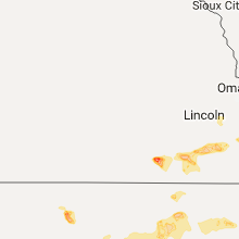
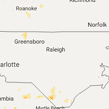
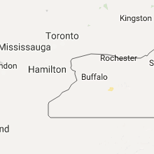
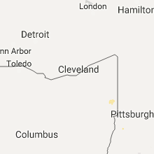
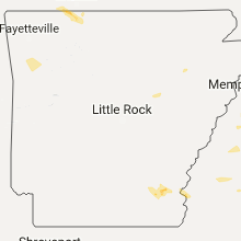
Hail Map for Thursday, June 15, 2017

Number of Impacted Households on 6/15/2017
0
Impacted by 1" or Larger Hail
0
Impacted by 1.75" or Larger Hail
0
Impacted by 2.5" or Larger Hail
Square Miles of Populated Area Impacted on 6/15/2017
0
Impacted by 1" or Larger Hail
0
Impacted by 1.75" or Larger Hail
0
Impacted by 2.5" or Larger Hail


Cities Most Affected by Hail Storms of 6/15/2017
| Hail Size | Demographics of Zip Codes Affected | ||||||
|---|---|---|---|---|---|---|---|
| City | Count | Average | Largest | Pop Density | House Value | Income | Age |
| Shenandoah, IA | 4 | 2.06 | 2.75 | 54 | $58k | $31.5k | 45.4 |
| Kiowa, KS | 2 | 3.00 | 4.00 | 10 | $32k | $32.8k | 47.3 |
| Waterloo, IA | 3 | 2.00 | 2.50 | 471 | $78k | $38.7k | 37.1 |
| Clarendon, TX | 3 | 2.00 | 2.50 | 1 | $51k | $29.3k | 42.4 |
| Knoxville, IA | 2 | 2.75 | 2.75 | 67 | $75k | $38.9k | 41.3 |
| Stafford, KS | 2 | 2.25 | 2.50 | 6 | $25k | $30.5k | 48.4 |
| Gage, OK | 2 | 2.13 | 2.50 | 2 | $32k | $28.7k | 41.3 |
| Okemah, OK | 2 | 1.88 | 2.00 | 19 | $42k | $23.8k | 40.2 |
| Albert, KS | 2 | 1.75 | 1.75 | 2 | $44k | $37.1k | 50.2 |
| Ellis, KS | 2 | 1.75 | 1.75 | 8 | $55k | $30.4k | 40.4 |
| Cedar Falls, IA | 2 | 1.75 | 1.75 | 304 | $104k | $41.0k | 27.8 |
| Thurman, IA | 2 | 1.75 | 1.75 | 7 | $61k | $38.5k | 43.0 |
| Pawnee Rock, KS | 2 | 1.75 | 1.75 | 3 | $36k | $38.4k | 47.4 |
| Bruning, NE | 2 | 1.75 | 1.75 | 4 | $46k | $33.6k | 47.1 |
| Cunningham, KS | 2 | 1.75 | 1.75 | 3 | $48k | $33.1k | 50.4 |
| Anthony, KS | 1 | 2.75 | 2.75 | 11 | $45k | $26.1k | 44.9 |
| Hays, KS | 1 | 2.50 | 2.50 | 62 | $91k | $32.5k | 30.5 |
| Miami, TX | 1 | 2.50 | 2.50 | 1 | $48k | $38.1k | 40.5 |
| Big Spring, TX | 1 | 2.00 | 2.00 | 32 | $39k | $30.5k | 38.4 |
| Creston, IA | 1 | 2.00 | 2.00 | 45 | $59k | $31.7k | 40.3 |
| De Witt, NE | 1 | 2.00 | 2.00 | 8 | $64k | $40.7k | 45.1 |
| Hoisington, KS | 1 | 2.00 | 2.00 | 15 | $43k | $29.3k | 41.7 |
| Dumont, IA | 1 | 2.00 | 2.00 | 8 | $37k | $31.1k | 48.0 |
| Altoona, IA | 1 | 1.75 | 1.75 | 689 | $119k | $51.6k | 34.3 |
| Munising, MI | 1 | 1.75 | 1.75 | 22 | $78k | $38.3k | 43.7 |
| Garden City, TX | 1 | 1.75 | 1.75 | 1 | $52k | $36.3k | 38.3 |
| Lindsborg, KS | 1 | 1.75 | 1.75 | 29 | $84k | $40.9k | 40.5 |
| Melcher-dallas, IA | 1 | 1.75 | 1.75 | 20 | $54k | $36.9k | 43.0 |
| Ogallah, KS | 1 | 1.75 | 1.75 | 1 | $70k | $41.4k | 47.7 |
| Turon, KS | 1 | 1.75 | 1.75 | 3 | $31k | $28.1k | 44.3 |
| Wakeeney, KS | 1 | 1.75 | 1.75 | 7 | $49k | $30.4k | 49.0 |
| Hardtner, KS | 1 | 1.75 | 1.75 | 0 | $24k | $30.0k | 50.4 |
| Summerville, SC | 1 | 1.75 | 1.75 | 1432 | $124k | $50.9k | 35.6 |
| Swanton, NE | 1 | 1.75 | 1.75 | 3 | $33k | $24.1k | 46.3 |
| Lake City, KS | 1 | 1.75 | 1.75 | 0 | $23k | $42.8k | 52.8 |
| Bison, KS | 1 | 1.75 | 1.75 | 2 | $32k | $37.0k | 46.3 |
| Newton, IA | 1 | 1.75 | 1.75 | 119 | $82k | $40.9k | 41.7 |
| Plainfield, IA | 1 | 1.75 | 1.75 | 14 | $72k | $39.6k | 41.2 |
| Ness City, KS | 1 | 1.75 | 1.75 | 5 | $46k | $32.2k | 47.5 |
Hail and Wind Damage Spotted on 6/15/2017
Filter by Report Type:Hail ReportsWind Reports
States Impacted
Iowa, Missouri, Oklahoma, Arkansas, Kentucky, Tennessee, Mississippi, Alabama, North Carolina, Kansas, South Carolina, Pennsylvania, Georgia, Florida, New York, Texas, Virginia, Michigan, Nebraska, Wisconsin, IllinoisIowa
| Local Time | Report Details |
|---|---|
| 9:09 AM CDT | Tree limbs down on the southeast corner of the mount vernon with no power in the city. report was delayed and time of the event was estimated using rada in linn county IA, 13.6 miles ESE of Cedar Rapids, IA |
| 10:55 AM CDT | Two trees limbs... one on east side and one on west side of merle hay... snapped. estimate diameter 1-2 fee in polk county IA, 6.5 miles NW of Des Moines, IA |
| 11:41 AM CDT | Quarter sized hail reported near Newton, IA, 31.4 miles ENE of Des Moines, IA, via social media. |
| 12:19 PM CDT | Half Dollar sized hail reported near Center Point, IA, 15.5 miles NNW of Cedar Rapids, IA, i-380 near mile marker 32 |
| 5:32 PM CDT | Half Dollar sized hail reported near Hampton, IA, 35.7 miles S of Mason City, IA, reported near 80th and nettle bradford ia. |
| 5:34 PM CDT | Ping Pong Ball sized hail reported near Hampton, IA, 28.1 miles S of Mason City, IA |
| 5:34 PM CDT | Half Dollar sized hail reported near Hampton, IA, 28.1 miles S of Mason City, IA |
| 5:35 PM CDT | Nickel sized hail covering the ground as wel in franklin county IA, 28.8 miles S of Mason City, IA |
| 5:45 PM CDT | Quarter sized hail reported near Geneva, IA, 33.1 miles S of Mason City, IA, 50 mph wind and quarter sized hail. |
| 5:55 PM CDT | Quarter sized hail reported near Aplington, IA, 38.5 miles SSE of Mason City, IA |
| 6:01 PM CDT | Quarter sized hail reported near Latimer, IA, 28.3 miles SSW of Mason City, IA |
| 6:06 PM CDT | Quarter sized hail reported near Aplington, IA, 42.4 miles SSE of Mason City, IA |
| 6:08 PM CDT | Quarter sized hail reported near Hampton, IA, 27.4 miles S of Mason City, IA, via social media. |
| 6:12 PM CDT | Quarter sized hail reported near Parkersburg, IA, 45.2 miles SSE of Mason City, IA |
| 6:17 PM CDT | Hen Egg sized hail reported near Dumont, IA, 28.7 miles SSE of Mason City, IA |
| 6:18 PM CDT | Half Dollar sized hail reported near Clarksville, IA, 34.2 miles SE of Mason City, IA |
| 6:18 PM CDT | Quarter sized hail reported near Pacific Junction, IA, 17.1 miles SSE of Omaha, NE, mainly 1/2-3/4 inch |
| 6:18 PM CDT | Half Dollar sized hail reported near Parkersburg, IA, 45.2 miles SSE of Mason City, IA |
| 6:28 PM CDT | Golf Ball sized hail reported near Plainfield, IA, 39.6 miles ESE of Mason City, IA, via nws employee. |
| 6:44 PM CDT | Golf Ball sized hail reported near Cedar Falls, IA, 54.7 miles NW of Cedar Rapids, IA |
| 6:45 PM CDT | Quarter sized hail reported near Cedar Falls, IA, 54.7 miles NW of Cedar Rapids, IA |
| 6:52 PM CDT | Quarter sized hail reported near Cedar Falls, IA, 54.7 miles NW of Cedar Rapids, IA |
| 6:54 PM CDT | Ping Pong Ball sized hail reported near Waterloo, IA, 52 miles NW of Cedar Rapids, IA |
| 6:58 PM CDT | Tennis Ball sized hail reported near Waterloo, IA, 49.6 miles NW of Cedar Rapids, IA, from kwwl tv meteorologist. time estimated from radar. |
| 6:58 PM CDT | Ping Pong Ball sized hail reported near Cedar Falls, IA, 52.7 miles NW of Cedar Rapids, IA |
| 6:58 PM CDT | Golf Ball sized hail reported near Waterloo, IA, 49.6 miles NW of Cedar Rapids, IA, from social media. |
| 7:10 PM CDT | Quarter sized hail reported near Shenandoah, IA, 45.6 miles SE of Omaha, NE |
| 7:10 PM CDT | Ping Pong Ball sized hail reported near Shenandoah, IA, 45.6 miles SE of Omaha, NE |
| 7:10 PM CDT | Golf Ball sized hail reported near Shenandoah, IA, 47.7 miles SE of Omaha, NE, dime to golfball |
| 7:11 PM CDT | Quarter sized hail reported near Raymond, IA, 45.1 miles NW of Cedar Rapids, IA |
| 7:14 PM CDT | Hen Egg sized hail reported near Shenandoah, IA, 45.6 miles SE of Omaha, NE |
| 7:16 PM CDT | Baseball sized hail reported near Shenandoah, IA, 45.6 miles SE of Omaha, NE, ping pong ball to baseball size hail |
| 7:20 PM CDT | Golf Ball sized hail reported near Shenandoah, IA, 45.6 miles SE of Omaha, NE |
| 7:22 PM CDT | Quarter sized hail reported near Cumberland, IA, 51.6 miles E of Omaha, NE, time estimated by radar. |
| 7:24 PM CDT | Half Dollar sized hail reported near Cedar Falls, IA, 52.1 miles NW of Cedar Rapids, IA |
| 7:26 PM CDT | Half Dollar sized hail reported near Cedar Falls, IA, 52.4 miles NW of Cedar Rapids, IA, near ridgeway and highway 58. |
| 7:30 PM CDT | Golf Ball sized hail reported near Cedar Falls, IA, 52.9 miles NW of Cedar Rapids, IA, near the intersection of hwy 27 and viking road. |
| 7:32 PM CDT | Quarter sized hail reported near Jesup, IA, 40.3 miles NNW of Cedar Rapids, IA, began as peas 6 minutes ago and grew to quarters. |
| 7:33 PM CDT | Golf Ball sized hail reported near Waterloo, IA, 47.9 miles NW of Cedar Rapids, IA |
| 7:39 PM CDT | Quarter sized hail reported near Waterloo, IA, 48.5 miles NW of Cedar Rapids, IA, nickel to quarter hail. |
| 7:39 PM CDT | Ping Pong Ball sized hail reported near Evansdale, IA, 47.3 miles NW of Cedar Rapids, IA, quarter to ping pong ball sized hail. |
| 7:40 PM CDT | Half Dollar sized hail reported near Shell Rock, IA, 47.1 miles SE of Mason City, IA, via social media. |
| 7:40 PM CDT | Ping Pong Ball sized hail reported near Waterloo, IA, 48.5 miles NW of Cedar Rapids, IA |
| 7:42 PM CDT | Quarter sized hail reported near Raymond, IA, 45.1 miles NW of Cedar Rapids, IA, lots of quarter hail. |
| 7:50 PM CDT | Ping Pong Ball sized hail reported near Janesville, IA, 51.3 miles SE of Mason City, IA |
| 7:58 PM CDT | Half Dollar sized hail reported near Janesville, IA, 52.4 miles SE of Mason City, IA, pea to half dollar hail. |
| 7:58 PM CDT | Golf Ball sized hail reported near Thurman, IA, 29.9 miles SSE of Omaha, NE |
| 8:01 PM CDT | Half Dollar sized hail reported near Janesville, IA, 53.4 miles SE of Mason City, IA, niekels to half dollar. |
| 8:03 PM CDT | Hen Egg sized hail reported near Creston, IA, 51 miles SW of Des Moines, IA, via social media. time estimated from radar. |
| 8:03 PM CDT | Ping Pong Ball sized hail reported near Waterloo, IA, 54.9 miles NW of Cedar Rapids, IA, reported along e bennington rd.... |
| 8:11 PM CDT | Golf Ball sized hail reported near Thurman, IA, 33.1 miles SSE of Omaha, NE |
| 8:15 PM CDT | Large trees limbs down reported on alice road between center point and toddville via amateur radi in linn county IA, 13.8 miles NNW of Cedar Rapids, IA |
| 8:18 PM CDT | Quarter sized hail reported near Urbana, IA, 19.9 miles NNW of Cedar Rapids, IA, from the urbana police department. |
| 8:19 PM CDT | Half Dollar sized hail reported near Center Point, IA, 15.5 miles NNW of Cedar Rapids, IA, i-380 near mile marker 32 |
| 8:20 PM CDT | Ping Pong Ball sized hail reported near Sidney, IA, 38.6 miles SSE of Omaha, NE, quarter to ping pong ball sized hail |
| 8:23 PM CDT | Quarter sized hail reported near Center Point, IA, 15.7 miles NNW of Cedar Rapids, IA |
| 8:28 PM CDT | Quarter sized hail reported near Center Point, IA, 15.7 miles NNW of Cedar Rapids, IA, dime to quarter size hail. |
| 8:29 PM CDT | Half Dollar sized hail reported near Sidney, IA, 38.6 miles SSE of Omaha, NE, quarter to half dollar size |
| 8:33 PM CDT | Ping Pong Ball sized hail reported near Osceola, IA, 35.9 miles SSW of Des Moines, IA, estimated 60 mph winds as well. |
| 8:34 PM CDT | Quarter sized hail reported near Independence, IA, 36.2 miles NNW of Cedar Rapids, IA |
| 8:36 PM CDT | Quarter sized hail reported near Independence, IA, 35.8 miles NNW of Cedar Rapids, IA, pea to quarter |
| 8:36 PM CDT | Quarter sized hail reported near Osceola, IA, 38.1 miles SSW of Des Moines, IA, lots of rain and dime to quarter hail. |
| 8:39 PM CDT | Large tree down near mario in linn county IA, 5.7 miles NE of Cedar Rapids, IA |
| 8:40 PM CDT | Quarter sized hail reported near Independence, IA, 35.8 miles NNW of Cedar Rapids, IA |
| 8:43 PM CDT | Spotter estimated winds 60-70 mph taking down tree branches at intersection of highways 13 and 15 in linn county IA, 9 miles NNE of Cedar Rapids, IA |
| 8:46 PM CDT | Half Dollar sized hail reported near Clarinda, IA, 60.1 miles SE of Omaha, NE |
| 8:50 PM CDT | 18-inch diameter tree blown dow in linn county IA, 2.5 miles SE of Cedar Rapids, IA |
| 8:53 PM CDT | Quarter sized hail reported near Marion, IA, 6.5 miles NE of Cedar Rapids, IA, along highway 150. dime to quarter hail. |
| 8:53 PM CDT | Quarter sized hail reported near Sidney, IA, 38.7 miles SSE of Omaha, NE |
| 9:02 PM CDT | Quarter sized hail reported near Atkins, IA, 9.6 miles W of Cedar Rapids, IA |
| 9:09 PM CDT | Quarter sized hail reported near Stuart, IA, 38.2 miles WSW of Des Moines, IA |
| 9:16 PM CDT | Quarter sized hail reported near Lacona, IA, 30.2 miles SSE of Des Moines, IA |
| 9:20 PM CDT | Half Dollar sized hail reported near Earlham, IA, 27 miles WSW of Des Moines, IA, lots of hail from pea to half dollar sized. via social media. |
| 9:21 PM CDT | Golf Ball sized hail reported near Melcher-dallas, IA, 31.6 miles SE of Des Moines, IA |
| 9:30 PM CDT | Tree and power lines down across highway 38 south of tipton. public report relayed by broadcast media. time estimated by rada in cedar county IA, 32.8 miles ESE of Cedar Rapids, IA |
| 9:30 PM CDT | Baseball sized hail reported near Knoxville, IA, 35.8 miles SE of Des Moines, IA, multiple patrol cars and ema vehicles damaged by large hail. some reports coming in of damages to homes... buildings... etc from the hail. most reports coming in are fr |
| 9:32 PM CDT | Baseball sized hail reported near Knoxville, IA, 35.5 miles SE of Des Moines, IA, baseball sized hail and very strong wind. |
| 9:59 PM CDT | Half Dollar sized hail reported near Cumming, IA, 10.6 miles SW of Des Moines, IA, slightly larger than 1.00 inch hail. was preceded by 50 mph winds. |
| 10:00 PM CDT | Measured in scott county IA, 61.6 miles ESE of Cedar Rapids, IA |
| 10:00 PM CDT | Iowa dot rwis at i-80 and i-280 interchang in scott county IA, 58.9 miles ESE of Cedar Rapids, IA |
| 10:05 PM CDT | Quarter sized hail reported near Adair, IA, 54 miles W of Des Moines, IA, reported near 140th and delta ave. |
| 10:10 PM CDT | Numerous public reports and photos of large tree branches and trees down in davenport relayed through local tv social medi in scott county IA, 62.5 miles ESE of Cedar Rapids, IA |
| 10:15 PM CDT | Numerous reports/photos of large tree branch damage and trees down in bettendorf. relayed on local tv social medi in scott county IA, 68 miles ESE of Cedar Rapids, IA |
| 10:15 PM CDT | Storm damage reported in scott county IA, 67 miles ESE of Cedar Rapids, IA |
| 10:53 PM CDT | Quarter sized hail reported near Johnston, IA, 9.3 miles NW of Des Moines, IA, lots of nickel hail with a few quarters. |
| 10:54 PM CDT | Frontage road west of merle hay between meredith and the chapel hill gardens cemetary... 4-5 power poles down. at least 2 snapped 1/3 to 1/2 way up pole... may have bee in polk county IA, 5.6 miles NW of Des Moines, IA |
| 10:55 PM CDT | Two trees limbs... one on east side and one on west side of merle hay... snapped. estimate diameter 1-2 feet. corrected for tim in polk county IA, 6.5 miles NW of Des Moines, IA |
| 10:55 PM CDT | Along with dime sized hail. via social medi in polk county IA, 7.7 miles WNW of Des Moines, IA |
| 10:57 PM CDT | Quarter sized hail reported near Centerville, IA, 65.1 miles WNW of Kahoka, MO |
| 11:07 PM CDT | Quarter sized hail reported near Des Moines, IA, 4.2 miles N of Des Moines, IA, amateur radio operator reported nickle quarter sized hail and heavy rainfall. |
| 11:16 PM CDT | Golf Ball sized hail reported near Altoona, IA, 7.7 miles NE of Des Moines, IA, lots of quarter to golf ball hail near the highway 65/interstate 80 exit. |
| 11:17 PM CDT | Half Dollar sized hail reported near Bondurant, IA, 11.1 miles NE of Des Moines, IA, via social media. |
| 11:17 PM CDT | Ping Pong Ball sized hail reported near Bondurant, IA, 11.1 miles NE of Des Moines, IA, via social media. |
| 11:22 PM CDT | Quarter sized hail reported near Iowa City, IA, 28.9 miles SSE of Cedar Rapids, IA, mostly nickel size hail with a few stones the size of quarters. occurring for two mintues. |
| 11:28 PM CDT | Quarter sized hail reported near Colfax, IA, 20.9 miles ENE of Des Moines, IA |
| 11:36 PM CDT | Golf Ball sized hail reported near Newton, IA, 28.3 miles ENE of Des Moines, IA, reports of golf ball hail from colfax to west side of newton. |
| 11:43 PM CDT | Half Dollar sized hail reported near Newton, IA, 30.4 miles ENE of Des Moines, IA |
| 11:45 PM CDT | Ping Pong Ball sized hail reported near Newton, IA, 31.8 miles ENE of Des Moines, IA, trained spotter reported lots of quarter sized hail and at times ping pong ball sized hail mixed in. |
| 11:53 PM CDT | Storm damage reported in jasper county IA, 33.8 miles ENE of Des Moines, IA |
| 11:59 PM CDT | Quarter sized hail reported near Belle Plaine, IA, 30.2 miles W of Cedar Rapids, IA |
| 12:07 AM CDT | From the awos at the grinnell regional airpor in poweshiek county IA, 46.6 miles E of Des Moines, IA |
| 1:50 AM CDT | Large tree branch down and blocking road. time estimated by rada in lee county IA, 16.9 miles E of Kahoka, MO |
Missouri
| Local Time | Report Details |
|---|---|
| 9:55 AM CDT | Quarter sized hail reported near Blue Eye, MO, 49.3 miles S of Springfield, MO, quarter size hail reported at the post office in blue eye. |
| 9:05 PM CDT | Reports coming into dispatch of trees down across hwy 45 near waldron in platte county MO, 15 miles NW of Kansas City, MO |
| 9:28 PM CDT | Numerous reports of trees and limbs down in the riss lake area as well as other parts of parkville in platte county MO, 8.2 miles NW of Kansas City, MO |
| 9:32 PM CDT | Quarter sized hail reported near Kansas City, MO, 10.8 miles N of Kansas City, MO, near the intersection of 152 and n. oak trfwy |
| 9:32 PM CDT | Estimated 55-60 mph near 152 and n. oak trfwy in clay county MO, 10.1 miles N of Kansas City, MO |
| 9:35 PM CDT | Ping Pong Ball sized hail reported near Liberty, MO, 12.2 miles NE of Kansas City, MO |
| 9:35 PM CDT | Quarter sized hail reported near Kansas City, MO, 5.2 miles NNE of Kansas City, MO, quarter size hail reported via facebook near i-35 and chouteau trfwy |
| 9:38 PM CDT | Reports coming into dispatch of trees down across hwy 45 near waldron in platte county MO, 15 miles NW of Kansas City, MO |
| 9:53 PM CDT | Quarter sized hail reported near Liberty, MO, 15.3 miles NE of Kansas City, MO, quarter size hail reported via facebook |
| 9:53 PM CDT | Several trees down across western portions of nodaway county per 911 dispatch communications in nodaway county MO, 73 miles SE of Omaha, NE |
| 11:03 PM CDT | Machine shed destroyed. power lines down from ridgeway to cainsville to blythedale... along with power outages in those areas... including eaglevill in harrison county MO, 84.2 miles SSW of Des Moines, IA |
| 11:03 PM CDT | Tree fell on mobile home on the 200 block of second street... temporarily trapping someone in harrison county MO, 85.2 miles SSW of Des Moines, IA |
| 11:03 PM CDT | Semi blown off of i-35 nb near mm 99 with possible minor injuries in harrison county MO, 86.5 miles SSW of Des Moines, IA |
| 11:03 PM CDT | Outbuildings destroyed on w. 200th st. east of washington center in harrison county MO, 84.9 miles SSW of Des Moines, IA |
| 11:04 PM CDT | Roof partially damaged on residence... garage roof taken off... outbuildings destroyed between blythedale and cainsville in harrison county MO, 79.7 miles S of Des Moines, IA |
| 11:15 PM CDT | Tree limbs down blocking roads...time estimated in mercer county MO, 82.1 miles S of Des Moines, IA |
| 11:23 PM CDT | Tree down blocking crowder rd. at mable s in grundy county MO, 84.8 miles NE of Kansas City, MO |
| 11:30 PM CDT | Tree down blocking crowder rd. at mable s in grundy county MO, 84.8 miles NE of Kansas City, MO |
| 12:30 AM CDT | Power poles and lines down in adair county MO, 48.2 miles WSW of Kahoka, MO |
Oklahoma
| Local Time | Report Details |
|---|---|
| 10:11 AM CDT | Golf Ball sized hail reported near Okemah, OK, 59.5 miles SSW of Tulsa, OK |
| 10:15 AM CDT | Hen Egg sized hail reported near Okemah, OK, 59.5 miles SSW of Tulsa, OK |
| 10:30 AM CDT | Quarter sized hail reported near Chandler, OK, 41.3 miles ENE of Oklahoma City, OK, nickel to quarter hail. |
| 10:30 AM CDT | Quarter sized hail reported near Wetumka, OK, 61.6 miles N of Atoka, OK, hwy 27 |
| 10:55 AM CDT | Quarter sized hail reported near Holdenville, OK, 54.7 miles NNW of Atoka, OK |
| 5:05 PM CDT | Quarter sized hail reported near Shattuck, OK, 28.8 miles WSW of Woodward, OK, relayed by kwtv. |
| 5:20 PM CDT | Golf Ball sized hail reported near Gage, OK, 31.8 miles W of Woodward, OK, reported by kwtv. |
| 6:16 PM CDT | Tennis Ball sized hail reported near Gage, OK, 27 miles W of Woodward, OK |
| 6:27 PM CDT | Quarter sized hail reported near Freedom, OK, 28.2 miles NE of Woodward, OK |
| 6:35 PM CDT | May ranch sit in woods county OK, 44.3 miles NNE of Woodward, OK |
| 6:40 PM CDT | May ranch sit in woods county OK, 43.7 miles NNE of Woodward, OK |
| 9:07 PM CDT | At ponca city municipal airpor in kay county OK, 67.3 miles S of Wichita, KS |
| 9:10 PM CDT | Relayed by kfor t in kay county OK, 55.6 miles S of Wichita, KS |
| 9:15 PM CDT | At blackwell-tonkawa municipal airpor in kay county OK, 63.9 miles S of Wichita, KS |
| 9:15 PM CDT | At medford sit in grant county OK, 65.3 miles SSW of Wichita, KS |
| 9:40 PM CDT | Storm damage reported in osage county OK, 40.7 miles NNW of Tulsa, OK |
| 10:00 PM CDT | 10 to 12 inch diameter tree snapped. previously damaged. time and location estimated. report via social medi in tulsa county OK, 15.2 miles NE of Tulsa, OK |
| 10:05 PM CDT | Storm damage reported in tulsa county OK, 11.9 miles NNE of Tulsa, OK |
| 10:10 PM CDT | Storm damage reported in mayes county OK, 39.2 miles ENE of Tulsa, OK |
| 10:15 PM CDT | 58 mph thunderstorm wind gusts in ottawa county OK, 64.2 miles SSE of Chanute, KS |
| 10:31 PM CDT | Storm damage reported in ottawa county OK, 67.3 miles SSE of Chanute, KS |
| 10:40 PM CDT | Side of balcony blown off at apartment complex near 61st and memorial. time estimated. report via social medi in tulsa county OK, 7.5 miles SE of Tulsa, OK |
| 10:45 PM CDT | Tree down on house. wind estimated 65 mp in mayes county OK, 39.2 miles ENE of Tulsa, OK |
| 10:55 PM CDT | Several power poles down on east side of tow in wagoner county OK, 37.3 miles ESE of Tulsa, OK |
| 11:00 PM CDT | Large tree and branches down. some baranches having fallen on transforme in tulsa county OK, 9 miles S of Tulsa, OK |
| 11:05 PM CDT | Storm damage reported in mayes county OK, 45.1 miles ENE of Tulsa, OK |
| 11:10 PM CDT | Large tree down in rogers county OK, 26.6 miles ENE of Tulsa, OK |
| 11:35 PM CDT | Storm damage reported in muskogee county OK, 40.1 miles W of Fort Smith, AR |
| 11:39 PM CDT | Trees down along chewey road by the chewey stor in adair county OK, 52.9 miles NNW of Fort Smith, AR |
| 11:43 PM CDT | Trees down in westville. power outages reporte in adair county OK, 42.6 miles N of Fort Smith, AR |
Arkansas
| Local Time | Report Details |
|---|---|
| 10:20 AM CDT | Quarter sized hail reported near Omaha, AR, 56.8 miles S of Springfield, MO |
| 8:30 PM CDT | A large tree was blown down on old dermott rd near cherry st. power lines were also blown dow in drew county AR, 57.9 miles N of Bastrop, LA |
| 11:47 PM CDT | Tree damage and a few power poles broken in washington county AR, 39 miles N of Fort Smith, AR |
| 12:30 AM CDT | Storm damage reported in crawford county AR, 22.6 miles NE of Fort Smith, AR |
| 12:30 AM CDT | Trees down on power line in sebastian county AR, 1.3 miles ENE of Fort Smith, AR |
| 1:00 AM CDT | Storm damage reported in sebastian county AR, 16 miles SE of Fort Smith, AR |
Kentucky
| Local Time | Report Details |
|---|---|
| 10:25 AM CDT | Tree limb down at meng road northeast of woodbur in warren county KY, 59.1 miles NNE of Nashville, TN |
| 7:45 PM EDT | A few trees were reported down in paintsville. the time of the event is estimated from rada in johnson county KY, 64.3 miles E of Irvine, KY |
Tennessee
| Local Time | Report Details |
|---|---|
| 12:00 PM CDT | Tspotter report and photo showed a tree down blocking petty lane in spring hill. time estimated based on rada in maury county TN, 30.5 miles SSW of Nashville, TN |
| 2:07 PM CDT | House on 7th street damaged by falling tree. no injuries. time estimated from other reports in the vicinity and from rada in marion county TN, 22.8 miles W of Chattanooga, TN |
| 2:15 PM CDT | Power outages reported in several locations as thunderstorms moved through according to svec. time estimated by rada in marion county TN, 22.8 miles W of Chattanooga, TN |
Mississippi
| Local Time | Report Details |
|---|---|
| 12:05 PM CDT | Large tree down on a truck. time is radar es in tishomingo county MS, 36.8 miles W of Florence, AL |
| 1:05 PM CDT | Large tree down on a truck. time is radar es in tishomingo county MS, 36.8 miles W of Florence, AL |
| 1:34 PM CDT | Large tree down on highway 25 south near tilden. another tree down on riverwalk by browns cov in itawamba county MS, 56.6 miles NNE of Starkville, MS |
| 1:37 PM CDT | Large tree blown over across chesterville road in extreme northeast pontotoc count in pontotoc county MS, 56.8 miles N of Starkville, MS |
| 1:40 PM CDT | Large tree branches fell on vehicle near belde in lee county MS, 58.2 miles N of Starkville, MS |
| 3:00 PM CDT | Estimated winds around 50 mph ripped the metal roofing off an apartment building. several trees were also downed in the area... including 15th avenue n... near bluecut in lowndes county MS, 22.5 miles ENE of Starkville, MS |
| 3:05 PM CDT | Two trees were down... one on luxapalila park road and one on second ave in lowndes county MS, 22.8 miles E of Starkville, MS |
| 3:07 PM CDT | Tree down on ericson roa in lowndes county MS, 29.6 miles E of Starkville, MS |
| 5:04 PM CDT | Estimated winds of 45 mph brought a tree down on a hous in lauderdale county MS, 77.2 miles S of Starkville, MS |
| 6:45 PM CDT | Ping Pong Ball sized hail reported near Biloxi, MS, 55.4 miles WSW of Mobile, AL, ping pong ball sized hail reported near biloxi high. time estimated. report relayed via social media. |
Alabama
| Local Time | Report Details |
|---|---|
| 1:00 PM CDT | Two trees down on highway 101 near hatto in lawrence county AL, 20.5 miles SE of Florence, AL |
| 1:11 PM CDT | A tree knocked down on highway 33 just north of moulto in lawrence county AL, 28.4 miles SE of Florence, AL |
| 1:14 PM CDT | A dead tree down on highway 31 at pryor stree in limestone county AL, 41.2 miles E of Florence, AL |
| 1:20 PM CDT | Several trees down near the intersection of nick davis rd. and mooresville rd. from outflow wind in limestone county AL, 45.2 miles E of Florence, AL |
| 1:29 PM CDT | *** 1 inj *** trees down on blankenship roa in morgan county AL, 40.9 miles SE of Florence, AL |
| 1:32 PM CDT | Tree across balch road. time estimated from rada in madison county AL, 51.8 miles E of Florence, AL |
| 1:35 PM CDT | Multiple trees down in decatur. time estimated from rada in morgan county AL, 41.7 miles ESE of Florence, AL |
| 1:40 PM CDT | Tree down on power lines on broadmor rd. time estimated from rada in madison county AL, 59.5 miles E of Florence, AL |
| 1:42 PM CDT | Multiple trees down in hartselle. time estimated from rada in morgan county AL, 48.7 miles ESE of Florence, AL |
| 1:47 PM CDT | Tree down near the intersection of hwy 431 and dug hill road. time estimated from rada in madison county AL, 66.1 miles E of Florence, AL |
| 1:53 PM CDT | Trees down along hurricane creek r in madison county AL, 64.9 miles WSW of Chattanooga, TN |
| 2:11 PM CDT | Tree down across lookout drive. time estimated from rada in marshall county AL, 58.7 miles NNE of Birmingham, AL |
| 2:17 PM CDT | Tree down blocking fishtrap road near grant road. time estimated from rada in marshall county AL, 64.3 miles WSW of Chattanooga, TN |
| 2:22 PM CDT | Tree down across junkins rd. time estimated from rada in marshall county AL, 62.7 miles NNE of Birmingham, AL |
| 2:25 PM CDT | Tree down on armstrong road. time estimated from rada in marshall county AL, 62.6 miles SW of Chattanooga, TN |
| 2:25 PM CDT | Numerous trees down in cullman. time estimated from rada in cullman county AL, 45.5 miles N of Birmingham, AL |
| 2:28 PM CDT | Trees down on hodges street in woodvill in jackson county AL, 62 miles WSW of Chattanooga, TN |
| 2:30 PM CDT | Tree down on a car near cottonville rd and natural bridge ln. time estimated from rada in marshall county AL, 70.4 miles NNE of Birmingham, AL |
| 2:35 PM CDT | Tree down near the intersection of hwy 75 and west concord rd. time estimated from rada in marshall county AL, 51.5 miles NNE of Birmingham, AL |
| 2:35 PM CDT | Trees down along hwy 71 and hwy 40 in the pleasant view communit in jackson county AL, 43.3 miles SW of Chattanooga, TN |
| 2:39 PM CDT | Numerous trees down in hanceville. time estimated from rada in cullman county AL, 37.3 miles N of Birmingham, AL |
| 2:41 PM CDT | Large tree down on a house along county road 329. time estimated from rada in dekalb county AL, 60.6 miles SW of Chattanooga, TN |
| 2:50 PM CDT | *** 1 inj *** tree down on a mobile home on plunkett d in marshall county AL, 53 miles NNE of Birmingham, AL |
| 2:53 PM CDT | Reported along hwy 229 north of geraldin in dekalb county AL, 61.4 miles SW of Chattanooga, TN |
| 3:00 PM CDT | Tree downed onto a hous in jefferson county AL, 7 miles NW of Birmingham, AL |
| 3:00 PM CDT | Large part of a tall tree fell onto a hous in etowah county AL, 57.3 miles NE of Birmingham, AL |
| 3:05 PM CDT | Several trees downed in the are in jefferson county AL, 11.7 miles WSW of Birmingham, AL |
| 3:10 PM CDT | Trees down on county road 261 near adamsburg. time estimated from rada in dekalb county AL, 48.4 miles SSW of Chattanooga, TN |
| 3:10 PM CDT | Roof blown off canada auto sales building in besseme in jefferson county AL, 11.5 miles SW of Birmingham, AL |
| 3:10 PM CDT | Tree and power pole downe in jefferson county AL, 9 miles ENE of Birmingham, AL |
| 3:15 PM CDT | Several trees uprooted along county road 10 in cherokee county AL, 43.3 miles SSW of Chattanooga, TN |
| 3:20 PM CDT | Two trees uproote in etowah county AL, 58.4 miles NE of Birmingham, AL |
| 3:23 PM CDT | Several trees down and snapped. power outages reporte in shelby county AL, 13.9 miles S of Birmingham, AL |
| 3:25 PM CDT | Several trees uproote in etowah county AL, 68.3 miles ENE of Birmingham, AL |
| 3:40 PM CDT | Tree on power lines along alabama highway 3 in cherokee county AL, 51.6 miles SSW of Chattanooga, TN |
| 3:40 PM CDT | Tree down on county road 4 in shelby county AL, 15.8 miles ESE of Birmingham, AL |
| 3:40 PM CDT | Tree down on al 68 at cr 140 near al/ga state lin in cherokee county AL, 51 miles S of Chattanooga, TN |
| 3:45 PM CDT | Tree on house; no injuries reporte in cherokee county AL, 55.9 miles SSW of Chattanooga, TN |
| 3:48 PM CDT | Tree blown dow in calhoun county AL, 56.4 miles ENE of Birmingham, AL |
| 3:48 PM CDT | Tree dow in shelby county AL, 25.3 miles ESE of Birmingham, AL |
| 3:48 PM CDT | Tree dow in shelby county AL, 25.1 miles ESE of Birmingham, AL |
| 3:54 PM CDT | Tree and large branches blown dow in calhoun county AL, 59.9 miles ENE of Birmingham, AL |
| 3:55 PM CDT | Tree down on pelham rd. in jacksonvill in calhoun county AL, 63.8 miles ENE of Birmingham, AL |
| 3:55 PM CDT | Tree down at the intersection of glade rd. & bellvue r in calhoun county AL, 58.1 miles ENE of Birmingham, AL |
| 3:56 PM CDT | Several trees uprooted in the riverside communit in st. clair county AL, 35.8 miles E of Birmingham, AL |
| 3:58 PM CDT | Several trees uprooted along county road 2 in shelby county AL, 21.9 miles SSE of Birmingham, AL |
| 4:00 PM CDT | Trees on houses near peaceburg rd. and jacksonville s in calhoun county AL, 60.2 miles ENE of Birmingham, AL |
| 4:15 PM CDT | Several trees uprooted along county road 10 in cherokee county AL, 43.3 miles SSW of Chattanooga, TN |
| 4:32 PM CDT | Trees and power lines dow in clay county AL, 60.2 miles E of Birmingham, AL |
| 4:35 PM CDT | Power lines dow in clay county AL, 50.2 miles NNW of Auburn, AL |
| 4:45 PM CDT | Trees and power lines dow in clay county AL, 54.1 miles NNW of Auburn, AL |
| 4:45 PM CDT | Tree down across roa in clay county AL, 50.4 miles NNW of Auburn, AL |
| 4:45 PM CDT | Trees and power lines downe in clay county AL, 58.8 miles NNW of Auburn, AL |
| 4:45 PM CDT | Tree down on roa in clay county AL, 54 miles NNW of Auburn, AL |
| 5:02 PM CDT | Tree on road at grier rd. & old grier r in elmore county AL, 39.7 miles W of Auburn, AL |
| 5:04 PM CDT | Power lines dow in elmore county AL, 30.6 miles W of Auburn, AL |
| 5:07 PM CDT | A lot of additional reports of downed trees and power lines/poles across the count in elmore county AL, 28.5 miles W of Auburn, AL |
| 5:08 PM CDT | Small tree down on road at the intersection of balm rd. & mt. zion r in elmore county AL, 38.5 miles W of Auburn, AL |
| 5:10 PM CDT | *** 1 inj *** a cinder block wall fell onto a woman. she was injured and taken to the hospita in elmore county AL, 29.8 miles W of Auburn, AL |
| 5:13 PM CDT | Tree in road at the intersection of buyck rd. and jackson trace r in elmore county AL, 46.6 miles W of Auburn, AL |
| 5:14 PM CDT | Power lines down at holtville high schoo in elmore county AL, 49.5 miles W of Auburn, AL |
| 5:15 PM CDT | Shed blown down near friendship communit in elmore county AL, 29.8 miles W of Auburn, AL |
| 5:19 PM CDT | Reports of trees and power lines down county-wide in randolph count in randolph county AL, 48.4 miles N of Auburn, AL |
| 5:25 PM CDT | Trees down on motley road in davisto in tallapoosa county AL, 32.5 miles NNW of Auburn, AL |
| 5:25 PM CDT | Trees down on east south stree in tallapoosa county AL, 22.3 miles NW of Auburn, AL |
| 5:37 PM CDT | Storm damage reported in macon county AL, 11.5 miles WSW of Auburn, AL |
| 5:50 PM CDT | Tree blown down onto a hous in lee county AL, 6.3 miles ENE of Auburn, AL |
| 5:50 PM CDT | Several reports of trees and power lines downe in lee county AL, 1.6 miles N of Auburn, AL |
| 5:50 PM CDT | Tree blown dow in lee county AL, 2.2 miles W of Auburn, AL |
| 5:51 PM CDT | Tree on house on grove av in lee county AL, 6.3 miles ENE of Auburn, AL |
| 6:20 PM CDT | 3 reports of downed trees in the are in lee county AL, 23.3 miles ESE of Auburn, AL |
North Carolina
| Local Time | Report Details |
|---|---|
| 2:40 PM EDT | Report of several trees down on george ii hwy near martinville dr. time estimated by rada in brunswick county NC, 13.9 miles SW of Wilmington, NC |
| 4:00 PM EDT | Trees and powerlines down at bedford ave and bedford s in burke county NC, 61.6 miles WNW of Charlotte, NC |
| 8:38 PM EDT | Quarter sized hail reported near Stoneville, NC, 55.3 miles S of Roanoke, VA |
Kansas
| Local Time | Report Details |
|---|---|
| 2:00 PM CDT | Golf Ball sized hail reported near Ellis, KS, 19.7 miles WNW of Hays, KS |
| 2:09 PM CDT | Golf Ball sized hail reported near Ellis, KS, 18 miles WNW of Hays, KS |
| 2:10 PM CDT | Tennis Ball sized hail reported near Hays, KS, 5.4 miles NW of Hays, KS |
| 2:33 PM CDT | Quarter sized hail reported near Hays, KS, 2.7 miles N of Hays, KS |
| 2:54 PM CDT | Golf Ball sized hail reported near Wakeeney, KS, 30.1 miles W of Hays, KS |
| 3:00 PM CDT | Storm damage reported in ellis county KS, 1.5 miles SSW of Hays, KS |
| 3:06 PM CDT | Storm damage reported in ellis county KS, 3.7 miles ESE of Hays, KS |
| 3:07 PM CDT | Ping Pong Ball sized hail reported near Hays, KS, 7 miles SSW of Hays, KS |
| 3:08 PM CDT | Golf Ball sized hail reported near Ogallah, KS, 21.5 miles W of Hays, KS |
| 3:15 PM CDT | Spotter reported damage to trees... fences... and some outbuilding in ellis county KS, 10.4 miles S of Hays, KS |
| 3:15 PM CDT | Quarter sized hail reported near Hays, KS, 2.5 miles SW of Hays, KS |
| 3:15 PM CDT | Storm damage reported in ellis county KS, 2.5 miles SW of Hays, KS |
| 3:32 PM CDT | Half Dollar sized hail reported near Hays, KS, 11.1 miles S of Hays, KS |
| 3:40 PM CDT | Storm damage reported in trego county KS, 17.1 miles WSW of Hays, KS |
| 3:59 PM CDT | Quarter sized hail reported near Sylvan Grove, KS, 51.7 miles E of Hays, KS, heavy rain was also reported in addition to the large hail. |
| 4:00 PM CDT | Quarter sized hail reported near Wakeeney, KS, 31.7 miles W of Hays, KS |
| 4:04 PM CDT | Ping Pong Ball sized hail reported near Stockton, KS, 41.9 miles N of Hays, KS, trained spotter reports ping pong ball size hail. |
| 4:11 PM CDT | Ping Pong Ball sized hail reported near Stockton, KS, 37.7 miles N of Hays, KS, rooks county em relayed a report of ping pong size hail at webster state park. |
| 4:14 PM CDT | Quarter sized hail reported near Stockton, KS, 37.5 miles N of Hays, KS, nws observer reports quarter size hail below the dam. |
| 4:16 PM CDT | Quarter sized hail reported near Lincoln, KS, 57.9 miles ENE of Hays, KS |
| 4:24 PM CDT | Quarter sized hail reported near Beverly, KS, 73.2 miles E of Hays, KS |
| 4:25 PM CDT | Quarter sized hail reported near Tescott, KS, 66 miles WSW of Manhattan, KS |
| 4:26 PM CDT | Estimated 60-70 mph win in rush county KS, 19.4 miles SSE of Hays, KS |
| 4:26 PM CDT | Golf Ball sized hail reported near Bison, KS, 19.4 miles SSE of Hays, KS, mostly quarters with largest hail being golf ball sized. |
| 4:35 PM CDT | Quarter sized hail reported near Little River, KS, 68.2 miles NNW of Wichita, KS, quarter size hail reported on k-4 about 8 miles east of geneseo. |
| 4:40 PM CDT | Storm damage reported in barton county KS, 29.2 miles SE of Hays, KS |
| 4:43 PM CDT | Quarter sized hail reported near Ransom, KS, 32.4 miles WSW of Hays, KS |
| 4:46 PM CDT | Quarter sized hail reported near Otis, KS, 27.5 miles SSE of Hays, KS |
| 4:51 PM CDT | Golf Ball sized hail reported near Albert, KS, 31.6 miles SSE of Hays, KS, mainly quarters with the largest being golf ball. |
| 4:52 PM CDT | Quarter sized hail reported near Minneapolis, KS, 67.6 miles W of Manhattan, KS |
| 4:58 PM CDT | Half Dollar sized hail reported near Ransom, KS, 28.9 miles WSW of Hays, KS |
| 4:59 PM CDT | Golf Ball sized hail reported near Albert, KS, 33.9 miles SSE of Hays, KS |
| 4:59 PM CDT | Hen Egg sized hail reported near Hoisington, KS, 36.7 miles SE of Hays, KS |
| 5:03 PM CDT | Quarter sized hail reported near Olmitz, KS, 35.3 miles SE of Hays, KS, lots of nickel hail as well. |
| 5:11 PM CDT | Half Dollar sized hail reported near Great Bend, KS, 40.4 miles SE of Hays, KS |
| 5:12 PM CDT | Recorded at smoky valley middle schoo in mcpherson county KS, 63.6 miles NNW of Wichita, KS |
| 5:12 PM CDT | Storm damage reported in barton county KS, 44.4 miles SE of Hays, KS |
| 5:12 PM CDT | Storm damage reported in barton county KS, 46.1 miles SSE of Hays, KS |
| 5:15 PM CDT | Also quarter size hail with this storm. all items outside blown aroun in ottawa county KS, 50.6 miles WSW of Manhattan, KS |
| 5:19 PM CDT | Quarter sized hail reported near Pawnee Rock, KS, 46.1 miles SSE of Hays, KS, quarter size hail falling and wind gusts still at 60 mph. |
| 5:21 PM CDT | Near the saline/mcpherson county line. also golfball hai in mcpherson county KS, 65.6 miles NNW of Wichita, KS |
| 5:21 PM CDT | Golf Ball sized hail reported near Pawnee Rock, KS, 46.1 miles SSE of Hays, KS |
| 5:21 PM CDT | Golf Ball sized hail reported near Lindsborg, KS, 65.6 miles NNW of Wichita, KS, along the saline/mcpherson county line. also 70 mph winds. |
| 5:23 PM CDT | Storm damage reported in mcpherson county KS, 64.2 miles NNW of Wichita, KS |
| 5:25 PM CDT | Several semi tractor trailers blown over along interstate 13 in saline county KS, 67.4 miles NNW of Wichita, KS |
| 5:25 PM CDT | 1 foot diameter tree limbs dow in mcpherson county KS, 65.6 miles NNW of Wichita, KS |
| 5:25 PM CDT | Storm damage reported in barton county KS, 45.9 miles SE of Hays, KS |
| 5:27 PM CDT | Damage to the roof of an outbuilding. also large trees blown dow in saline county KS, 65.7 miles WSW of Manhattan, KS |
| 5:28 PM CDT | Golf Ball sized hail reported near Pawnee Rock, KS, 46.5 miles SSE of Hays, KS |
| 5:30 PM CDT | Storm damage reported in saline county KS, 56.9 miles SW of Manhattan, KS |
| 5:35 PM CDT | Lost power and wind was getting stronge in dickinson county KS, 51.5 miles SW of Manhattan, KS |
| 5:44 PM CDT | Quarter sized hail reported near Ransom, KS, 38.7 miles WSW of Hays, KS |
| 5:45 PM CDT | Delayed repor in ellsworth county KS, 57.2 miles ESE of Hays, KS |
| 5:50 PM CDT | Storm damage reported in clay county KS, 31.5 miles WNW of Manhattan, KS |
| 5:54 PM CDT | Quarter sized hail reported near Saint John, KS, 56.1 miles SSE of Hays, KS |
| 5:56 PM CDT | 55-60 mph wind in rice county KS, 65.7 miles NW of Wichita, KS |
| 6:02 PM CDT | Storm damage reported in dickinson county KS, 41.7 miles SW of Manhattan, KS |
| 6:05 PM CDT | Half Dollar sized hail reported near Saint John, KS, 58.6 miles SE of Hays, KS |
| 6:15 PM CDT | Quarter sized hail reported near Hudson, KS, 63.1 miles SE of Hays, KS |
| 6:25 PM CDT | Golf Ball sized hail reported near Ness City, KS, 42.7 miles SW of Hays, KS, mostly quarters with a few golf ball. |
| 6:25 PM CDT | 6-8 inch tree limbs down in town. also sporadic power outage in marion county KS, 48.9 miles NNE of Wichita, KS |
| 6:28 PM CDT | Quarter sized hail reported near Ness City, KS, 41.8 miles SW of Hays, KS |
| 6:28 PM CDT | Storm damage reported in reno county KS, 59.2 miles WNW of Wichita, KS |
| 6:32 PM CDT | 14 to 16 inch tree broken off. delayed repor in harvey county KS, 23.6 miles NNW of Wichita, KS |
| 6:33 PM CDT | Light pole blown over at k17 and k6 in reno county KS, 41 miles NW of Wichita, KS |
| 6:34 PM CDT | Storm damage reported in mcpherson county KS, 47.4 miles NNW of Wichita, KS |
| 6:36 PM CDT | Quarter sized hail reported near Macksville, KS, 58.8 miles SSE of Hays, KS, mostly nickel sized with a few quarters. |
| 6:39 PM CDT | 50 to 60 mph winds at 17th and plum. via social medi in reno county KS, 41 miles NW of Wichita, KS |
| 6:40 PM CDT | Quarter sized hail reported near Coldwater, KS, 45.2 miles NNE of Woodward, OK |
| 6:40 PM CDT | Estimated 50-60 mph win in barber county KS, 52.3 miles NNE of Woodward, OK |
| 6:40 PM CDT | Golf Ball sized hail reported near Lake City, KS, 51.7 miles NNE of Woodward, OK |
| 6:41 PM CDT | *** 4 inj *** large tree fell on the car... and injured the occupant in reno county KS, 41 miles NW of Wichita, KS |
| 6:44 PM CDT | 60 to 70 mph. 4 to 6 inch tree limbs down in tow in mcpherson county KS, 36.8 miles NNW of Wichita, KS |
| 6:47 PM CDT | Storm damage reported in reno county KS, 40.6 miles NW of Wichita, KS |
| 6:48 PM CDT | Tree fell on the power line in reno county KS, 41.1 miles NW of Wichita, KS |
| 6:52 PM CDT | Multiple reports of power lines down... and trees down in tow in reno county KS, 41 miles NW of Wichita, KS |
| 6:52 PM CDT | Storm damage reported in reno county KS, 39.4 miles NW of Wichita, KS |
| 6:54 PM CDT | Storm damage reported in harvey county KS, 26 miles N of Wichita, KS |
| 6:55 PM CDT | Half Dollar sized hail reported near Macksville, KS, 67.5 miles SSE of Hays, KS |
| 6:58 PM CDT | Quarter sized hail reported near Saint John, KS, 70.8 miles SSE of Hays, KS |
| 6:58 PM CDT | 50-60 mp in reno county KS, 32.1 miles NW of Wichita, KS |
| 6:59 PM CDT | Semi tractor trailer blown over on us highway 5 in harvey county KS, 30.8 miles N of Wichita, KS |
| 7:00 PM CDT | Spotter confident that he received 60mph winds with the leading edge of the lin in lyon county KS, 58.1 miles NW of Chanute, KS |
| 7:00 PM CDT | Storm damage reported in pottawatomie county KS, 9.7 miles NE of Manhattan, KS |
| 7:00 PM CDT | Multiple trees dow in lyon county KS, 56.3 miles SSE of Manhattan, KS |
| 7:02 PM CDT | Ping Pong Ball sized hail reported near Saint John, KS, 67.6 miles SSE of Hays, KS |
| 7:03 PM CDT | Quarter sized hail reported near Washington, KS, 51.7 miles NW of Manhattan, KS |
| 7:03 PM CDT | Ping Pong Ball sized hail reported near Saint John, KS, 70.8 miles SSE of Hays, KS |
| 7:05 PM CDT | Golf Ball sized hail reported near Hardtner, KS, 57.5 miles NE of Woodward, OK |
| 7:05 PM CDT | Tree branches broke in barber county KS, 58 miles NE of Woodward, OK |
| 7:05 PM CDT | Via social medi in harvey county KS, 22.1 miles NNE of Wichita, KS |
| 7:05 PM CDT | 60 to 65 mph. along the county lin in marion county KS, 37 miles NE of Wichita, KS |
| 7:07 PM CDT | 50-60 mp in sedgwick county KS, 17.3 miles NW of Wichita, KS |
| 7:10 PM CDT | Half Dollar sized hail reported near Stafford, KS, 72.4 miles SSE of Hays, KS |
| 7:11 PM CDT | 55 to 60 mp in sedgwick county KS, 12.9 miles WNW of Wichita, KS |
| 7:11 PM CDT | 70 to 75 mp in sedgwick county KS, 17.3 miles NW of Wichita, KS |
| 7:15 PM CDT | Grapefruit sized hail reported near Kiowa, KS, 66.4 miles NE of Woodward, OK, delayed report from broadcast media photo. |
| 7:16 PM CDT | Quarter sized hail reported near Stafford, KS, 71.3 miles WNW of Wichita, KS |
| 7:17 PM CDT | Storm damage reported in barber county KS, 73.7 miles WSW of Wichita, KS |
| 7:18 PM CDT | Ping Pong Ball sized hail reported near Stafford, KS, 71 miles WNW of Wichita, KS |
| 7:19 PM CDT | Storm damage reported in butler county KS, 30.2 miles ENE of Wichita, KS |
| 7:20 PM CDT | Storm damage reported in sedgwick county KS, 12.9 miles WNW of Wichita, KS |
| 7:20 PM CDT | Hen Egg sized hail reported near Kiowa, KS, 65.1 miles NE of Woodward, OK |
| 7:20 PM CDT | 3-4 inch diameter limbs blown dow in lyon county KS, 60.6 miles SSE of Manhattan, KS |
| 7:22 PM CDT | Law enforcement reported damage to a mobile home and tree damage in the town of potwi in butler county KS, 24.5 miles NE of Wichita, KS |
| 7:24 PM CDT | Hen Egg sized hail reported near Stafford, KS, 70.2 miles W of Wichita, KS |
| 7:28 PM CDT | Tennis Ball sized hail reported near Stafford, KS, 71.9 miles WNW of Wichita, KS, via photo from nws chat. |
| 7:30 PM CDT | Quarter sized hail reported near Topeka, KS, 39 miles ESE of Manhattan, KS, also 55mph wind gust and very heavy rain. |
| 7:31 PM CDT | Storm damage reported in butler county KS, 27.6 miles ENE of Wichita, KS |
| 7:32 PM CDT | 8 inch tree limbs down on north side of tow in butler county KS, 19.5 miles E of Wichita, KS |
| 7:33 PM CDT | Quarter sized hail reported near Turon, KS, 67.3 miles W of Wichita, KS |
| 7:34 PM CDT | Storm damage reported in sedgwick county KS, 6 miles WSW of Wichita, KS |
| 7:34 PM CDT | 29th and tyler. via social medi in sedgwick county KS, 6.8 miles W of Wichita, KS |
| 7:39 PM CDT | Power poles snapped by winds. at 151st west just north of k9 in sedgwick county KS, 11 miles NW of Wichita, KS |
| 7:39 PM CDT | 5th wheel trailer on the kansas turnpipke rolled over at mm 8 in butler county KS, 34 miles ENE of Wichita, KS |
| 7:41 PM CDT | Quarter sized hail reported near Turon, KS, 60.5 miles W of Wichita, KS |
| 7:42 PM CDT | Carport blown over. delayed repor in butler county KS, 19.5 miles E of Wichita, KS |
| 7:44 PM CDT | 60 to 65 mph. also nickel hail reporte in butler county KS, 10.7 miles E of Wichita, KS |
| 7:44 PM CDT | Baseball sized hail reported near Anthony, KS, 59 miles SW of Wichita, KS, golball hail upto baseball size hail. golfballs lasted 20 minutes. delayed report. |
| 7:45 PM CDT | 21st and amido in sedgwick county KS, 4.2 miles E of Wichita, KS |
| 7:46 PM CDT | Golfball hail also reporte in kingman county KS, 60 miles W of Wichita, KS |
| 7:46 PM CDT | 75-80 mph. via social medi in harper county KS, 47 miles SW of Wichita, KS |
| 7:46 PM CDT | Golf Ball sized hail reported near Cunningham, KS, 60 miles W of Wichita, KS, 60 mph winds also reported. |
| 7:48 PM CDT | Half Dollar sized hail reported near Turon, KS, 60.1 miles W of Wichita, KS |
| 7:50 PM CDT | 55 to 65 mph. via social media. delayed repor in sedgwick county KS, 10.3 miles SSE of Wichita, KS |
| 7:51 PM CDT | Golf Ball sized hail reported near Turon, KS, 64.3 miles W of Wichita, KS, also reported 60 mph wind. |
| 7:52 PM CDT | Golf Ball sized hail reported near Cunningham, KS, 60.1 miles W of Wichita, KS, hail was quarter to golfball. |
| 7:52 PM CDT | The spotter reported a few small tree limbs downe in harper county KS, 47.1 miles WSW of Wichita, KS |
| 7:52 PM CDT | 6 to 8 inch tree limbs dow in harper county KS, 47 miles SW of Wichita, KS |
| 7:56 PM CDT | 55 to 60 mp in cowley county KS, 23.7 miles SSE of Wichita, KS |
| 7:56 PM CDT | At winfield city lak in cowley county KS, 34.6 miles SE of Wichita, KS |
| 7:57 PM CDT | Quarter sized hail reported near Pratt, KS, 81.9 miles W of Wichita, KS |
| 8:00 PM CDT | Half Dollar sized hail reported near Iuka, KS, 77.1 miles W of Wichita, KS |
| 8:02 PM CDT | At k15 and us highway 7 in cowley county KS, 27.7 miles SE of Wichita, KS |
| 8:08 PM CDT | Large tree limb on a house. delayed repor in kingman county KS, 42.5 miles W of Wichita, KS |
| 8:11 PM CDT | Storm damage reported in cowley county KS, 35.4 miles ESE of Wichita, KS |
| 8:17 PM CDT | 75 to 80 mp in sumner county KS, 30 miles SSW of Wichita, KS |
| 8:29 PM CDT | Half Dollar sized hail reported near Pratt, KS, 85.8 miles W of Wichita, KS |
| 8:30 PM CDT | Storm damage reported in cowley county KS, 40 miles SSE of Wichita, KS |
| 8:33 PM CDT | Power lines down about 4 miles north of oskaloos in jefferson county KS, 40.5 miles WNW of Kansas City, MO |
| 8:35 PM CDT | Tree blocking road near mclout in jefferson county KS, 36.3 miles W of Kansas City, MO |
| 8:40 PM CDT | At kwch tv studio in sedgwick county KS, 4.2 miles E of Wichita, KS |
| 8:41 PM CDT | Tree fell on hom in jefferson county KS, 34.3 miles WNW of Kansas City, MO |
| 8:41 PM CDT | Power poles down in the 300 block of east lake st. in mclout in jefferson county KS, 34.2 miles W of Kansas City, MO |
| 8:53 PM CDT | At dexter high schoo in cowley county KS, 48.7 miles SE of Wichita, KS |
| 8:55 PM CDT | Quarter sized hail reported near Leavenworth, KS, 26.9 miles NW of Kansas City, MO, spotter reports via em nickel to quarter size hail |
| 8:56 PM CDT | Storm damage reported in cowley county KS, 40 miles SSE of Wichita, KS |
| 9:01 PM CDT | Fire reports via em of several trees down and approximately 60mph winds in the city of lansing in leavenworth county KS, 19.3 miles WNW of Kansas City, MO |
| 9:01 PM CDT | Quarter sized hail reported near Tonganoxie, KS, 27.8 miles W of Kansas City, MO, spotter reports via em quarter size hail near the intersection of hwys 24/40 and honey creek rd. |
| 9:02 PM CDT | Quarter sized hail reported near Leavenworth, KS, 25.7 miles WNW of Kansas City, MO, spotter reports via em quarter size hail at 187th st and high prairie rd. |
| 9:18 PM CDT | Storm damage reported in montgomery county KS, 40.7 miles S of Chanute, KS |
South Carolina
| Local Time | Report Details |
|---|---|
| 3:11 PM EDT | Half Dollar sized hail reported near Georgetown, SC, 42.8 miles ENE of Charleston, SC, report of quarter sized to half dollar sized hail. |
| 3:11 PM EDT | Report of a large tree down on hwy 1 in georgetown county SC, 42.8 miles ENE of Charleston, SC |
| 4:15 PM EDT | At least 2 trees down along trout farm roa in oconee county SC, 39.1 miles WSW of Greenville, SC |
| 5:22 PM EDT | Trees down near fair pla in oconee county SC, 32.6 miles SW of Greenville, SC |
| 5:32 PM EDT | Golf Ball sized hail reported near Summerville, SC, 18.7 miles SSW of Charleston, SC, report of hail up to and including golf-ball size on old trolley road near oakbrook lane. time estimated based on radar and original report time. |
| 5:40 PM EDT | Tree reported down near the intersection of grand oaks drive and spanish oaks lan in dorchester county SC, 18.1 miles SSW of Charleston, SC |
| 5:50 PM EDT | Highway patrol reports two trees down--one on starks ferry rd near bethel church rd... and one on pinewood road near gwyndale r in sumter county SC, 49.3 miles NNW of Charleston, SC |
| 5:53 PM EDT | Quarter sized hail reported near Summerville, SC, 18.7 miles SSW of Charleston, SC, video of hail up to quarter size posted on social media taken near summer ridge drive. another report of hail up to quarter size nearby in grand oaks preserve neighborh |
| 6:38 PM EDT | One tree blown down in leed in chester county SC, 51.8 miles SW of Charlotte, NC |
| 7:17 PM EDT | Report of tree down on south center rd near country manor rd. time estimated by rada in darlington county SC, 70.6 miles N of Charleston, SC |
| 7:17 PM EDT | Report of tree down on south center rd near lake swamp rd. time estimated by rada in darlington county SC, 70.6 miles N of Charleston, SC |
| 7:43 PM EDT | Sc hwy patrol reported a tree on the road along n eden drive near russell r in lexington county SC, 61.4 miles ENE of Augusta, GA |
| 8:07 PM EDT | Report of tree down on christmas tree rd. time estimated by rada in darlington county SC, 69.9 miles N of Charleston, SC |
| 8:10 PM EDT | Many trees down and at least one power pole snapped along peach orchard road and webber lake roa in union county SC, 54.2 miles SW of Charlotte, NC |
| 8:20 PM EDT | Trees down from the south side of the city of greenwood to near lake greenwoo in greenwood county SC, 47.7 miles N of Augusta, GA |
| 9:30 PM EDT | Schp reports two trees on roadways--one on state park rd near hwy 302... and the other on wagontong rd near holstein r in aiken county SC, 34.5 miles ENE of Augusta, GA |
Pennsylvania
| Local Time | Report Details |
|---|---|
| 3:35 PM EDT | Tree down on a car in allegheny county PA, 9.2 miles N of Pittsburgh, PA |
| 3:35 PM EDT | Tree down across the roadway at 176 w ingomar road in allegheny county PA, 10 miles NNW of Pittsburgh, PA |
| 3:40 PM EDT | Trees down on the intersections of ingomar road and saratoga drive... mcknight road and blazier drive in allegheny county PA, 9.9 miles N of Pittsburgh, PA |
| 3:52 PM EDT | Tree and wires down on 17 jefferson street in allegheny county PA, 3.2 miles NNE of Pittsburgh, PA |
| 3:59 PM EDT | Tree down across the roadway at 300 tarentum culmerville road in allegheny county PA, 16.8 miles NNE of Pittsburgh, PA |
| 5:25 PM EDT | Multiple trees down near hanging rock road and chambersville road in indiana county PA, 48.1 miles ENE of Pittsburgh, PA |
| 6:08 PM EDT | Trees and wires down along home camp road in union townshi in clearfield county PA, 45.9 miles WNW of State College, PA |
| 6:22 PM EDT | Tree and wires down on ash stree in cambria county PA, 58.1 miles E of Pittsburgh, PA |
| 7:20 PM EDT | Tree on rao in blair county PA, 39.5 miles SW of State College, PA |
| 7:25 PM EDT | Tree on road in blair county PA, 25.6 miles WSW of State College, PA |
Georgia
| Local Time | Report Details |
|---|---|
| 3:50 PM EDT | A tree and a power line was reported down near the intersection of reed pond road northwest and reed road northwes in whitfield county GA, 23.5 miles SE of Chattanooga, TN |
| 3:50 PM EDT | A tree and a power line was reported down near the intersection of maple grove road northwest and highway 7 in whitfield county GA, 24.2 miles ESE of Chattanooga, TN |
| 3:50 PM EDT | A tree was reported down near the intersection of chattanooga avenue and north selvidge stree in whitfield county GA, 26.6 miles SE of Chattanooga, TN |
| 3:50 PM EDT | A tree was reported down near the intersection of reed road and highway 4 in whitfield county GA, 25.7 miles SE of Chattanooga, TN |
| 4:05 PM EDT | A tree was reported down near the intersection of wiggins road northeast and mitchell bridge roa in whitfield county GA, 28.9 miles ESE of Chattanooga, TN |
| 4:18 PM EDT | Trees were reported down across the highway near the intersection of highway 48 and highway 15 in chattooga county GA, 38.5 miles SSW of Chattanooga, TN |
| 4:18 PM EDT | Trees were reported down at highway 48 and ridge stree in chattooga county GA, 39.6 miles SSW of Chattanooga, TN |
| 4:18 PM EDT | Trees were reported down near the intersection of highway 337 and trion teloga roa in chattooga county GA, 34.6 miles S of Chattanooga, TN |
| 4:20 PM EDT | A car was reported trapped under two trees on highway 33 in chattooga county GA, 33.1 miles S of Chattanooga, TN |
| 4:55 PM EDT | A tree was reported down along van tassel driv in floyd county GA, 54.2 miles WNW of Atlanta, GA |
| 4:55 PM EDT | Eight trees were reported down on robin stree in floyd county GA, 54 miles S of Chattanooga, TN |
| 4:55 PM EDT | Trees were reported down on mahogany stree in floyd county GA, 52.8 miles S of Chattanooga, TN |
| 4:55 PM EDT | Trees were reported down at 220 technology parkwa in floyd county GA, 52.4 miles S of Chattanooga, TN |
| 4:55 PM EDT | Quarter sized hail reported near Mount Airy, GA, 50.7 miles WSW of Greenville, SC, quarter size hail reported along antioch church road. |
| 5:12 PM EDT | Power lines were reported down near the intersection of doyle road and reeceburg roa in floyd county GA, 52.6 miles WNW of Atlanta, GA |
| 5:25 PM EDT | Two trees down in road near intersection of cassville rd and grassville rd in bartow county GA, 39.2 miles NW of Atlanta, GA |
| 5:35 PM EDT | Trees reported down around highway 121 and u.s. 1 and gardener road. time of event based on radar dat in charlton county GA, 42.7 miles NNW of Jacksonville, FL |
| 5:36 PM EDT | One 40 foot live tree was blown over blocking a road in paynes creek campgroun in hart county GA, 31.9 miles SW of Greenville, SC |
| 5:48 PM EDT | A tree was reported down near the intersection of village oaks lane and gatewood driv in gwinnett county GA, 29.8 miles NE of Atlanta, GA |
| 5:48 PM EDT | A tree was reported down on a house along north fork court northwes in gwinnett county GA, 20 miles NE of Atlanta, GA |
| 5:48 PM EDT | A tree was reported down on a house on azalea driv in gwinnett county GA, 29.7 miles NE of Atlanta, GA |
| 5:54 PM EDT | A tree was reported down on a power line near the intersection of breckinridge blvd and newpoint plac in gwinnett county GA, 23.1 miles NE of Atlanta, GA |
| 5:55 PM EDT | A tree was reported down near the intersection of camp perrin road and azalea driv in gwinnett county GA, 29.7 miles NE of Atlanta, GA |
| 5:55 PM EDT | A tree was reported down on a house along weatherwood trac in gwinnett county GA, 30.2 miles NE of Atlanta, GA |
| 5:55 PM EDT | Trees and powerlines were reported down in the roadway near the intersection of austin bridge road and mein mitchell roa in paulding county GA, 23.3 miles W of Atlanta, GA |
| 5:55 PM EDT | A tree was reported down near the intersection of bankhead highway and jason industria in douglas county GA, 24.7 miles W of Atlanta, GA |
| 5:55 PM EDT | A tree was reported blocking the road near the intersection of deer run road and the circle northeas in gwinnett county GA, 29.3 miles NE of Atlanta, GA |
| 6:00 PM EDT | An eight inch diameter pine tree was snapped 4 inches above the groun in douglas county GA, 28.7 miles W of Atlanta, GA |
| 6:09 PM EDT | Tree and powerlines downed on lynhurst drive in sw atlanta in fulton county GA, 6 miles WSW of Atlanta, GA |
| 6:12 PM EDT | Three trees were down... multiple tree branches were snapped... and a power line was reported down in the riverside neighborhoo in fulton county GA, 6.7 miles NW of Atlanta, GA |
| 6:12 PM EDT | A large tree was reported down in the road on lenox road in morningsid in fulton county GA, 4.3 miles NNE of Atlanta, GA |
| 6:25 PM EDT | Tree down in road near new hope church rd and double springs church rd in walton county GA, 35.7 miles E of Atlanta, GA |
| 6:30 PM EDT | Tree down blocking road near panola rd and hwy 155 in henry county GA, 13.8 miles ESE of Atlanta, GA |
| 6:36 PM EDT | A tree was reported down on a house along mcdaniels bridge road southwes in gwinnett county GA, 19.5 miles ENE of Atlanta, GA |
| 6:36 PM EDT | Power lines were reported down on lamar wa in gwinnett county GA, 20.1 miles ENE of Atlanta, GA |
| 6:40 PM EDT | Tree down on road near intersection of rock mills rd and holliday rd in troup county GA, 35.5 miles NNE of Auburn, AL |
| 9:20 PM EDT | Tree down on road near interesection of gilbert rd and elko rd in houston county GA, 79.9 miles NW of Douglas, GA |
| 9:55 PM EDT | Large tree on road near missle base rd and hamlin-floyd rd in twiggs county GA, 83.1 miles NNW of Douglas, GA |
| 9:56 PM EDT | Two trees on us hwy 80 near turkey creek bridge in twiggs county GA, 83.1 miles NNW of Douglas, GA |
Florida
| Local Time | Report Details |
|---|---|
| 3:56 PM EDT | Light pole down on the ups building near pecan park road and cole flyer roa in duval county FL, 11 miles N of Jacksonville, FL |
| 3:56 PM EDT | Light pole down on the ups building near pecan park road and cole flyer roa in duval county FL, 11 miles N of Jacksonville, FL |
| 5:20 PM EDT | Tree downe in marion county FL, 54.4 miles NW of Orlando, FL |
| 5:20 PM EDT | Tree downe in marion county FL, 48.1 miles NW of Orlando, FL |
| 6:05 PM EDT | Tree limbs fell on power lines. large hail reported to central dispatch... size unknow in putnam county FL, 49.1 miles S of Jacksonville, FL |
| 6:50 PM EDT | Quarter sized hail reported near Orange Park, FL, 16.1 miles SSW of Jacksonville, FL, broadcast media showed a video of quarter sized hail near doctors inlet. |
| 7:10 PM EDT | 6 inch wide branch knocked down from tre in clay county FL, 13.7 miles SSW of Jacksonville, FL |
New York
| Local Time | Report Details |
|---|---|
| 4:21 PM EDT | Trees and wires down in livingston county NY, 54.6 miles E of Buffalo, NY |
| 4:23 PM EDT | Tree and powerlines down on groveland roa in livingston county NY, 55.2 miles E of Buffalo, NY |
| 4:33 PM EDT | Trees down in livingston county NY, 61.5 miles E of Buffalo, NY |
| 4:39 PM EDT | Trees and wires down in livingston county NY, 61.5 miles E of Buffalo, NY |
| 5:31 PM EDT | Trees down in livingston county NY, 59.3 miles ESE of Buffalo, NY |
| 5:32 PM EDT | Trees down in livingston county NY, 57.9 miles ESE of Buffalo, NY |
| 5:45 PM EDT | Trees down on house... lakeshore dr. and west springbrook rd in wyoming county NY, 44.9 miles ESE of Buffalo, NY |
| 6:50 PM EDT | Wires down within town in monroe county NY, 68.6 miles W of Syracuse, NY |
Texas
| Local Time | Report Details |
|---|---|
| 3:48 PM CDT | Tennis Ball sized hail reported near Miami, TX, 67.4 miles ENE of Amarillo, TX |
| 4:18 PM CDT | Bay door blown off of a welding shop on the east side of tow in hockley county TX, 29.1 miles W of Lubbock, TX |
| 4:20 PM CDT | Storm damage reported in hockley county TX, 29.4 miles W of Lubbock, TX |
| 4:30 PM CDT | Storm damage reported in hockley county TX, 29.4 miles W of Lubbock, TX |
| 4:55 PM CDT | Storm damage reported in reeves county TX, 71 miles N of Alpine, TX |
| 5:27 PM CDT | Hen Egg sized hail reported near , , 43.6 miles WNW of Childress, TX |
| 5:50 PM CDT | Tree branches off of tree in hall county TX, 13.7 miles WNW of Childress, TX |
| 6:05 PM CDT | Half Dollar sized hail reported near Turkey, TX, 40 miles W of Childress, TX |
| 6:10 PM CDT | Quarter sized hail reported near Odonnell, TX, 42.9 miles S of Lubbock, TX |
| 6:10 PM CDT | Storm damage reported in lynn county TX, 42.2 miles S of Lubbock, TX |
| 6:15 PM CDT | Tree limbs down of 8 inch diameter and large in lynn county TX, 42.9 miles S of Lubbock, TX |
| 6:20 PM CDT | Half Dollar sized hail reported near Odonnell, TX, 42.9 miles S of Lubbock, TX |
| 6:36 PM CDT | Storm damage reported in childress county TX, 3.9 miles W of Childress, TX |
| 6:46 PM CDT | Storm damage reported in childress county TX, 2.2 miles NNE of Childress, TX |
| 7:11 PM CDT | Quarter sized hail reported near Gail, TX, 64.3 miles SSE of Lubbock, TX, along 1054 about 5 miles south of hwy 180. |
| 7:15 PM CDT | Quarter sized hail reported near Clarendon, TX, 53.1 miles NW of Childress, TX |
| 7:15 PM CDT | Half Dollar sized hail reported near Clarendon, TX, 53.1 miles NW of Childress, TX, corrected size |
| 7:15 PM CDT | Storm damage reported in motley county TX, 24.8 miles WSW of Childress, TX |
| 7:16 PM CDT | Golf Ball sized hail reported near Clarendon, TX, 52.2 miles NW of Childress, TX |
| 7:18 PM CDT | Golf Ball sized hail reported near Clarendon, TX, 52.3 miles NW of Childress, TX |
| 7:20 PM CDT | Tennis Ball sized hail reported near Clarendon, TX, 51.4 miles NW of Childress, TX, tennis ball size hail south of clarendon on hwy 70. |
| 7:30 PM CDT | Storm damage reported in scurry county TX, 67.7 miles WNW of Abilene, TX |
| 7:32 PM CDT | Half Dollar sized hail reported near Big Spring, TX, 66.9 miles NE of Odessa, TX |
| 7:45 PM CDT | Ping Pong Ball sized hail reported near Big Spring, TX, 68.8 miles ENE of Odessa, TX, reported along hwy 350 |
| 8:00 PM CDT | Power lines down in rotan and roby. power poles down in roby. roof damage reported. two foot diameter tree blown down. numerous tree branches dow in fisher county TX, 42.6 miles WNW of Abilene, TX |
| 8:05 PM CDT | Hen Egg sized hail reported near Big Spring, TX, 67.1 miles ENE of Odessa, TX, hail lasted for about 20 minutes. |
| 8:15 PM CDT | Quarter sized hail reported near Coahoma, TX, 69.2 miles ENE of Odessa, TX |
| 8:26 PM CDT | Storm damage reported in nolan county TX, 39.1 miles W of Abilene, TX |
| 8:34 PM CDT | Storm damage reported in nolan county TX, 46.6 miles W of Abilene, TX |
| 8:40 PM CDT | Quarter sized hail reported near Big Spring, TX, 73.5 miles NE of Odessa, TX |
| 8:50 PM CDT | Taylor county so reports power poles and trees down in merkel and trent in taylor county TX, 15.8 miles W of Abilene, TX |
| 8:56 PM CDT | Storm damage reported in taylor county TX, 7.2 miles WSW of Abilene, TX |
| 9:10 PM CDT | Golf Ball sized hail reported near Garden City, TX, 52.1 miles E of Odessa, TX |
| 9:10 PM CDT | Storm damage reported in taylor county TX, 7.2 miles WSW of Abilene, TX |
| 10:15 PM CDT | Storm damage reported in coleman county TX, 46.5 miles SSE of Abilene, TX |
Virginia
| Local Time | Report Details |
|---|---|
| 5:05 PM EDT | Thunderstorm winds downed a tree along firetower road temporarily closing it to through traffi in montgomery county VA, 32.4 miles WSW of Roanoke, VA |
| 5:10 PM EDT | Thunderstorm winds downed several trees along ellett road near the city of christiansburg temporarily closing i in montgomery county VA, 26.9 miles WSW of Roanoke, VA |
| 5:10 PM EDT | Thunderstorm winds caused a tree and several branches to topple in a back yard along cambria street. pea size hail was also reported at this locatio in montgomery county VA, 28.3 miles WSW of Roanoke, VA |
| 5:19 PM EDT | Thunderstorms winds downed numerous trees along union valley road near riner. an estimated 8 to 10 trees were toppled... closing the roadway at multiple location in montgomery county VA, 30.9 miles WSW of Roanoke, VA |
| 5:37 PM EDT | Trained spotter reports several small limbs and other debris down along catawba road in montgomery county VA, 21.5 miles W of Roanoke, VA |
| 6:17 PM EDT | 54kt reported at kro in city of roanoke county VA, 4.6 miles NNW of Roanoke, VA |
| 6:22 PM EDT | Thunderstorm winds downed a powerpole within the community of cave spring knocking out powe in roanoke county VA, 5.2 miles SW of Roanoke, VA |
| 6:45 PM EDT | Tree down on jordan town rd. time radar estimate in bedford county VA, 8.3 miles E of Roanoke, VA |
| 7:06 PM EDT | One tree down on lost mountain rd. near 122. time radar estimate in franklin county VA, 15.6 miles SE of Roanoke, VA |
| 7:17 PM EDT | Tree on a power line just south of roselan in nelson county VA, 62.7 miles ENE of Roanoke, VA |
| 10:40 PM EDT | Several trees down on highway 360 completely blocking the road. time based on rada in pittsylvania county VA, 55.1 miles SE of Roanoke, VA |
Michigan
| Local Time | Report Details |
|---|---|
| 6:27 PM EDT | Ping Pong Ball sized hail reported near Munising, MI, 34.8 miles ESE of Marquette, MI, public report of up of 1.5 inch diameter hail. hail fell for approximately 10 minutes. |
| 6:38 PM EDT | Quarter sized hail reported near Munising, MI, 38.9 miles ESE of Marquette, MI, marble to quarter size hail fell for 11 minutes. |
| 6:50 PM EDT | A 59 mph wind gust was reported at the grand marais glos station grmm in lsz251 county MI, 69.3 miles E of Marquette, MI |
| 6:51 PM EDT | Golf Ball sized hail reported near Munising, MI, 39.3 miles ESE of Marquette, MI, golfball sized hail reported at pictured rocks golf course. |
| 7:55 PM EDT | Quarter sized hail reported near Manistique, MI, 50.5 miles ESE of Marquette, MI, hail from dime size to quarter size fell for approximately 5 minutes. |
Nebraska
| Local Time | Report Details |
|---|---|
| 7:17 PM CDT | Ping Pong Ball sized hail reported near Swanton, NE, 76.1 miles ESE of Grand Island, NE, pea to ping pong ball size hail |
| 7:18 PM CDT | Golf Ball sized hail reported near Swanton, NE, 76.1 miles ESE of Grand Island, NE |
| 7:20 PM CDT | Hen Egg sized hail reported near De Witt, NE, 77 miles ESE of Grand Island, NE |
| 7:41 PM CDT | Golf Ball sized hail reported near Bruning, NE, 56 miles SE of Grand Island, NE, trained spotter reports golf ball size hail 2 miles west of bruning. |
| 7:46 PM CDT | Quarter sized hail reported near Bruning, NE, 57.6 miles SE of Grand Island, NE, hail to the size of quarters reported in bruning. |
| 7:51 PM CDT | Half Dollar sized hail reported near Plymouth, NE, 78.3 miles ESE of Grand Island, NE |
| 7:55 PM CDT | Golf Ball sized hail reported near Bruning, NE, 57.6 miles SE of Grand Island, NE, nws observer reported hail to the size of golf balls and 0.60" rain in 20 minutes. |
| 8:00 PM CDT | Half Dollar sized hail reported near Cortland, NE, 65.6 miles SW of Omaha, NE, quarters to half dollars |
| 8:03 PM CDT | Quarter sized hail reported near Cortland, NE, 63.7 miles SW of Omaha, NE, quarter sized hail |
| 8:19 PM CDT | Half Dollar sized hail reported near Belvidere, NE, 60.7 miles SE of Grand Island, NE |
Wisconsin
| Local Time | Report Details |
|---|---|
| 9:23 PM CDT | Many trees and power lines down from south wayne and southwar in lafayette county WI, 42.8 miles SW of Madison, WI |
| 9:28 PM CDT | A few trees down on west river roa in green county WI, 43.5 miles SSW of Madison, WI |
Illinois
| Local Time | Report Details |
|---|---|
| 10:17 PM CDT | Tree branches down relayed through local tv social medi in rock island county IL, 69.8 miles ESE of Cedar Rapids, IA |
| 10:45 PM CDT | Large trees reported down in henry county IL, 54.9 miles NNW of Peoria, IL |
| 10:51 PM CDT | Large trees reported down in henry county IL, 51.7 miles NNW of Peoria, IL |
Connect with Interactive Hail Maps