

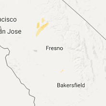
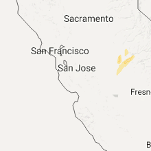
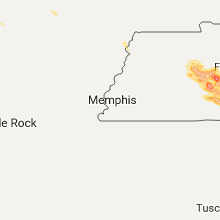
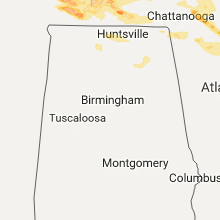
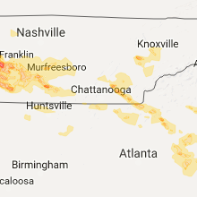
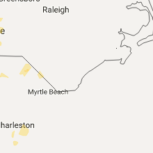
Hail Map for Tuesday, March 21, 2017

Number of Impacted Households on 3/21/2017
0
Impacted by 1" or Larger Hail
0
Impacted by 1.75" or Larger Hail
0
Impacted by 2.5" or Larger Hail
Square Miles of Populated Area Impacted on 3/21/2017
0
Impacted by 1" or Larger Hail
0
Impacted by 1.75" or Larger Hail
0
Impacted by 2.5" or Larger Hail


Cities Most Affected by Hail Storms of 3/21/2017
| Hail Size | Demographics of Zip Codes Affected | ||||||
|---|---|---|---|---|---|---|---|
| City | Count | Average | Largest | Pop Density | House Value | Income | Age |
| Greer, SC | 10 | 2.08 | 3.00 | 930 | $136k | $52.6k | 37.9 |
| Cleveland, TN | 6 | 1.92 | 2.50 | 506 | $83k | $27.2k | 34.0 |
| Travelers Rest, SC | 5 | 1.80 | 2.00 | 189 | $92k | $38.2k | 37.5 |
| Taylors, SC | 4 | 1.81 | 2.00 | 878 | $106k | $43.0k | 37.8 |
| Lewisburg, TN | 2 | 2.00 | 2.00 | 104 | $83k | $36.7k | 39.3 |
| Lenoir City, TN | 2 | 2.00 | 2.00 | 333 | $76k | $33.2k | 38.5 |
| Cleveland, SC | 2 | 1.75 | 1.75 | 19 | $108k | $41.2k | 48.4 |
| Powell, TN | 2 | 1.75 | 1.75 | 674 | $104k | $43.2k | 39.4 |
| Cleveland, GA | 2 | 1.75 | 1.75 | 116 | $110k | $35.6k | 40.4 |
| Concord, NC | 1 | 2.50 | 2.50 | 870 | $127k | $50.4k | 35.5 |
| Charlotte, NC | 1 | 1.75 | 1.75 | 1813 | $135k | $50.5k | 25.8 |
| Lynchburg, TN | 1 | 1.75 | 1.75 | 60 | $87k | $34.6k | 43.1 |
| Sugar Tree, TN | 1 | 1.75 | 1.75 | 21 | $49k | $29.1k | 55.0 |
| Mulberry, TN | 1 | 1.75 | 1.75 | 20 | $60k | $34.3k | 44.6 |
| Summertown, TN | 1 | 1.75 | 1.75 | 56 | $74k | $31.3k | 36.7 |
| Waynesboro, TN | 1 | 1.75 | 1.75 | 21 | $57k | $27.1k | 43.0 |
| Partridge, KY | 1 | 1.75 | 1.75 | 22 | $38k | $23.6k | 39.9 |
| Kingston, TN | 1 | 1.75 | 1.75 | 172 | $94k | $36.5k | 45.3 |
| Alto, GA | 1 | 1.75 | 1.75 | 142 | $95k | $36.4k | 37.0 |
| Joplin, MO | 1 | 1.75 | 1.75 | 583 | $68k | $30.4k | 35.1 |
| Trezevant, TN | 1 | 1.75 | 1.75 | 46 | $47k | $26.1k | 43.9 |
| Neosho, MO | 1 | 1.75 | 1.75 | 121 | $68k | $33.8k | 35.9 |
Hail and Wind Damage Spotted on 3/21/2017
Filter by Report Type:Hail ReportsWind Reports
States Impacted
Missouri, Tennessee, Georgia, Alabama, South Carolina, California, Texas, Kentucky, North Carolina, Idaho, UtahMissouri
| Local Time | Report Details |
|---|---|
| 8:42 AM CDT | Quarter sized hail reported near Joplin, MO, 66 miles SE of Chanute, KS, quarter size hail on 17th street in south joplin. |
| 8:50 AM CDT | Golf Ball sized hail reported near Neosho, MO, 65.4 miles WSW of Springfield, MO, golfball sized hail at crowder college. |
| 8:50 AM CDT | Quarter sized hail reported near Neosho, MO, 65.4 miles WSW of Springfield, MO, corrected for hail size. 1 inch hail at crowder college. |
| 8:57 AM CDT | Golf Ball sized hail reported near Joplin, MO, 61.8 miles W of Springfield, MO, . |
| 8:57 AM CDT | Quarter sized hail reported near Joplin, MO, 61.8 miles W of Springfield, MO, corrected for size. |
| 9:40 AM CDT | Quarter sized hail reported near Purdy, MO, 43.9 miles SW of Springfield, MO, lots of dime sized hail with about 5 minutes of quarter size hail. |
| 9:50 AM CDT | Quarter sized hail reported near Wentworth, MO, 41 miles WSW of Springfield, MO, . |
| 10:34 AM CDT | Ping Pong Ball sized hail reported near Galena, MO, 27.9 miles S of Springfield, MO, corrected time of report. |
| 10:38 AM CDT | Ping Pong Ball sized hail reported near Galena, MO, 27.9 miles S of Springfield, MO, . |
| 10:43 AM CDT | Quarter sized hail reported near Billings, MO, 20.2 miles SW of Springfield, MO, trained spotter reported quarter sized hail between billings and marionville. |
| 12:20 PM CDT | Ping Pong Ball sized hail reported near Russellville, MO, 35.6 miles SSW of Columbia, MO |
| 12:27 PM CDT | Quarter sized hail reported near Russellville, MO, 32.3 miles S of Columbia, MO, . |
| 12:38 PM CDT | Quarter sized hail reported near Buffalo, MO, 32.4 miles NNE of Springfield, MO, . |
| 2:30 PM CDT | Quarter sized hail reported near Success, MO, 33.1 miles WSW of Salem, MO, quarter size hail reported at success elementary school south of success on highway 17. |
Tennessee
| Local Time | Report Details |
|---|---|
| 2:44 PM CDT | Golf Ball sized hail reported near Sugar Tree, TN, 34 miles SE of Mc Kenzie, TN, quarter to golf ball sized hail in northern decatur county. |
| 3:03 PM CDT | Golf Ball sized hail reported near Trezevant, TN, 10.2 miles SSW of Mc Kenzie, TN, golf ball size hail in trezevant |
| 3:25 PM CDT | Quarter sized hail reported near Linden, TN, 52.5 miles SE of Mc Kenzie, TN, video showed hail of quarter size and larger in linden |
| 3:32 PM CDT | Quarter sized hail reported near Hohenwald, TN, 51.7 miles N of Florence, AL |
| 3:35 PM CDT | Power lines down at smith st. and walnut in lewis county TN, 52.1 miles N of Florence, AL |
| 3:40 PM CDT | Golf Ball sized hail reported near Waynesboro, TN, 36.1 miles N of Florence, AL |
| 3:43 PM CDT | Quarter sized hail reported near Waynesboro, TN, 37.2 miles NNW of Florence, AL, clifton turnpike |
| 3:45 PM CDT | Trees down blocking road at little swan creek road and marvin whitehead road. also nickle size hail reporte in lewis county TN, 52.2 miles NNE of Florence, AL |
| 3:48 PM CDT | Hen Egg sized hail reported near Lewisburg, TN, 53.6 miles S of Nashville, TN, photos showed hail up to small orange sized hail fell south of lewisburg with hail covering the ground |
| 3:49 PM CDT | Quarter sized hail reported near Yuma, TN, 22.2 miles SSE of Mc Kenzie, TN |
| 3:50 PM CDT | Golf Ball sized hail reported near Summertown, TN, 48.1 miles NNE of Florence, AL, photos showed hail up to golf ball size fell in and around summertown |
| 3:52 PM CDT | 12 to 16 inch diameter tree down blocking red hill center road 1 mile south of hwy 240 in lawrence county TN, 40 miles NNE of Florence, AL |
| 3:53 PM CDT | Ping Pong Ball sized hail reported near Hampshire, TN, 48.5 miles SW of Nashville, TN, hampshire community |
| 3:53 PM CDT | Quarter sized hail reported near Hampshire, TN, 48.5 miles SW of Nashville, TN, hampshire community |
| 4:55 PM EDT | Quarter sized hail reported near Kingston, TN, 31.4 miles WSW of Knoxville, TN, quarter size hail |
| 3:56 PM CDT | Quarter sized hail reported near Lewisburg, TN, 49.5 miles S of Nashville, TN, spring place rd. |
| 4:00 PM CDT | Quarter sized hail reported near Summertown, TN, 49 miles NNE of Florence, AL, us-43 near lawrence/maury co. line at summertown |
| 5:00 PM EDT | Quarter sized hail reported near Loudon, TN, 29 miles WSW of Knoxville, TN, quarter size hail |
| 4:03 PM CDT | 18 diameter tree down on mt. ariat rd. on north side of lawrenceburg in lawrence county TN, 36.4 miles NNE of Florence, AL |
| 5:08 PM EDT | Half Dollar sized hail reported near Cleveland, TN, 24.5 miles ENE of Chattanooga, TN, quarter to half dollar size hail |
| 4:09 PM CDT | Trees down on powerlines in bellevue... powerlines on the ground in davidson county TN, 7.4 miles W of Nashville, TN |
| 4:09 PM CDT | Metal roof blown off building next to fire station in lawrence county TN, 41.7 miles NNE of Florence, AL |
| 4:10 PM CDT | Tree down across from whitthorne middle school in maury county TN, 40.7 miles SSW of Nashville, TN |
| 4:12 PM CDT | Quarter sized hail reported near Lewisburg, TN, 49.6 miles S of Nashville, TN |
| 5:12 PM EDT | Hen Egg sized hail reported near Lenoir City, TN, 20.8 miles WSW of Knoxville, TN, 2 inch hail |
| 5:15 PM EDT | Golf Ball sized hail reported near Powell, TN, 7.8 miles NW of Knoxville, TN, golf ball hail near clinton highway and schad road |
| 5:15 PM EDT | Ping Pong Ball sized hail reported near Cleveland, TN, 26.5 miles ENE of Chattanooga, TN, ping pong ball size hail |
| 5:15 PM EDT | Golf Ball sized hail reported near Cleveland, TN, 26.5 miles ENE of Chattanooga, TN, ping pong to golf ball size hail |
| 4:16 PM CDT | Tree down at franklin green subdivision in williamson county TN, 16.8 miles SSW of Nashville, TN |
| 5:17 PM EDT | Golf Ball sized hail reported near Cleveland, TN, 26.5 miles ENE of Chattanooga, TN, media report of ping pong size hail in north cleveland |
| 4:18 PM CDT | Quarter sized hail reported near Lawrenceburg, TN, 35 miles NNE of Florence, AL, numerous reports of quarter-size hail from 3 miles west of lawrenceburg to north of ethridge |
| 4:22 PM CDT | Tree down on gosey hill rd. in peytonsville in williamson county TN, 21.3 miles S of Nashville, TN |
| 4:25 PM CDT | Hen Egg sized hail reported near Lewisburg, TN, 49.5 miles S of Nashville, TN, corrected info. photos showed hail up to small orange sized hail fell in lewisburg with hail covering the ground. |
| 4:25 PM CDT | Quarter sized hail reported near Cornersville, TN, 55.8 miles S of Nashville, TN |
| 5:26 PM EDT | Quarter sized hail reported near Cleveland, TN, 26.5 miles ENE of Chattanooga, TN, quarter size hail |
| 4:28 PM CDT | Quarter sized hail reported near Petersburg, TN, 65.3 miles S of Nashville, TN, . |
| 5:30 PM EDT | Golf Ball sized hail reported near Cleveland, TN, 25.1 miles ENE of Chattanooga, TN, golf ball size hail |
| 5:30 PM EDT | Golf Ball sized hail reported near Cleveland, TN, 26.5 miles ENE of Chattanooga, TN, golf ball size hail in downtown cleveland |
| 5:30 PM EDT | Hen Egg sized hail reported near Cleveland, TN, 26.5 miles ENE of Chattanooga, TN, 2 inch hail reported by amateur radio operator |
| 4:30 PM CDT | Trees down from north of dunlap to the county line... also seeing dime size hail in sequatchie county TN, 22.8 miles NNW of Chattanooga, TN |
| 4:30 PM CDT | Power lines down across the county...but mainly near and north of whitwell... also roof damage at a house in new hope in marion county TN, 15.9 miles NW of Chattanooga, TN |
| 5:30 PM EDT | Tennis Ball sized hail reported near Cleveland, TN, 26.5 miles ENE of Chattanooga, TN, tennis ball size hail total car in rolling hills near golf course |
| 4:30 PM CDT | Photo showed a barn was destroyed near college grove in williamson county TN, 26.6 miles SSE of Nashville, TN |
| 4:30 PM CDT | Several trees down across the county. small barn roof blown off and into roadwa in marshall county TN, 49.5 miles S of Nashville, TN |
| 4:31 PM CDT | Quarter sized hail reported near Unionville, TN, 39.7 miles SSE of Nashville, TN, unionville |
| 4:42 PM CDT | Several trees down in rockvale in rutherford county TN, 32 miles SSE of Nashville, TN |
| 4:42 PM CDT | Quarter sized hail reported near Rockvale, TN, 32 miles SSE of Nashville, TN, photos show quarter size hail in rockvale |
| 5:45 PM EDT | Quarter sized hail reported near Athens, TN, 48.8 miles NE of Chattanooga, TN, quarter size hail near highway 30 east of athens |
| 4:47 PM CDT | Roof damage to elementary school in rutherford county TN, 42.4 miles SSE of Nashville, TN |
| 4:47 PM CDT | Roof and siding to damage to homes and trees down near christiana in rutherford county TN, 38 miles SE of Nashville, TN |
| 4:48 PM CDT | Tree fell on a house on cason lane causing major damage to the home in rutherford county TN, 30.6 miles SE of Nashville, TN |
| 4:50 PM CDT | Three power poles were snapped on barfield road in rutherford county TN, 31.3 miles SE of Nashville, TN |
| 4:50 PM CDT | Several trees snapped near world outreach church on highway 99 in rutherford county TN, 30.9 miles SE of Nashville, TN |
| 4:50 PM CDT | Roof blown off christiana elementary school in rutherford county TN, 36.6 miles SE of Nashville, TN |
| 4:51 PM CDT | Multiple reports of trees down across murfreesboro in rutherford county TN, 30.9 miles SE of Nashville, TN |
| 4:53 PM CDT | Tractor trailer blown onto car at i-24/highway 231 in rutherford county TN, 32.4 miles SE of Nashville, TN |
| 4:53 PM CDT | Tree down near wartrace in bedford county TN, 50.7 miles SSE of Nashville, TN |
| 4:55 PM CDT | Multiple trees down in east murfreesboro in rutherford county TN, 30.9 miles SE of Nashville, TN |
| 5:55 PM EDT | Several reports of trees and powerlines down in polk count in polk county TN, 37.4 miles E of Chattanooga, TN |
| 4:56 PM CDT | Golf Ball sized hail reported near Mulberry, TN, 61.9 miles WNW of Chattanooga, TN |
| 4:57 PM CDT | Roof reportedly blown off home on lytle creek road in rutherford county TN, 38 miles SE of Nashville, TN |
| 5:00 PM CDT | Quarter sized hail reported near Lynchburg, TN, 61.6 miles WNW of Chattanooga, TN |
| 5:02 PM CDT | Widespread area of trees down on shelbyville hwy and along hwy 43 in lincoln county TN, 67.7 miles ENE of Florence, AL |
| 5:03 PM CDT | Tspotter reports of a tree blown down on meadowbrook lane and a tree down across thacker road in tullahoma in coffee county TN, 56.1 miles WNW of Chattanooga, TN |
| 5:08 PM CDT | Power lines down across jim cummings highway at tommy parker r in cannon county TN, 49.5 miles SE of Nashville, TN |
| 5:09 PM CDT | Roof damage to several buildings in manchester including raider academy...garners on the square...and an old pool hall on hwy 41. numerous trees and power lines were bl in coffee county TN, 52.4 miles NW of Chattanooga, TN |
| 5:09 PM CDT | Tva transmission pole was blown over onto other power lines on ragsdale road near beans creek winery knocking out power to 4500 customers in coffee county TN, 51.4 miles NW of Chattanooga, TN |
| 5:10 PM CDT | Facebook report of several homes with significant roof damage...trees uprooted...and outbuildings destroyed around lonnie smith road and pleasant view road in cannon county TN, 53.1 miles ESE of Nashville, TN |
| 5:13 PM CDT | Widespread tree damage across the southern half of franklin county in franklin county TN, 50.2 miles W of Chattanooga, TN |
| 5:13 PM CDT | Trees down across the town in franklin county TN, 54.5 miles W of Chattanooga, TN |
| 5:16 PM CDT | Two trees down on smartt station r in warren county TN, 51.4 miles NW of Chattanooga, TN |
| 5:18 PM CDT | Roof damage to home in 2000 block of pigeon hill roa in warren county TN, 57.9 miles ESE of Nashville, TN |
| 5:20 PM CDT | A hay barn was destroyed in hillsboro in coffee county TN, 45 miles NW of Chattanooga, TN |
| 5:20 PM CDT | Measured 55 mph wind gust... also trees down... including a 2-ft. diameter tree that was uprooted in warren county TN, 57.2 miles ESE of Nashville, TN |
| 5:22 PM CDT | Roof damage to home in 200 block of sparta street. numerous trees and powerlines down across the county with several roadways blocked. trees on houses at 4113 old nashv in warren county TN, 51.7 miles NNW of Chattanooga, TN |
| 5:23 PM CDT | Trees down and a few ppower outages in coffee county TN, 52.4 miles NW of Chattanooga, TN |
| 5:24 PM CDT | Numerous trees and power lines down across the city in warren county TN, 51.7 miles NNW of Chattanooga, TN |
| 5:26 PM CDT | Power outages in kings lane subdivision in coffee county TN, 56.1 miles WNW of Chattanooga, TN |
| 5:30 PM CDT | Power lines down across the county...but mainly near and north of whitwell... also roof damage at a house in new hope in marion county TN, 15.9 miles NW of Chattanooga, TN |
| 5:30 PM CDT | Power lines down across the county...but mainly near and north of whitwell... also roof damage at a house in new hope in marion county TN, 15.9 miles NW of Chattanooga, TN |
| 5:30 PM CDT | Trees down from north of dunlap to the county line... also seeing dime size hail in sequatchie county TN, 22.8 miles NNW of Chattanooga, TN |
| 5:35 PM CDT | Trees and power lines down with power outages across the county in grundy county TN, 35.6 miles NW of Chattanooga, TN |
| 5:35 PM CDT | Wind gust of 54 knots measured at mcminnville airport krnc in warren county TN, 51.7 miles NNW of Chattanooga, TN |
| 6:39 PM EDT | Quarter sized hail reported near Cleveland, TN, 26.5 miles ENE of Chattanooga, TN, quarter size hail |
| 6:45 PM EDT | Golf Ball sized hail reported near Kingston, TN, 29.8 miles WSW of Knoxville, TN, golf ball size hail along buttermilk road |
| 6:45 PM EDT | Quarter sized hail reported near Kingston, TN, 33.6 miles W of Knoxville, TN, nickel to quarter size hail near dogwood shores estates |
| 6:45 PM EDT | Quarter sized hail reported near Athens, TN, 48.8 miles NE of Chattanooga, TN, quarter size hail near highway 30 east of athens |
| 5:50 PM CDT | Numerous trees down at fall creek falls with many falling on campers and vehicles in van buren county TN, 42.4 miles N of Chattanooga, TN |
| 6:55 PM EDT | Quarter sized hail reported near Kingston, TN, 31.4 miles WSW of Knoxville, TN, quarter size hail |
| 5:56 PM CDT | Golf Ball sized hail reported near Lynchburg, TN, 63.7 miles WNW of Chattanooga, TN |
| 7:00 PM EDT | Quarter sized hail reported near Loudon, TN, 29 miles WSW of Knoxville, TN, quarter size hail |
| 7:12 PM EDT | Hen Egg sized hail reported near Lenoir City, TN, 20.8 miles WSW of Knoxville, TN, 2 inch hail |
| 7:12 PM EDT | Estimate 60 to 70 mph winds in loudon county TN, 22.5 miles WSW of Knoxville, TN |
| 7:12 PM EDT | Half Dollar sized hail reported near Soddy Daisy, TN, 24.1 miles NE of Chattanooga, TN, half dollar size hail |
| 7:15 PM EDT | Trees down along interstate in loudon county TN, 22.5 miles WSW of Knoxville, TN |
| 7:15 PM EDT | Golf Ball sized hail reported near Powell, TN, 7.8 miles NW of Knoxville, TN, golf ball hail near clinton highway and schad road |
| 7:20 PM EDT | Ping Pong Ball sized hail reported near Powell, TN, 7.8 miles NW of Knoxville, TN, ping pong size hail |
| 7:30 PM EDT | Tree down near mile marker 359 in i 40 in roane county TN, 28.7 miles WSW of Knoxville, TN |
| 6:30 PM CDT | Power lines down across the county...but mainly near and north of whitwell... also roof damage at a house in new hope in marion county TN, 15.9 miles NW of Chattanooga, TN |
| 6:30 PM CDT | Power lines down across the county...but mainly near and north of whitwell... also roof damage at a house in new hope in marion county TN, 15.9 miles NW of Chattanooga, TN |
| 7:53 PM EDT | Tree down in knox county TN, 7.8 miles NW of Knoxville, TN |
| 7:55 PM EDT | A few trees and powerlines down across portions of blount count in blount county TN, 9.8 miles SE of Knoxville, TN |
| 8:00 PM EDT | Numerous trees down across the count in monroe county TN, 39.1 miles SW of Knoxville, TN |
| 8:00 PM EDT | Numerous trees down countywide in polk county TN, 43 miles ENE of Chattanooga, TN |
| 8:00 PM EDT | A few trees down across the county - one across county road 442 and another at county road 750 near county road 604 in mcminn county TN, 48.8 miles NE of Chattanooga, TN |
| 8:20 PM EDT | Quarter sized hail reported near Kingston, TN, 33.6 miles W of Knoxville, TN, nickel to quarter size hail near dogwood shores estates |
| 8:35 PM EDT | A couple of large limbs reported down near cades cove via park servic in blount county TN, 25.6 miles SSE of Knoxville, TN |
Georgia
| Local Time | Report Details |
|---|---|
| 4:00 PM EDT | Ping Pong Ball sized hail reported near Cleveland, GA, 65.2 miles NE of Atlanta, GA, trained spotter reported walnut sized hail in white county... ga |
| 4:10 PM EDT | Quarter sized hail reported near Cleveland, GA, 65.2 miles NE of Atlanta, GA, trained spotter reported hail covering the ground and still hailing at time of call. |
| 4:23 PM EDT | Golf Ball sized hail reported near Cleveland, GA, 65 miles NE of Atlanta, GA, white county fire reporting up to golf ball size hail along old hwy 75 near the hall and white county line. time estimated. |
| 5:09 PM EDT | Half Dollar sized hail reported near Dalton, GA, 26.1 miles SE of Chattanooga, TN, quarter to hail dollar size hail north side of dalton. |
| 5:50 PM EDT | Quarter sized hail reported near Cleveland, GA, 70 miles NNE of Atlanta, GA, quarter size hail. |
| 5:51 PM EDT | Golf Ball sized hail reported near Alto, GA, 63 miles NE of Atlanta, GA, golf ball size hail reported by amateur radio operator. |
| 6:07 PM EDT | Golf Ball sized hail reported near Cleveland, GA, 67.9 miles WSW of Greenville, SC, reported in city of cleveland by white county public safety. |
| 6:14 PM EDT | Quarter sized hail reported near Alto, GA, 61.9 miles WSW of Greenville, SC, up to quarter sized hail relayed via media social media site in the alto ga area |
| 6:18 PM EDT | Quarter sized hail reported near Jefferson, GA, 51.5 miles ENE of Atlanta, GA, public reported quarter-sized hail at jackson county high school |
| 6:25 PM EDT | Quarter sized hail reported near Jefferson, GA, 54.4 miles ENE of Atlanta, GA, public reported quarter-sized hail in outside home in jefferson... ga. |
| 6:44 PM EDT | Half Dollar sized hail reported near Ringgold, GA, 10.1 miles SSE of Chattanooga, TN, up to half dollar size hail near ft. oglethorpe. |
| 7:00 PM EDT | Reported tree through a home on creek roa in dade county GA, 9.1 miles SW of Chattanooga, TN |
| 7:00 PM EDT | Three homes on sims drive in dade county suffered significant roof damag in dade county GA, 10 miles SW of Chattanooga, TN |
| 7:11 PM EDT | Quarter sized hail reported near Blue Ridge, GA, 57.6 miles ESE of Chattanooga, TN, penny to quarter sized hail reported in blue ridge. |
| 7:12 PM EDT | Numerous trees and powerlines downed in the rort oglethorpe area. over 3000 without power in catoosa county GA, 7.2 miles SSE of Chattanooga, TN |
| 7:15 PM EDT | Quarter sized hail reported near Danielsville, GA, 60.4 miles SW of Greenville, SC, hail relayed via media social media page up to a quarter in size |
| 7:15 PM EDT | Received a report of 50 mph gust and a tree down near intersection of us-27 and ga-2 in catoosa county GA, 6.6 miles SSE of Chattanooga, TN |
| 7:17 PM EDT | Quarter sized hail reported near Winterville, GA, 65.7 miles ENE of Atlanta, GA, public relayed quarter sized hail report via twitter in winterville |
| 7:20 PM EDT | Trees and power lines down along sandy cross roa in franklin county GA, 52.3 miles SW of Greenville, SC |
| 7:25 PM EDT | Quarter sized hail reported near Royston, GA, 47.3 miles SW of Greenville, SC, police officer relayed report of quarter size hail to the 911 center. |
| 7:26 PM EDT | Em reporting several trees down around 1400 block of lafayette hw in whitfield county GA, 22.7 miles SE of Chattanooga, TN |
| 7:33 PM EDT | Multiple trees down and all lanes of traffic are blocked on i-59 southbound at mile marker 1 in dade county GA, 13.5 miles SW of Chattanooga, TN |
| 7:34 PM EDT | Quarter sized hail reported near Lawrenceville, GA, 29.9 miles ENE of Atlanta, GA, penny to quarter sized hail reports in gwinnet county. quarter sized hail reported south side of dacula |
| 7:36 PM EDT | Numerous trees downed in union point along hwy 41 and airport road area. over 10000 without power across whitfield county in whitfield county GA, 28.8 miles SE of Chattanooga, TN |
| 7:36 PM EDT | Emergency manager relayed multiple trees downed and power outages in the ringgold area in catoosa county GA, 14.3 miles SE of Chattanooga, TN |
| 7:45 PM EDT | Roof damage and tree split along hunts gin r in gordon county GA, 43.4 miles SSE of Chattanooga, TN |
| 8:01 PM EDT | Quarter sized hail reported near Athens, GA, 61.5 miles E of Atlanta, GA, received a report of quarter-sized hail on lindmar court. |
| 8:10 PM EDT | Gdot rwis site measured 64 mph wind gust with the line of storm in fannin county GA, 57.5 miles ESE of Chattanooga, TN |
| 8:10 PM EDT | Trees downed...snapped along seminola road near cartersville in bartow county GA, 41.8 miles NW of Atlanta, GA |
| 8:11 PM EDT | Quarter sized hail reported near Winder, GA, 42 miles ENE of Atlanta, GA, hail estimated...up to a quarter relayed via broadcast media social media site. |
| 8:23 PM EDT | Several trees downed along magnolia springs trace in canto in cherokee county GA, 34.4 miles N of Atlanta, GA |
| 8:25 PM EDT | Multiple reports of trees and power lines down in the waleska area...several brush fires caused by downed power lines in cherokee county GA, 39.8 miles NNW of Atlanta, GA |
| 8:30 PM EDT | Trees reported down at the intersection of hickory flat highway and n stringer road in cherokee county GA, 30.6 miles N of Atlanta, GA |
| 8:30 PM EDT | Trees down in forsyth county...possible tree on house on pleasant grove roa in forsyth county GA, 37.9 miles NNE of Atlanta, GA |
| 8:30 PM EDT | Gdot rwis site reported 61 mph wind gust with the line in forsyth county GA, 33.1 miles NNE of Atlanta, GA |
| 8:30 PM EDT | Multiple trees downed on power lines and vehicles in and around the dawsonville area in dawson county GA, 48.8 miles NNE of Atlanta, GA |
| 8:35 PM EDT | Quarter sized hail reported near Watkinsville, GA, 57 miles E of Atlanta, GA, quarter-sized hail reported on the ground in watkinsville. |
| 8:36 PM EDT | Cwop site measured 60 mph wind gust in hall county GA, 41.2 miles NE of Atlanta, GA |
| 8:40 PM EDT | Road sign reported on top of a car at intersection of us-92 and i-57 in cherokee county GA, 25.1 miles NNW of Atlanta, GA |
| 8:55 PM EDT | Trained spotter estimated 50-60 mph winds with trees snapping along hwy 60 and guy cooper roa in jackson county GA, 46.9 miles NE of Atlanta, GA |
| 8:55 PM EDT | Roof blown off a building and a tree fell onto the same building. along hwy 332 east of braselto in jackson county GA, 46 miles ENE of Atlanta, GA |
| 8:55 PM EDT | Trees reported down near the intersection of findley chase drive and findley road in fulton county GA, 24.7 miles NNE of Atlanta, GA |
| 8:55 PM EDT | *** 1 fatal *** large tree downed on home killing 1 person inside the home along hwy 332 between braselton and pendergrass. additional details unknown at this tim in jackson county GA, 47.7 miles ENE of Atlanta, GA |
| 8:57 PM EDT | Trees reported down at the intersection of johns creek parkway and medlock bridge road in fulton county GA, 25 miles NNE of Atlanta, GA |
| 8:57 PM EDT | Tree on a house on ferrite loop in lawrenceville in gwinnett county GA, 21.4 miles NE of Atlanta, GA |
| 8:58 PM EDT | Tree on a home along raleigh way in lawrenceville area in gwinnett county GA, 25.3 miles NE of Atlanta, GA |
| 8:59 PM EDT | Tree on house on carlysle inn ct in gwinnett county GA, 22.7 miles NE of Atlanta, GA |
| 9:00 PM EDT | Damage to a barn on sunset drive...tin roof ripped off and debris scattered around in barrow county GA, 42.1 miles ENE of Atlanta, GA |
| 9:00 PM EDT | Tree and power lines down on apple pie ridge roa in habersham county GA, 59 miles WSW of Greenville, SC |
| 9:05 PM EDT | Trees were reported down on two cars in different locations in arcade... ga in jackson county GA, 53.7 miles ENE of Atlanta, GA |
| 9:09 PM EDT | Numerous reports of trees down throughout gwinnett county across roads.. notably i85 at mm 117 in bufor in gwinnett county GA, 32.4 miles NE of Atlanta, GA |
| 9:45 PM EDT | Multiple trees and powerlines down along stanton road... south of conyers. time estimated from rada in rockdale county GA, 22.9 miles ESE of Atlanta, GA |
| 9:50 PM EDT | Trees down along brookwood roa in elbert county GA, 51.9 miles SSW of Greenville, SC |
| 9:50 PM EDT | Trees down along ruckersville roa in elbert county GA, 49.4 miles SSW of Greenville, SC |
| 10:30 PM EDT | Sheriffs dispatch reported large limbs down on woodlawn amity road near the amity community. in lincoln county GA, 32 miles WNW of Augusta, GA |
| 10:35 PM EDT | 2 trees fell in yar in mcduffie county GA, 30.3 miles W of Augusta, GA |
| 11:00 PM EDT | Richmond county law enforcement reported trees down at azalea drive and washington roa in richmond county GA, 3.3 miles NW of Augusta, GA |
| 11:02 PM EDT | 2 trees fell in yar in mcduffie county GA, 30.3 miles W of Augusta, GA |
| 11:13 PM EDT | Jenkins 911 reported trees and power lines down on s masonic s in jenkins county GA, 46.8 miles S of Augusta, GA |
| 11:28 PM EDT | Trees and power lines down on ga 21 near sand hills church r in jenkins county GA, 47.5 miles S of Augusta, GA |
Alabama
| Local Time | Report Details |
|---|---|
| 3:26 PM CDT | Quarter sized hail reported near Bridgeport, AL, 24.4 miles WSW of Chattanooga, TN |
| 5:42 PM CDT | Trees down on 117n heading into stevenson in jackson county AL, 32.5 miles WSW of Chattanooga, TN |
| 5:47 PM CDT | Shingles blown off a roof in jackson county AL, 24.4 miles WSW of Chattanooga, TN |
| 5:55 PM CDT | Steeple knocked off a church in jackson county AL, 22.7 miles SW of Chattanooga, TN |
| 6:04 PM CDT | Quarter sized hail reported near Decatur, AL, 48.7 miles ESE of Florence, AL |
| 6:37 PM CDT | Quarter sized hail reported near Hazel Green, AL, 63.4 miles E of Florence, AL |
| 6:42 PM CDT | A large tree was blown down along highway 35. winds estimated at 45 mp in cherokee county AL, 54.9 miles SSW of Chattanooga, TN |
| 6:48 PM CDT | Traffic lights on a line were blown down in leesburg. winds estimated at 45 mp in cherokee county AL, 65 miles SSW of Chattanooga, TN |
| 6:48 PM CDT | A large tree blown down along highway 273. winds estimated at 50 mp in cherokee county AL, 60.3 miles SSW of Chattanooga, TN |
South Carolina
| Local Time | Report Details |
|---|---|
| 5:00 PM EDT | Quarter sized hail reported near Taylors, SC, 16.9 miles ENE of Greenville, SC |
| 5:03 PM EDT | Golf Ball sized hail reported near Travelers Rest, SC, 16.6 miles NE of Greenville, SC, golf ball size hail off feversham ct. |
| 5:10 PM EDT | Quarter sized hail reported near Travelers Rest, SC, 19.1 miles NE of Greenville, SC, quarter size hail off starview rd in travelers rest |
| 5:15 PM EDT | Ping Pong Ball sized hail reported near Cleveland, SC, 17 miles NNE of Greenville, SC, ping pong ball size hail |
| 5:15 PM EDT | Golf Ball sized hail reported near Cleveland, SC, 17 miles NNE of Greenville, SC, ping pong to golf ball size hail |
| 5:17 PM EDT | Golf Ball sized hail reported near Cleveland, SC, 17 miles NNE of Greenville, SC, media report of ping pong size hail in north cleveland |
| 5:23 PM EDT | Golf Ball sized hail reported near Travelers Rest, SC, 13.2 miles NE of Greenville, SC, hail to golfball size covering the ground. |
| 5:23 PM EDT | Golf Ball sized hail reported near Travelers Rest, SC, 15.8 miles NE of Greenville, SC, hail to golfball size covering the ground. |
| 5:25 PM EDT | Hen Egg sized hail reported near Greer, SC, 18.1 miles ENE of Greenville, SC, 2 inch hail on overcup ct in greer from 525-550pm. damage to siding. |
| 5:32 PM EDT | Half Dollar sized hail reported near Taylors, SC, 17.6 miles ENE of Greenville, SC, half dollar size hail near lee and edwards rd in taylors |
| 5:35 PM EDT | Quarter sized hail reported near Taylors, SC, 17.4 miles ENE of Greenville, SC, quarter size hail at east lee rd and avon dr |
| 5:40 PM EDT | Golf Ball sized hail reported near Taylors, SC, 17.6 miles ENE of Greenville, SC, golf ball size hail off old spartanburg rd. |
| 5:44 PM EDT | Quarter sized hail reported near Boiling Springs, SC, 38.1 miles ENE of Greenville, SC, quarter size hail near boiling springs |
| 5:45 PM EDT | Golf Ball sized hail reported near Taylors, SC, 17.6 miles ENE of Greenville, SC, golf ball size hail near eastside high school |
| 5:50 PM EDT | Golf Ball sized hail reported near Greer, SC, 19.5 miles E of Greenville, SC, golf ball size hail near pelham |
| 5:50 PM EDT | Quarter sized hail reported near Greer, SC, 22.3 miles ENE of Greenville, SC, quarter size hail in greer |
| 5:52 PM EDT | Golf Ball sized hail reported near Taylors, SC, 17.6 miles ENE of Greenville, SC, golf ball size hail and small limbs down off wade hampton rd |
| 5:54 PM EDT | Hen Egg sized hail reported near Taylors, SC, 17.5 miles ENE of Greenville, SC, 2 inch hail. damage to cars and vinyl siding |
| 5:55 PM EDT | Ping Pong Ball sized hail reported near Taylors, SC, 21 miles NE of Greenville, SC, ping pong ball size hail at north greenville university |
| 6:00 PM EDT | Golf Ball sized hail reported near Greer, SC, 19.4 miles E of Greenville, SC, golf ball size hail i85 at pelham |
| 6:01 PM EDT | Hen Egg sized hail reported near Travelers Rest, SC, 15.8 miles NE of Greenville, SC, 2 inch hail reported off mosteller rd in travelers rest |
| 6:05 PM EDT | Quarter sized hail reported near Taylors, SC, 17.6 miles ENE of Greenville, SC, quarter size hail off st. martin rd |
| 6:14 PM EDT | Quarter sized hail reported near Taylors, SC, 19.7 miles NE of Greenville, SC, nickel to quarter size hail at groce meadow rd and beaver brook ct |
| 6:15 PM EDT | Golf Ball sized hail reported near Travelers Rest, SC, 13.2 miles NE of Greenville, SC, golf ball size hail broke sun roof in travelers rest |
| 6:16 PM EDT | Quarter sized hail reported near Greenville, SC, 20.5 miles E of Greenville, SC |
| 6:20 PM EDT | Tennis Ball sized hail reported near Greer, SC, 22.3 miles ENE of Greenville, SC, 2.5 inch hail on shelter dr. in greer |
| 6:22 PM EDT | Golf Ball sized hail reported near Greer, SC, 24.9 miles E of Greenville, SC, windshields broken by hail at the bmw manufacturing plant in greer. |
| 6:24 PM EDT | Golf Ball sized hail reported near Greer, SC, 22.3 miles ENE of Greenville, SC, golf ball size hail falling at nws gsp at gsp airport. |
| 6:30 PM EDT | Hen Egg sized hail reported near Greer, SC, 19.1 miles E of Greenville, SC, 2 inch hail near buena vista grade school in taylors |
| 6:30 PM EDT | Trees down near intersection of flat shoals rd and horseshoe lan in oconee county SC, 23.9 miles W of Greenville, SC |
| 6:40 PM EDT | Ping Pong Ball sized hail reported near Taylors, SC, 18 miles NE of Greenville, SC, 1.5 inch hail and water overflowing drainage ditches and flowing onto locust hill rd. |
| 6:57 PM EDT | Tennis Ball sized hail reported near Greer, SC, 18.1 miles ENE of Greenville, SC, 2.5 inch hail at hudson rd and old spartanburg rd. |
| 7:02 PM EDT | Golf Ball sized hail reported near Greer, SC, 22.1 miles ENE of Greenville, SC, golf ball size hail at the nws gsp office at the gsp airport...again |
| 7:15 PM EDT | Tea Cup sized hail reported near Greer, SC, 22.7 miles ENE of Greenville, SC, 3 inch hailstone about half a mile south of the gsp airport. |
| 7:21 PM EDT | Ping Pong Ball sized hail reported near Greer, SC, 20.3 miles ENE of Greenville, SC, 1.5 inch hail in the shelbourne farms neighborhood in greer |
| 9:37 PM EDT | Sc highway patrol reported trees down at the intersection of denny highway and hollywood r in saluda county SC, 45.6 miles NNE of Augusta, GA |
| 9:38 PM EDT | Sc highway patrol reported several trees down at the intersection of prosperity highway and mt. willing roa in saluda county SC, 46.6 miles NNE of Augusta, GA |
| 9:44 PM EDT | Sc highway patrol reported trees down on big creek road in prosperity... s in newberry county SC, 52 miles NNE of Augusta, GA |
| 9:44 PM EDT | Sc highway patrol reported tree down on dreher island road at state park roa in newberry county SC, 53.2 miles NE of Augusta, GA |
| 9:50 PM EDT | Sc highway patrol reported trees down at rocky cove road at rocky cove court in lexington county SC, 51.7 miles NE of Augusta, GA |
| 9:55 PM EDT | Sc highway patrol reported trees down on corley mill road at sc highway 6 in lexington county SC, 58.2 miles NE of Augusta, GA |
| 10:00 PM EDT | Sc highway patrol reported trees down at the intersection of beechcreek road and wise ferry road. multiple trees down throughout lexington count in lexington county SC, 53.9 miles NE of Augusta, GA |
| 10:05 PM EDT | Highway patrol reported trees down near old orangeburg road and squirrel hollow roa in lexington county SC, 53.5 miles NE of Augusta, GA |
| 10:05 PM EDT | Sc highway patrol reported trees down on sunset blvd us 378 at white oak lane in lexington county SC, 60.4 miles NE of Augusta, GA |
| 10:05 PM EDT | Sc highway patrol reported a tree down on rainbow drive at rainbow circl in lexington county SC, 60.7 miles NE of Augusta, GA |
| 10:05 PM EDT | Sc highway patrol reported tree down on corley mill road at river bluff high schoo in lexington county SC, 60.4 miles NE of Augusta, GA |
| 10:10 PM EDT | Highway patrol reported power lines down in the roadway at highway 378 and leaphart roa in lexington county SC, 60.4 miles NE of Augusta, GA |
| 10:10 PM EDT | Richland county mesonet site at the lake murray dam reported a wind gust to 60 mph. in lexington county SC, 58.2 miles NE of Augusta, GA |
| 10:18 PM EDT | Sc highway patrol reported tree down on pleasant ridge drive at mountainbrook driv in richland county SC, 70.4 miles ENE of Augusta, GA |
| 10:21 PM EDT | Sc highway patrol reported power lines done on kneece mill road state 10 in lexington county SC, 35.5 miles NE of Augusta, GA |
| 10:35 PM EDT | Sc highway patrol reported trees down on grammar road and congaree road in richland county SC, 70.5 miles NW of Charleston, SC |
| 10:43 PM EDT | Highway patrol reported trees down on highway 261 and fish roa in sumter county SC, 63.2 miles NNW of Charleston, SC |
| 10:46 PM EDT | Mcentire jang station near eastover reported a wind gust of 58 mp in richland county SC, 67.8 miles NW of Charleston, SC |
| 10:52 PM EDT | Highway patrol reported trees down at highway 441 and shakemia roa in sumter county SC, 61.8 miles NNW of Charleston, SC |
| 10:55 PM EDT | Sc highway patrol reported trees down on north purdy street at haynsworth street in downtown sumte in sumter county SC, 54.4 miles NNW of Charleston, SC |
| 11:08 PM EDT | Highway patrol reported a tree down at east brewington road and winkles roa in sumter county SC, 55.3 miles NNW of Charleston, SC |
| 11:09 PM EDT | Highway patrol reported trees down along highway 15 near the lee county line. in sumter county SC, 63.4 miles NNW of Charleston, SC |
| 11:10 PM EDT | Sheriff's department reported trees down across the county with power lines down in the town of bishopville. damage ended as storm exited the county at 1130 pm. . the d in lee county SC, 71.9 miles N of Charleston, SC |
| 11:16 PM EDT | Sc highway patrol reported multiple trees down on dibble road at westcliff drive and old dibble road at lewis lan in aiken county SC, 13.1 miles ENE of Augusta, GA |
| 11:20 PM EDT | Report of tree down on us hwy 15 near lydia fire department. time estimated by rada in darlington county SC, 75.6 miles N of Charleston, SC |
| 11:21 PM EDT | Tree down at intersection of oates hwy and indian branch rd. time estimated by rada in darlington county SC, 74.1 miles N of Charleston, SC |
| 11:22 PM EDT | Srs reported a 71 mph wind gust on 200 foot tower between 1115 pm and 1130 pm. in barnwell county SC, 26.2 miles ESE of Augusta, GA |
| 11:33 PM EDT | Tree down in roadway at intersection of bethel rd and cottonwood dr. time estimated by rada in darlington county SC, 76.8 miles N of Charleston, SC |
| 12:04 AM EDT | Allendale 911 center reported multiple trees down on power lines on bay shore dr near fairfax s in allendale county SC, 55.6 miles SE of Augusta, GA |
| 12:09 AM EDT | Hampton county 911 center reports multiple trees down along columbia hwy near estil in hampton county SC, 46.9 miles N of Savannah, GA |
| 12:15 AM EDT | Sc highway patrol reports a tree down at intersection of sc-63 and moselle roa in colleton county SC, 57.3 miles WSW of Charleston, SC |
| 12:26 AM EDT | Tree reported down near intersection of hiers corner road and bells highwa in colleton county SC, 43.2 miles WSW of Charleston, SC |
| 12:30 AM EDT | Public reported a tree down on i-95 near exit 5 in colleton county SC, 43.4 miles WSW of Charleston, SC |
| 12:42 AM EDT | Beaufort county 911 reported a tree down on pinckney colony r in beaufort county SC, 19.3 miles NE of Savannah, GA |
| 12:44 AM EDT | Quarter sized hail reported near Ladson, SC, 16.2 miles SSW of Charleston, SC, spotter reports quarter size hail in ladson |
| 12:45 AM EDT | Quarter sized hail reported near Summerville, SC, 18.7 miles SSW of Charleston, SC, nws employee reported quarter size hail 4 miles s of ladson. |
| 12:49 AM EDT | Quarter sized hail reported near Moncks Corner, SC, 7.8 miles SSW of Charleston, SC, public reported quarter size hail on cypress gardens rd. |
| 12:50 AM EDT | Quarter sized hail reported near North Charleston, SC, 24 miles S of Charleston, SC, spotters reported quarter size hail on kellum rd...ashley phosphate rd...and royal palms ln |
| 1:15 AM EDT | 51 kt wind gust mearured at folly beach pier in amz350 county SC, 37.9 miles S of Charleston, SC |
California
| Local Time | Report Details |
|---|---|
| 2:30 PM PDT | Significant wind damage along twain harte rd with many trees and power lines knocked down as a severe thunderstorm passed through. in tuolumne county CA, 73 miles SE of Citrus Heights, CA |
Texas
| Local Time | Report Details |
|---|---|
| 5:10 PM CDT | Quarter sized hail reported near Post, TX, 39.1 miles SE of Lubbock, TX, reported by the garza county so |
Kentucky
| Local Time | Report Details |
|---|---|
| 6:45 PM EDT | Golf Ball sized hail reported near Partridge, KY, 46.6 miles NW of Bristol, TN, golf ball size hail along buttermilk road |
North Carolina
| Local Time | Report Details |
|---|---|
| 8:00 PM EDT | Ping Pong Ball sized hail reported near Denver, NC, 24.2 miles NNW of Charlotte, NC, walnut sized hail measured at 1.5 inches. |
| 8:05 PM EDT | Half Dollar sized hail reported near Charlotte, NC, 8.3 miles NNE of Charlotte, NC |
| 8:08 PM EDT | Half Dollar sized hail reported near Charlotte, NC, 7.7 miles NNE of Charlotte, NC, half dollar hail north of charlotte |
| 8:09 PM EDT | Quarter sized hail reported near Huntersville, NC, 10.2 miles N of Charlotte, NC, quarter size hail north of charlotte |
| 8:12 PM EDT | Half Dollar sized hail reported near Charlotte, NC, 7.5 miles NE of Charlotte, NC, half dollar size hail at w.wt harris blvd and research dr. |
| 8:20 PM EDT | Trees down countywide in cherokee county NC, 60.3 miles S of Knoxville, TN |
| 8:27 PM EDT | Tennis Ball sized hail reported near Concord, NC, 12.5 miles NE of Charlotte, NC, golf ball to tennis ball hail approx 12 miles ne of uptown charlotte |
| 8:29 PM EDT | Quarter sized hail reported near Cornelius, NC, 17.8 miles N of Charlotte, NC, quarter size hail in cornelius |
| 8:30 PM EDT | Numerous trees down across graham county in graham county NC, 44.6 miles S of Knoxville, TN |
| 8:40 PM EDT | Golf Ball sized hail reported near Charlotte, NC, 8.2 miles NE of Charlotte, NC, glof ball size hail at unc charlotte |
| 8:41 PM EDT | Quarter sized hail reported near Denver, NC, 23.8 miles NNW of Charlotte, NC, quarter size hail |
| 8:43 PM EDT | Quarter sized hail reported near Cornelius, NC, 17.1 miles N of Charlotte, NC, quarter size hail near davidson |
| 8:50 PM EDT | Trees down countywide in clay county NC, 63 miles S of Knoxville, TN |
| 9:20 PM EDT | Quarter sized hail reported near Rockwell, NC, 33 miles NE of Charlotte, NC, quarter size hail and a railing blown off a front porch in rockwell |
| 9:30 PM EDT | Quarter sized hail reported near Salisbury, NC, 33 miles NNE of Charlotte, NC |
| 9:38 PM EDT | 1 tree down across the road. pea sized hail also reported. time estimated by rada in stanly county NC, 39.6 miles ENE of Charlotte, NC |
| 10:08 PM EDT | Trees down on power line in transylvania county NC, 31.5 miles NNW of Greenville, SC |
| 10:30 PM EDT | Trees down on power line in transylvania county NC, 29.1 miles NNW of Greenville, SC |
Idaho
| Local Time | Report Details |
|---|---|
| 8:00 PM MDT | Measured at the timmerman hill itd sit in blaine county ID, 54.3 miles N of Twin Falls, ID |
Utah
| Local Time | Report Details |
|---|---|
| 10:05 PM MDT | Fremont island - miller hill 4700 feet in weber county UT, 35.5 miles NW of Salt Lake City, UT |
Connect with Interactive Hail Maps