

Hail Map for Friday, June 16, 2023

Number of Impacted Households on 6/16/2023
0
Impacted by 1" or Larger Hail
0
Impacted by 1.75" or Larger Hail
0
Impacted by 2.5" or Larger Hail
Square Miles of Populated Area Impacted on 6/16/2023
0
Impacted by 1" or Larger Hail
0
Impacted by 1.75" or Larger Hail
0
Impacted by 2.5" or Larger Hail


Cities Most Affected by Hail Storms of 6/16/2023
| Hail Size | Demographics of Zip Codes Affected | ||||||
|---|---|---|---|---|---|---|---|
| City | Count | Average | Largest | Pop Density | House Value | Income | Age |
| Caledonia, MS | 3 | 3.50 | 4.75 | 61 | $77k | $35.0k | 38.0 |
| Springfield, CO | 3 | 3.17 | 4.00 | 3 | $53k | $26.5k | 47.2 |
| Cleveland, MS | 3 | 2.83 | 4.00 | 223 | $70k | $27.9k | 32.3 |
| Ethelsville, AL | 3 | 2.42 | 2.75 | 16 | $66k | $31.7k | 46.7 |
| Columbus, MS | 2 | 3.00 | 4.00 | 225 | $71k | $33.7k | 37.0 |
| Limon, CO | 2 | 2.50 | 2.50 | 2 | $88k | $35.1k | 38.2 |
| Richton, MS | 2 | 2.50 | 2.50 | 17 | $54k | $30.1k | 38.0 |
| Hamilton, MS | 2 | 2.38 | 3.00 | 35 | $62k | $33.9k | 39.1 |
| Traskwood, AR | 2 | 2.25 | 2.75 | 35 | $64k | $39.2k | 38.7 |
| Fredericksburg, TX | 1 | 4.00 | 4.00 | 30 | $105k | $37.9k | 49.3 |
| Waco, TX | 2 | 1.88 | 2.00 | 499 | $58k | $20.1k | 22.9 |
| Hugo, CO | 2 | 1.75 | 1.75 | 0 | $71k | $31.3k | 46.8 |
| Coldwater, MS | 2 | 1.75 | 1.75 | 61 | $69k | $34.2k | 39.3 |
| Lorena, TX | 1 | 3.25 | 3.25 | 101 | $90k | $52.4k | 41.1 |
| Sheridan, AR | 1 | 2.75 | 2.75 | 41 | $74k | $39.0k | 40.1 |
| Hot Springs Village, AR | 1 | 2.75 | 2.75 | 223 | $145k | $44.6k | 65.9 |
| Reform, AL | 1 | 2.75 | 2.75 | 22 | $56k | $23.7k | 43.4 |
| Gordo, AL | 1 | 2.50 | 2.50 | 21 | $73k | $34.2k | 39.8 |
| Weskan, KS | 1 | 2.25 | 2.25 | 1 | $52k | $32.9k | 34.3 |
| Genoa, CO | 1 | 2.00 | 2.00 | 1 | $38k | $28.8k | 43.5 |
| Oakley, KS | 1 | 2.00 | 2.00 | 5 | $57k | $32.4k | 45.3 |
| Spring Grove, VA | 1 | 2.00 | 2.00 | 17 | $91k | $35.9k | 45.1 |
| Grove Hill, AL | 1 | 2.00 | 2.00 | 21 | $69k | $29.3k | 40.4 |
| Tow, TX | 1 | 2.00 | 2.00 | 70 | $76k | $24.5k | 59.7 |
| Arriba, CO | 1 | 2.00 | 2.00 | 1 | $56k | $26.9k | 49.1 |
| Aberdeen, MS | 1 | 1.75 | 1.75 | 49 | $60k | $28.3k | 38.4 |
| Locust Grove, VA | 1 | 1.75 | 1.75 | 248 | $141k | $52.6k | 43.1 |
| Jessieville, AR | 1 | 1.75 | 1.75 | 9 | $88k | $32.8k | 43.0 |
| Seibert, CO | 1 | 1.75 | 1.75 | 0 | $43k | $25.8k | 49.4 |
| Lott, TX | 1 | 1.75 | 1.75 | 17 | $41k | $29.4k | 42.0 |
| Cedar Park, TX | 1 | 1.75 | 1.75 | 2541 | $128k | $69.5k | 34.0 |
| York, AL | 1 | 1.75 | 1.75 | 21 | $54k | $19.7k | 40.1 |
| Amory, MS | 1 | 1.75 | 1.75 | 89 | $69k | $31.7k | 40.9 |
| Junction, TX | 1 | 1.75 | 1.75 | 3 | $51k | $29.8k | 47.4 |
| Decatur, MS | 1 | 1.75 | 1.75 | 31 | $55k | $29.8k | 33.4 |
| Tichnor, AR | 1 | 1.75 | 1.75 | 3 | $49k | $29.1k | 49.0 |
| Copperas Cove, TX | 1 | 1.75 | 1.75 | 336 | $74k | $39.0k | 29.8 |
| Carrollton, AL | 1 | 1.75 | 1.75 | 21 | $70k | $26.9k | 40.2 |
Hail and Wind Damage Spotted on 6/16/2023
Filter by Report Type:Hail ReportsWind Reports
States Impacted
Florida, Mississippi, Alabama, Pennsylvania, Delaware, New Jersey, Virginia, Tennessee, Arkansas, North Carolina, Missouri, Colorado, Nebraska, Maryland, Texas, KansasFlorida
| Local Time | Report Details |
|---|---|
| 8:00 AM EDT | Tree snapped off at base... fell onto sidewalk at outside turlington hall at uf. time based of nearby weather station peak wind gust readin in alachua county FL, 62.3 miles SW of Jacksonville, FL |
| 7:55 AM CDT | Tempest weather station measures 73mph wind gust at 7:55am cd in escambia county FL, 38.3 miles E of Mobile, AL |
| 8:25 AM CDT | Multiple pine trees snappe in escambia county FL, 35.2 miles ENE of Mobile, AL |
| 8:40 AM CDT | Trees dow in santa rosa county FL, 56.3 miles ENE of Mobile, AL |
| 8:45 AM CDT | Several snapped trees reported in berrydale on letcher lblack road... uprooted trees as well. time estimated by rada in santa rosa county FL, 56.6 miles NW of Miramar Beach, FL |
| 9:10 AM CDT | Tree reported down on a house. time estimated by rada in okaloosa county FL, 30.9 miles NNW of Miramar Beach, FL |
| 9:14 AM CDT | Severe wind gust observed at kce in okaloosa county FL, 29.5 miles NNW of Miramar Beach, FL |
| 9:22 AM CDT | Severe wind gusts of 53 kts at kvp in okaloosa county FL, 12.8 miles NW of Miramar Beach, FL |
| 9:30 AM CDT | Severe wind gust measured at khr in okaloosa county FL, 19.9 miles W of Miramar Beach, FL |
| 9:31 AM CDT | Report from mping: 1-inch tree limbs broken; shingles blown of in okaloosa county FL, 17.1 miles WNW of Miramar Beach, FL |
| 9:32 AM CDT | Severe wind gust at kdts in destin... f in okaloosa county FL, 6.7 miles WNW of Miramar Beach, FL |
| 9:32 AM CDT | Numerous trees and power lines down across walton count in walton county FL, 27.8 miles NNE of Miramar Beach, FL |
| 9:38 AM CDT | Walton county reports a road closure of us-98 in miramar beach between seascape dr and poinciana blvd due to traffic lights offline and powerlines dow in walton county FL, 0.3 miles N of Miramar Beach, FL |
| 9:39 AM CDT | Corrects previous tstm wnd gst report from 2 ese destin. severe wind gust at kdts in destin... f in okaloosa county FL, 6.7 miles WNW of Miramar Beach, FL |
| 9:40 AM CDT | Several trees down in the freeport are in walton county FL, 15.7 miles ENE of Miramar Beach, FL |
| 9:44 AM CDT | Wind gusts to 54 kts at the fort walton weatherflow observation sit in gmz635 county FL, 11.4 miles W of Miramar Beach, FL |
| 9:46 AM CDT | Walton county so reports a road closure of sr-81 from the walton / holmes county line to county rd-181 in walton county... approximately a 3 mile stretch of the roadway in walton county FL, 33.6 miles NE of Miramar Beach, FL |
| 9:52 AM CDT | Numerous trees and power lines dow in holmes county FL, 49.6 miles NE of Miramar Beach, FL |
| 9:55 AM CDT | Fallen tree in verno in washington county FL, 42.3 miles ENE of Miramar Beach, FL |
| 9:58 AM CDT | Asos station kecp panama cit in bay county FL, 33.5 miles E of Miramar Beach, FL |
| 10:00 AM CDT | Lots of down trees... power lines... and a collapsed house just reported from washington county f in washington county FL, 49.2 miles ENE of Miramar Beach, FL |
| 10:06 AM CDT | Buoy station pcbf1 panama city beach... f in gmz750 county FL, 30.9 miles ESE of Miramar Beach, FL |
| 10:09 AM CDT | Gulf coast state college weatherste in bay county FL, 40.4 miles ESE of Miramar Beach, FL |
| 10:10 AM CDT | Lake marin ambient station gusted to 75 mp in bay county FL, 44 miles ESE of Miramar Beach, FL |
| 10:12 AM CDT | Panama city marin in gmz750 county FL, 44.1 miles ESE of Miramar Beach, FL |
| 10:13 AM CDT | Roof damage in the st andrews are in bay county FL, 41.9 miles ESE of Miramar Beach, FL |
| 10:13 AM CDT | Mesonet station xsta st. andrew ba in gmz750 county FL, 41.9 miles ESE of Miramar Beach, FL |
| 10:15 AM CDT | Mesonet station dvi01033 panama cit in bay county FL, 51.1 miles E of Miramar Beach, FL |
| 10:15 AM CDT | Estimated 70 mph gust with trees dow in bay county FL, 56.6 miles E of Miramar Beach, FL |
| 10:17 AM CDT | Ambient station gusted to 72 mp in bay county FL, 47.8 miles ESE of Miramar Beach, FL |
| 10:17 AM CDT | Awos station kpam tyndall af in bay county FL, 51.8 miles ESE of Miramar Beach, FL |
| 10:19 AM CDT | Ambient station gusted to 58 mp in bay county FL, 50.5 miles ESE of Miramar Beach, FL |
| 10:20 AM CDT | Mesonet station 1373w gulf coast state colleg in bay county FL, 39.8 miles ESE of Miramar Beach, FL |
| 10:20 AM CDT | Window blown out in youngstown with siding damage as wel in bay county FL, 55 miles E of Miramar Beach, FL |
| 10:30 AM CDT | Tree down on nw county road 27 in calhoun county FL, 51.4 miles W of Tallahassee, FL |
| 10:35 AM CDT | Tree down on highway 71 near ashley shiver roa in calhoun county FL, 50.3 miles W of Tallahassee, FL |
| 10:40 AM CDT | Downed tree in gulf county FL, 59.2 miles WSW of Tallahassee, FL |
| 10:48 AM CDT | Trees are on powerlines on sr71 near five acre farms in gulf count in gulf county FL, 64.4 miles WSW of Tallahassee, FL |
| 11:50 AM EDT | A few trees were blown down on highway 6 in liberty county FL, 32.8 miles W of Tallahassee, FL |
| 12:08 PM EDT | St george island bridge weatherstem gusted to 75 mp in gmz755 county FL, 61.6 miles SW of Tallahassee, FL |
| 12:15 PM EDT | St george island weatherflow station gusted to 61 mp in franklin county FL, 63.4 miles SSW of Tallahassee, FL |
| 12:25 PM EDT | Mesonet station xapa apalachee bay - panacea channe in gmz730 county FL, 29.8 miles S of Tallahassee, FL |
| 12:30 PM EDT | Wakulla dispatch is getting reports of multiple trees and lines down across the count in wakulla county FL, 16.6 miles S of Tallahassee, FL |
| 1:21 PM EDT | A couple of trees were blown down along beach roa in taylor county FL, 52.5 miles SE of Tallahassee, FL |
| 2:00 PM EDT | Power lines were down along highway 19 between old town and cross cit in dixie county FL, 93.8 miles SE of Tallahassee, FL |
| 2:25 PM EDT | A large tree snapped and fell across sw prairie st. photo was relayed via columbia county fire. time was estimated by rada in columbia county FL, 63.7 miles W of Jacksonville, FL |
| 2:30 PM EDT | Corrects previous tstm wnd dmg report from 4 ssw winfield. large tree uprooted and fell on a house along nw irene lane. damage unknown. photo was relayed via columbia c in columbia county FL, 63.6 miles W of Jacksonville, FL |
| 3:45 PM EDT | Tree down across sr 100 blocking traffic about 10 miles west of bunnel in flagler county FL, 60.3 miles SSE of Jacksonville, FL |
| 4:20 PM EDT | Ussf tower 1 measured a wind gust of 56kt/64mph from the west-northwes in brevard county FL, 49.7 miles E of Orlando, FL |
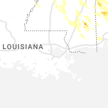
Mississippi
| Local Time | Report Details |
|---|---|
| 7:10 AM CDT | Quarter sized hail reported near Mc Lain, MS, 54.6 miles WNW of Mobile, AL, quarter size hail reported in the community of mclain. shared via facebook. time estimated from radar. |
| 8:26 AM CDT | Multiple trees and power lines down throughout the count in warren county MS, 34.2 miles WNW of Jackson, MS |
| 2:20 PM CDT | Quarter sized hail reported near Ripley, MS, 68.8 miles ESE of Memphis, TN, quarter size hail fell in ripley. time is radar estimated. |
| 3:31 PM CDT | Half Dollar sized hail reported near Olive Branch, MS, 16.2 miles SE of Memphis, TN, report from mping: half dollar (1.25 in.). |
| 3:36 PM CDT | Large tree limbs and trees down in north have in union county MS, 73.4 miles N of Starkville, MS |
| 3:46 PM CDT | Quarter sized hail reported near New Albany, MS, 72.9 miles N of Starkville, MS |
| 4:06 PM CDT | Tree down on roa in desoto county MS, 27.1 miles SSE of Memphis, TN |
| 4:19 PM CDT | Quarter sized hail reported near Hernando, MS, 26.9 miles SSE of Memphis, TN |
| 4:25 PM CDT | Golf Ball sized hail reported near Coldwater, MS, 33.6 miles SSE of Memphis, TN |
| 4:30 PM CDT | Golf Ball sized hail reported near Coldwater, MS, 33.6 miles SSE of Memphis, TN, corrects previous hail report from 1 w independence. |
| 4:30 PM CDT | Corrects previous tstm wnd dmg report from new albany. minor roof damage to home. also trees and powerlines down in tow in union county MS, 72.3 miles N of Starkville, MS |
| 4:30 PM CDT | Corrects previous tstm wnd dmg report from new albany. minor roof damage to home. also trees and powerlines down in tow in union county MS, 72.3 miles N of Starkville, MS |
| 4:30 PM CDT | Tea Cup sized hail reported near Hamilton, MS, 26.9 miles NE of Starkville, MS, photos of 3-inch hail southwest of new hamilton. time estimated by radar. |
| 4:35 PM CDT | Golf Ball sized hail reported near Hamilton, MS, 27.7 miles NE of Starkville, MS, corrects previous hail report from 1 ssw new hamilton. |
| 4:35 PM CDT | Quarter sized hail reported near Hamilton, MS, 27.7 miles NE of Starkville, MS |
| 4:42 PM CDT | Tennis Ball sized hail reported near Richton, MS, 67.9 miles NW of Mobile, AL, social media picture of tennis ball hail just outside richton... ms city limits. time using radar. |
| 4:42 PM CDT | Grapefruit sized hail reported near Caledonia, MS, 27 miles ENE of Starkville, MS, softball to ping pong sized hail reported in the caledonia area shared. |
| 4:43 PM CDT | Public reports a broken power pole with lines dow in union county MS, 71.6 miles N of Starkville, MS |
| 4:44 PM CDT | Golf Ball sized hail reported near Caledonia, MS, 32.9 miles ENE of Starkville, MS, ping pong to golf ball sized hail reported in caledonia. |
| 4:45 PM CDT | Quarter sized hail reported near Caledonia, MS, 32.5 miles ENE of Starkville, MS, quarter sized hail reported in caledonia. |
| 4:49 PM CDT | Tennis Ball sized hail reported near Richton, MS, 64.9 miles NW of Mobile, AL, social media picture of tennis ball hail in hiltonville... ms. time using radar. |
| 4:55 PM CDT | Trees down in ecr in pontotoc county MS, 62.2 miles NNW of Starkville, MS |
| 4:56 PM CDT | Grapefruit sized hail reported near Columbus, MS, 25.5 miles ENE of Starkville, MS, softball sized hail reported in columbus. |
| 5:01 PM CDT | Golf Ball sized hail reported near Aberdeen, MS, 32.5 miles NNE of Starkville, MS, corrects previous hail report from 6 ne aberdeen. trained spotter reports golf ball size hail on light rock road. |
| 5:01 PM CDT | Golf Ball sized hail reported near Amory, MS, 35 miles NNE of Starkville, MS, trained spotter reports golf ball size hail on light rock road. |
| 5:03 PM CDT | Quarter sized hail reported near Aberdeen, MS, 28.7 miles NNE of Starkville, MS |
| 5:20 PM CDT | Softball sized hail reported near Caledonia, MS, 28 miles ENE of Starkville, MS, at least two reports via social media of hail stones sizes estimated to be bigger than 4.5 inches from the caledonia area. |
| 6:10 PM CDT | Two trees down around west point... one on waverly mansion roa in clay county MS, 18.9 miles ENE of Starkville, MS |
| 6:30 PM CDT | Tree down near old port gibson road and rocky springs churc in claiborne county MS, 39.6 miles WSW of Jackson, MS |
| 6:35 PM CDT | Tree down on barland roa in claiborne county MS, 48.8 miles SW of Jackson, MS |
| 6:40 PM CDT | Hen Egg sized hail reported near Columbus, MS, 27.9 miles E of Starkville, MS, one to two inch hail reported in new hope via social media. |
| 6:54 PM CDT | Trees down on highway 14 near boon roa in winston county MS, 26.6 miles SSW of Starkville, MS |
| 8:10 PM CDT | Grapefruit sized hail reported near Cleveland, MS, 94.9 miles NE of Bastrop, LA, softball sized hail reported in cleveland. |
| 8:10 PM CDT | Hen Egg sized hail reported near Cleveland, MS, 94.9 miles NE of Bastrop, LA, corrects previous hail report from 1 sw cleveland. hail near two inches reported. |
| 8:13 PM CDT | Tennis Ball sized hail reported near Cleveland, MS, 96.3 miles NE of Bastrop, LA, golf ball to tennis ball hail being reported around cleveland. |
| 8:40 PM CDT | Golf Ball sized hail reported near Decatur, MS, 69.5 miles E of Jackson, MS, golf ball sized hail reported. |
| 9:00 PM CDT | Tree down on leflore county road 269 near swiftow in leflore county MS, 70.1 miles NNW of Jackson, MS |
| 9:23 PM CDT | Quarter sized hail reported near Perkinston, MS, 52.8 miles W of Mobile, AL, report from mping: quarter (1.00 in.). |
| 10:47 PM CDT | Trees down hwy 84 and jeffie craven roa in jones county MS, 80.5 miles ESE of Jackson, MS |
| 10:47 PM CDT | Trees down on highway 28 about 3 miles outside of calhou in jones county MS, 68.1 miles SE of Jackson, MS |
| 11:57 PM CDT | Tree down on interstate 59 at mile marker 5 in forrest county MS, 84.3 miles WNW of Mobile, AL |
Alabama
| Local Time | Report Details |
|---|---|
| 7:23 AM CDT | Emergency management reports roof damage to a building in the community of chatom. time estimated from rada in washington county AL, 55.2 miles NNW of Mobile, AL |
| 7:42 AM CDT | Trees down and power outages south of dixons mills along hwy 4 in marengo county AL, 28.2 miles W of Camden, AL |
| 7:50 AM CDT | Corrects previous tstm wnd gst report from 4 s barrytown. clarke county ema estimates 60-70 mph winds near the intersection of u.s. highway 43 and baugh rd. numerous tr in clarke county AL, 32.4 miles WSW of Camden, AL |
| 7:50 AM CDT | Clarke county ema estimates 60-70 mph winds near the intersection of u.s. highway 43 and baugh rd. numerous tree limbs on the roa in choctaw county AL, 58.3 miles WSW of Camden, AL |
| 7:52 AM CDT | Trees and power lines dow in clarke county AL, 34.2 miles SW of Camden, AL |
| 7:55 AM CDT | Broadcast media reports tress down with empty storage buildings flipped. time estimated by rada in mobile county AL, 29.9 miles NNW of Mobile, AL |
| 8:00 AM CDT | Thunderstorm wind damage at this location including 2 vehicles with windows blown out... a small camper rolled... and tree down. time estimated by rada in baldwin county AL, 17.1 miles ESE of Mobile, AL |
| 8:00 AM CDT | Report of a capsized barge on the mobile river with search and rescue. possible tornado. time estimated by rada in mobile county AL, 23 miles NNE of Mobile, AL |
| 8:15 AM CDT | Measured wind gust by alabama a&m mesonet site located on perdido river farms between 90 to 100mph. extensive damage also reported on the farms including multiple farm in escambia county AL, 41.8 miles NE of Mobile, AL |
| 8:16 AM CDT | Trees dow in baldwin county AL, 33.6 miles NE of Mobile, AL |
| 8:17 AM CDT | Public photo of multiple trees uprooted and some outbuilding structure damage. time estimated by rada in baldwin county AL, 21.5 miles NE of Mobile, AL |
| 8:38 AM CDT | Social media report with photos of uprooted trees on appleton road. time estimated by rada in escambia county AL, 54.2 miles S of Camden, AL |
| 8:40 AM CDT | Emergency manager reports widespread trees and powerlines down throughout the county. time estimated by rada in conecuh county AL, 43.1 miles SSE of Camden, AL |
| 8:40 AM CDT | Numerous trees and powerlines dow in escambia county AL, 62.9 miles SSE of Camden, AL |
| 8:41 AM CDT | Uprooted tree and downed power line on douglas lane. time estimated by rada in escambia county AL, 60.2 miles SSE of Camden, AL |
| 8:45 AM CDT | Social media picture showing large tree fell on a church on sowell rd in brewton al. time using rada in escambia county AL, 61 miles SSE of Camden, AL |
| 9:11 AM CDT | Report from em of tree falling onto a couple of car in covington county AL, 64.2 miles N of Miramar Beach, FL |
| 9:16 AM CDT | Public report with photo of a snapped pine tree on highway 84 between opp and andalusia. time estimated by rada in covington county AL, 63 miles N of Miramar Beach, FL |
| 9:17 AM CDT | Emergency manager relays widespread trees and powerlines down across the county. time estimated by rada in crenshaw county AL, 62.3 miles ESE of Camden, AL |
| 9:32 AM CDT | Near severe wind gusts at k79 in covington county AL, 62.6 miles N of Miramar Beach, FL |
| 9:40 AM CDT | Near severe wind gusts at k0j in covington county AL, 43.1 miles N of Miramar Beach, FL |
| 9:40 AM CDT | Several trees down in geneva count in geneva county AL, 53.9 miles NNE of Miramar Beach, FL |
| 9:48 AM CDT | Several trees down in coffee count in coffee county AL, 73.9 miles NNE of Miramar Beach, FL |
| 5:12 PM CDT | A few trees were blown down near millpor in lamar county AL, 39.4 miles E of Starkville, MS |
| 5:12 PM CDT | Quarter sized hail reported near Ethelsville, AL, 31.4 miles E of Starkville, MS |
| 5:18 PM CDT | A few trees were blown down around detroi in lamar county AL, 53.7 miles NE of Starkville, MS |
| 5:18 PM CDT | A few trees were blown down around sulligen in lamar county AL, 49.4 miles NE of Starkville, MS |
| 5:26 PM CDT | Baseball sized hail reported near Ethelsville, AL, 31.4 miles E of Starkville, MS, corrects previous hail report from forest. hail covering the ground. |
| 5:26 PM CDT | Baseball sized hail reported near Ethelsville, AL, 30.8 miles E of Starkville, MS, hail covering the ground. |
| 5:40 PM CDT | Baseball sized hail reported near Reform, AL, 42.6 miles E of Starkville, MS, social media photo of baseball sized hail in the coalfire area near reform. |
| 5:40 PM CDT | Golf Ball sized hail reported near Carrollton, AL, 41 miles ESE of Starkville, MS, hail up to 1 to 2 inches deep covering the ground. |
| 5:45 PM CDT | Quarter sized hail reported near Vincent, AL, 24.1 miles ESE of Birmingham, AL, hail up to quarter size. |
| 5:50 PM CDT | Quarter sized hail reported near Morris, AL, 15.9 miles N of Birmingham, AL, quarter sized hail reported in morris. |
| 5:50 PM CDT | Half Dollar sized hail reported near Morris, AL, 15.9 miles N of Birmingham, AL, corrects previous hail report from 1 e morris. quarter sized hail reported in morris. |
| 5:59 PM CDT | Golf Ball sized hail reported near Ethelsville, AL, 35 miles E of Starkville, MS, corrects storm report type. hail up to golf ball size in ethelsville. |
| 5:59 PM CDT | Hail up to golf ball size in ethelsvill in pickens county AL, 35 miles E of Starkville, MS |
| 6:06 PM CDT | Trees were blown down in gordo. at least one home sustained damag in pickens county AL, 53.7 miles E of Starkville, MS |
| 6:09 PM CDT | Ping Pong Ball sized hail reported near Pinson, AL, 16.9 miles NNE of Birmingham, AL, corrects previous hail report from 2 wnw palmerdale. social media photos of large hail in palmerdale. |
| 6:09 PM CDT | Quarter sized hail reported near Pinson, AL, 16.9 miles NNE of Birmingham, AL |
| 6:18 PM CDT | Quarter sized hail reported near Pinson, AL, 18.7 miles NNE of Birmingham, AL |
| 6:20 PM CDT | Quarter sized hail reported near Talladega, AL, 39.3 miles ESE of Birmingham, AL, social media photos and videos of dime to quarter size hail southwest of talladega. |
| 6:22 PM CDT | Tennis Ball sized hail reported near Gordo, AL, 51.7 miles ESE of Starkville, MS, ema reports 3 cars with busted windows and a home with busted windows from hail. hail size estimated. |
| 6:50 PM CDT | Tree down across i-20 near fosters. time estimated by rada in tuscaloosa county AL, 60.4 miles WSW of Birmingham, AL |
| 6:50 PM CDT | Numerous trees down on hwy 11... some on houses and cars. time estimated by rada in tuscaloosa county AL, 61.1 miles WSW of Birmingham, AL |
| 6:52 PM CDT | Large hardwood trees were blown down and blocking the roadway on speed mills roa in pickens county AL, 45.7 miles ESE of Starkville, MS |
| 6:56 PM CDT | Trees were blown down and blocking the roadwa in greene county AL, 58.6 miles ESE of Starkville, MS |
| 6:58 PM CDT | Ema reports windows blown out of a building due to wind driven hail. time using rada in clarke county AL, 35.6 miles SW of Camden, AL |
| 6:58 PM CDT | Hen Egg sized hail reported near Grove Hill, AL, 35.6 miles SW of Camden, AL, ema reports hen egg size hail in grove hill. time using radar. |
| 6:59 PM CDT | Corrects previous tstm wnd dmg report from knoxville. numerous trees were blown down on northbound and southbound i20/5 in greene county AL, 66.9 miles WSW of Birmingham, AL |
| 7:01 PM CDT | Quarter sized hail reported near Grove Hill, AL, 34.8 miles SW of Camden, AL, numerous reports of quarter hail in grove hill per ema. |
| 7:17 PM CDT | Quarter sized hail reported near Eutaw, AL, 66.6 miles NNW of Camden, AL, quarter size hail east of eutaw. relayed through social media. |
| 7:20 PM CDT | Several trees blown down in akro in hale county AL, 66.5 miles NNW of Camden, AL |
| 7:30 PM CDT | Trees and power lines were blown down north of greensbor in hale county AL, 57 miles NNW of Camden, AL |
| 7:36 PM CDT | Half Dollar sized hail reported near Forkland, AL, 56.9 miles NW of Camden, AL, social media photo of large hail in forkland. |
| 7:40 PM CDT | Trees were blown down on pearson chapel roa in tallapoosa county AL, 39.2 miles NW of Auburn, AL |
| 7:40 PM CDT | Ping Pong Ball sized hail reported near York, AL, 69.4 miles WNW of Camden, AL, ping pong ball sized hail estimated at exit 8 on i-20/59. |
| 7:42 PM CDT | Several trees were blown down on dejarnett roa in tallapoosa county AL, 38.3 miles NW of Auburn, AL |
| 7:42 PM CDT | Corrects previous tstm wnd dmg report from 3 sse dixons mill. trees down and power outages south of dixons mills along hwy 4 in marengo county AL, 28.2 miles W of Camden, AL |
| 7:43 PM CDT | Several trees down near forkland campgroun in greene county AL, 55.8 miles NW of Camden, AL |
| 7:45 PM CDT | Ping Pong Ball sized hail reported near Livingston, AL, 66.8 miles NW of Camden, AL |
| 7:47 PM CDT | Trees were blown down on highway 63 north and were blocking the roadway. two vehicles hit the downed trees. unknown injuries occurre in tallapoosa county AL, 39 miles NW of Auburn, AL |
| 7:50 PM CDT | Golf Ball sized hail reported near York, AL, 67.5 miles WNW of Camden, AL |
| 7:56 PM CDT | Half Dollar sized hail reported near Camden, AL, 0.2 miles S of Camden, AL, social media picture of quarter to half dollar size hail in camden. time using radar. |
| 7:59 PM CDT | Numerous trees were blown down on northbound and southbound i20/5 in greene county AL, 66.9 miles WSW of Birmingham, AL |
| 8:00 PM CDT | 30-40 trees were blown down around cub in sumter county AL, 70 miles WNW of Camden, AL |
| 8:06 PM CDT | Trees were blown down on west lafayette street and were blocking the roadwa in tallapoosa county AL, 22.7 miles NW of Auburn, AL |
| 8:12 PM CDT | Trees were blown down on highway 2 in marengo county AL, 46.8 miles NW of Camden, AL |
| 8:25 PM CDT | Trees were blown down around thomasto in marengo county AL, 27.6 miles NW of Camden, AL |
| 8:30 PM CDT | Trees were blown down around dixons mil in marengo county AL, 29.7 miles W of Camden, AL |
| 10:06 PM CDT | Numerous reports of trees down and various wind damage across pike count in pike county AL, 62 miles SSW of Auburn, AL |
| 10:36 PM CDT | Trees down across the northern portion of coffee count in coffee county AL, 73.7 miles SSW of Auburn, AL |
| 10:55 PM CDT | Ema reports trees down along i65 nb near mile marker 31. time using rada in baldwin county AL, 21.5 miles NNE of Mobile, AL |
| 12:14 AM CDT | Quarter sized hail reported near Mobile, AL, 9.3 miles W of Mobile, AL, social media photo of hail ranging from nickel to quarter size about a mile east of kmob. |
| 12:14 AM CDT | Half Dollar sized hail reported near Mobile, AL, 9.5 miles W of Mobile, AL, social media photo of hail ranging from nickel to half dollar sized. time using radar. |
| 12:28 AM CDT | Local chaser reports trees snapped... powerlines down... and half of home roof missing due to possible tornad in mobile county AL, 17.5 miles SW of Mobile, AL |
| 12:55 AM CDT | Tempest station recorded a wind gust of 53 knot in baldwin county AL, 14.5 miles SSE of Mobile, AL |
Pennsylvania
| Local Time | Report Details |
|---|---|
| 10:40 AM EDT | Multiple trees and branches down on wires along lancaster pike. time estimated by rada in lancaster county PA, 45.8 miles NNE of Baltimore, MD |
| 10:52 AM EDT | Trees and wires down on a mobile home. time estimated by rada in lancaster county PA, 48.5 miles NNE of Baltimore, MD |
| 11:15 AM EDT | Pictures on social media shows numerous tree damage including some trees on power lines in parts of west caln township. time estimated from rada in chester county PA, 63.7 miles NE of Baltimore, MD |
| 11:20 AM EDT | Downed tree in wires on hibernia road. time estimated from rada in chester county PA, 64.9 miles NE of Baltimore, MD |
| 11:22 AM EDT | Severe trees with branches twisted off about 10 feet above the ground with numerous other trees down. time estimated from rada in chester county PA, 66.3 miles NE of Baltimore, MD |
| 11:55 AM EDT | Quarter sized hail reported near Norristown, PA, 80.3 miles WSW of Brooklyn, NY |
| 12:09 PM EDT | Report from mping: 1-inch tree limbs broken; shingles blown of in montgomery county PA, 81.4 miles WSW of Brooklyn, NY |
Delaware
| Local Time | Report Details |
|---|---|
| 11:50 AM EDT | Quarter sized hail reported near New Castle, DE, 60.8 miles ENE of Baltimore, MD |
| 11:56 AM EDT | Quarter sized hail reported near New Castle, DE, 63.9 miles ENE of Baltimore, MD, trained spotter relayed report of quarter sized hail near the delaware memorial bridge on the delaware side. time estimated from radar. |
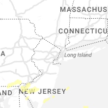
New Jersey
| Local Time | Report Details |
|---|---|
| 12:00 PM EDT | Lower alloways creek nj weather net statio in salem county NJ, 58.7 miles ENE of Baltimore, MD |
| 12:05 PM EDT | Quarter sized hail reported near Pennsville, NJ, 63.3 miles ENE of Baltimore, MD |
| 12:18 PM EDT | Report from mping: 1-inch tree limbs broken. time estimated from rada in gloucester county NJ, 82.7 miles ENE of Baltimore, MD |
| 12:37 PM EDT | Report of tree down on old marlton pike w. time estimated from rada in burlington county NJ, 74.7 miles SW of Brooklyn, NY |
| 12:53 PM EDT | Report from mping: 3-inch tree limbs broken; power poles broken. time estimated from rada in burlington county NJ, 65.8 miles SW of Brooklyn, NY |
| 12:55 PM EDT | Trees down on ongs hat road and stocktons bridge road just east of buddtown. time estimated from rada in burlington county NJ, 63.7 miles SW of Brooklyn, NY |
| 12:56 PM EDT | Large tree limbs down on a powerline and powerline is smoking. time estimated via rada in burlington county NJ, 62.8 miles SSW of Brooklyn, NY |
| 1:05 PM EDT | Corrects previous tstm wnd gst report from 2 e fort dix. 61 mph thunderstorm wind gust measured at joint bas in burlington county NJ, 56.2 miles SW of Brooklyn, NY |
| 1:08 PM EDT | 61 mph thunderstorm wind gust measured at joint bas in burlington county NJ, 56.2 miles SW of Brooklyn, NY |
| 1:25 PM EDT | Trees down in lakehurst. time estimated from rada in ocean county NJ, 49.8 miles SSW of Brooklyn, NY |
| 1:37 PM EDT | Trees and power lines down in brick. time estimated from rada in ocean county NJ, 44.3 miles S of Brooklyn, NY |
Virginia
| Local Time | Report Details |
|---|---|
| 1:26 PM EDT | Tree knocked down at prince edward hwy and tuggle road. time estimated from rada in prince edward county VA, 51.9 miles WSW of Richmond, VA |
| 1:34 PM EDT | Six trees blown dow in rockbridge county VA, 49 miles NE of Roanoke, VA |
| 1:36 PM EDT | Thunderstorm winds blew down a tree along the 600 block of mohele roa in buckingham county VA, 45.6 miles WSW of Richmond, VA |
| 1:50 PM EDT | Tree down near us-460 and poorhouse r in prince edward county VA, 40.9 miles WSW of Richmond, VA |
| 2:05 PM EDT | Two trees down across us-60 in the vicinity of cartersville r in cumberland county VA, 30.7 miles W of Richmond, VA |
| 2:08 PM EDT | Tree down across route 657 near genito roa in amelia county VA, 33.6 miles WSW of Richmond, VA |
| 2:10 PM EDT | Quarter sized hail reported near Gloucester, VA, 55.3 miles NNW of Virginia Beach, VA, one inch hail report received via social media from the ark area of gloucester. time estimated. |
| 2:13 PM EDT | Metal shed blown from concrete slab into side of house... damaging vinyl siding and hvac uni in rockbridge county VA, 36.6 miles NE of Roanoke, VA |
| 2:13 PM EDT | Metal shed blown from concrete slab into side of house... damaging vinyl siding and hvac uni in rockbridge county VA, 36.6 miles NE of Roanoke, VA |
| 2:28 PM EDT | Multiple trees down around thomas nelson hwy & river roa in nelson county VA, 68.4 miles WNW of Richmond, VA |
| 2:30 PM EDT | Large limbs and powerlines blocking caroline av in city of portsmouth county VA, 17.5 miles WNW of Virginia Beach, VA |
| 2:30 PM EDT | Thunderstorm winds blew down multiple trees on to seminole drive near the intersection with vinecrest cour in henry county VA, 36.7 miles S of Roanoke, VA |
| 2:32 PM EDT | Thunderstorm winds blew down a tree at the intersection of colonial drive and plantation driv in henry county VA, 36.7 miles S of Roanoke, VA |
| 2:37 PM EDT | Thunderstorm winds blew down a tree near the intersection of barrows mill road and nautica wa in henry county VA, 38.3 miles S of Roanoke, VA |
| 2:38 PM EDT | Quarter sized hail reported near Amherst, VA, 61.6 miles ENE of Roanoke, VA, report from tye river pottery |
| 2:42 PM EDT | Measured by lafayette river wxflow station in city of norfolk county VA, 16.7 miles NW of Virginia Beach, VA |
| 2:42 PM EDT | Ping Pong Ball sized hail reported near Chesterfield, VA, 7.3 miles SSW of Richmond, VA |
| 2:45 PM EDT | Spotter reports streets blocked off by police due to large limbs in the roa in city of portsmouth county VA, 18.4 miles WNW of Virginia Beach, VA |
| 2:45 PM EDT | Power line blown down onto truc in henry county VA, 40.6 miles S of Roanoke, VA |
| 2:49 PM EDT | Half Dollar sized hail reported near Norfolk, VA, 16.7 miles NW of Virginia Beach, VA |
| 2:50 PM EDT | Quarter sized hail reported near Midlothian, VA, 6 miles SSE of Richmond, VA, picture of quarter size hail along twelveoaks rd in chesterfield on social media. |
| 2:55 PM EDT | Tree down across taylor roa in chesterfield county VA, 12.2 miles SSW of Richmond, VA |
| 2:55 PM EDT | Thunderstorm winds blew down a tree near axton school roa in henry county VA, 44.1 miles SSE of Roanoke, VA |
| 2:56 PM EDT | Thunderstorm winds blew down a tree on route 58 near the intersection with mountain valley roa in henry county VA, 44.1 miles SSE of Roanoke, VA |
| 3:00 PM EDT | Quarter sized hail reported near Norfolk, VA, 12.5 miles NW of Virginia Beach, VA |
| 3:00 PM EDT | Tree down across route 4731 near deer thicket lan in chesterfield county VA, 7.2 miles S of Richmond, VA |
| 3:04 PM EDT | Trees down along thicket lane and route 4731. all lanes blocke in chesterfield county VA, 7.2 miles S of Richmond, VA |
| 3:05 PM EDT | Tree knocked down and multiple large limbs down. time estimated from rada in chesterfield county VA, 13.3 miles SE of Richmond, VA |
| 3:06 PM EDT | Tree down along oak hill roa in buckingham county VA, 49.5 miles W of Richmond, VA |
| 3:07 PM EDT | Numerous trees down near matoaca. damage was reported as intense in an isolated are in dinwiddie county VA, 21.1 miles SSE of Richmond, VA |
| 3:08 PM EDT | Quarter sized hail reported near Buckingham, VA, 51.7 miles W of Richmond, VA |
| 3:08 PM EDT | Hail up to the size of quarters fell at the courthouse in buckingha in buckingham county VA, 50 miles W of Richmond, VA |
| 3:08 PM EDT | Quarter sized hail reported near Buckingham, VA, 50 miles W of Richmond, VA, hail up to the size of quarters fell at the courthouse in buckingham. |
| 3:13 PM EDT | Tree down across route 669 in the vicinity of church roa in chesterfield county VA, 19.1 miles SSE of Richmond, VA |
| 3:14 PM EDT | Tree down near andersonville roa in buckingham county VA, 46.6 miles W of Richmond, VA |
| 3:15 PM EDT | Thunderstorm winds blew down a tree along the 900 block of andersonville roa in buckingham county VA, 53.9 miles W of Richmond, VA |
| 3:17 PM EDT | Tree down at the intersection of e james anderson hwy and whetstone lan in buckingham county VA, 44.4 miles W of Richmond, VA |
| 3:18 PM EDT | York river east rear range light (ykrv2) tower reported wind gust of 53kt in anz632 county VA, 38 miles NNW of Virginia Beach, VA |
| 3:18 PM EDT | Tree down across route 752 in the vicinity of river roa in chesterfield county VA, 21.9 miles SSE of Richmond, VA |
| 3:20 PM EDT | Tree down blocking interstat in city of petersburg county VA, 23.7 miles SE of Richmond, VA |
| 3:20 PM EDT | Several trees down near w. main stree in city of danville county VA, 56 miles SSE of Roanoke, VA |
| 3:21 PM EDT | A couple of trees down in ballou par in city of danville county VA, 56.3 miles SSE of Roanoke, VA |
| 3:22 PM EDT | Wset relayed a report from a viewer of considerable wind damage to trees in the westover hills area on the west side of danville. several trees fell on homes causing st in city of danville county VA, 53.7 miles SSE of Roanoke, VA |
| 3:22 PM EDT | Thunderstorm winds blew out a window at the danville regional hospita in city of danville county VA, 56 miles SSE of Roanoke, VA |
| 3:23 PM EDT | Trees down along route 630 at mica dr and route 721. all lanes blocke in prince george county VA, 26.6 miles SE of Richmond, VA |
| 3:26 PM EDT | Corrects previous tstm wnd dmg report from 2 nne south boston. tree down on the north side of south bosto in halifax county VA, 66.6 miles NNW of Raleigh, NC |
| 3:28 PM EDT | Tree down on the north side of south bosto in halifax county VA, 66.6 miles NNW of Raleigh, NC |
| 3:28 PM EDT | Tree down in the city of south bosto in halifax county VA, 66.2 miles NNW of Raleigh, NC |
| 3:29 PM EDT | Quarter sized hail reported near Green Bay, VA, 44.5 miles SW of Richmond, VA |
| 3:29 PM EDT | Shed blown over. time estimated from rada in city of hopewell county VA, 24.3 miles SE of Richmond, VA |
| 3:30 PM EDT | Large tree blocking the roa in prince george county VA, 30.4 miles SSE of Richmond, VA |
| 3:31 PM EDT | One tree down near the intersection of berry hill road and river road on the west side of south bosto in halifax county VA, 66.5 miles NNW of Raleigh, NC |
| 3:31 PM EDT | One tree down near the intersection of berry hill road and river road on the west side of south bosto in halifax county VA, 66.5 miles NNW of Raleigh, NC |
| 3:35 PM EDT | Numerous trees down along portions of route 45 from the cumberland courthouse south to farmville in cumberland county VA, 40.2 miles W of Richmond, VA |
| 3:40 PM EDT | Corrects previous tstm wnd dmg report from 4 e south boston. tree down from thunderstorm winds. hail reported as well... but size unknow in halifax county VA, 63.2 miles N of Raleigh, NC |
| 3:40 PM EDT | Corrects previous tstm wnd dmg report from 4 e south boston. tree down from thunderstorm winds. hail reported as well... but size unknow in halifax county VA, 63.2 miles N of Raleigh, NC |
| 3:50 PM EDT | Extensive tree damage off of rodophil rd. multiple large limbs knocked down as well. time estimated from rada in amelia county VA, 29.5 miles WSW of Richmond, VA |
| 3:56 PM EDT | Quarter sized hail reported near Berryville, VA, 73.5 miles W of Baltimore, MD, quarter-sized hail estimated |
| 3:56 PM EDT | Quarter sized hail reported near Berryville, VA, 72.4 miles W of Baltimore, MD |
| 3:57 PM EDT | Trees down along highway 460 at disputant in prince george county VA, 35.2 miles SE of Richmond, VA |
| 3:58 PM EDT | Trees down in the vicinity of rodophil road and route 620. all lanes are close in amelia county VA, 29.5 miles WSW of Richmond, VA |
| 4:00 PM EDT | Report of multiple trees down in the hungarytown road are in nottoway county VA, 38.5 miles SW of Richmond, VA |
| 4:05 PM EDT | Half Dollar sized hail reported near Amelia Court House, VA, 17.8 miles SW of Richmond, VA, video of quarter and half dollar sized hail on social media. |
| 4:12 PM EDT | Ping Pong Ball sized hail reported near Round Hill, VA, 66 miles W of Baltimore, MD |
| 4:12 PM EDT | Quarter sized hail reported near Round Hill, VA, 63.7 miles W of Baltimore, MD |
| 4:15 PM EDT | Half Dollar sized hail reported near Sutherland, VA, 21.5 miles SSE of Richmond, VA |
| 4:15 PM EDT | Hen Egg sized hail reported near Spring Grove, VA, 48 miles ESE of Richmond, VA, picture of 2 inch hail at pipsico scout reservation. time estimated. |
| 4:41 PM EDT | Golf Ball sized hail reported near Locust Grove, VA, 60 miles N of Richmond, VA, twitter video of half-dollar to golf ball-sized hailstones bouncing off the grass. |
| 4:55 PM EDT | Quarter sized hail reported near Richardsville, VA, 59.1 miles N of Richmond, VA |
| 4:58 PM EDT | Trees down in hilton villag in city of newport ne county VA, 29.2 miles NW of Virginia Beach, VA |
| 5:00 PM EDT | Corrects previous tstm wnd dmg report from 3 ene carrollton -- vadot station on james river bridge reported 72kt gus in isle of wight county VA, 29 miles WNW of Virginia Beach, VA |
| 5:00 PM EDT | Corrects previous tstm wnd dmg report from 3 ene carrollton -- vadot station on james river bridge reported 72kt gus in isle of wight county VA, 29 miles WNW of Virginia Beach, VA |
| 5:03 PM EDT | Numerous trees down across southern newport news. winds of 83 mph measured at the jr in city of newport ne county VA, 24.5 miles NW of Virginia Beach, VA |
| 5:10 PM EDT | Quarter sized hail reported near Newport News, VA, 27 miles NW of Virginia Beach, VA, quarter size hail reported at orcutt ave. |
| 5:15 PM EDT | Quarter sized hail reported near Norfolk, VA, 16.3 miles NW of Virginia Beach, VA, quarter size hail near wards corner. video from social media. |
| 5:18 PM EDT | Willoughby degaussing station nos-ports site reported 52kt gus in anz638 county VA, 21.2 miles NW of Virginia Beach, VA |
| 5:18 PM EDT | Tree down on the 3000 block of plank road in city of fredericks county VA, 55.5 miles N of Richmond, VA |
| 5:19 PM EDT | Ngu site reported a 53kt gus in city of norfolk county VA, 18.5 miles NW of Virginia Beach, VA |
| 5:19 PM EDT | Quarter sized hail reported near Centreville, VA, 53.9 miles SW of Baltimore, MD |
| 5:25 PM EDT | Quarter sized hail reported near Norfolk, VA, 14.9 miles NW of Virginia Beach, VA, picture of quarter sized hail in wayne creek area of norfolk. |
| 5:25 PM EDT | Quarter sized hail reported near Fredericksburg, VA, 55.5 miles N of Richmond, VA |
| 5:27 PM EDT | Quarter sized hail reported near Fredericksburg, VA, 56.7 miles N of Richmond, VA |
| 5:27 PM EDT | Quarter sized hail reported near Norfolk, VA, 15.7 miles NW of Virginia Beach, VA |
| 5:32 PM EDT | Multiple trees knocked down near lake monticello. time estimated from rada in fluvanna county VA, 46.6 miles NW of Richmond, VA |
| 5:32 PM EDT | Quarter sized hail reported near Clifton, VA, 54.8 miles SW of Baltimore, MD, quarter size hail was reported in clifton. |
| 5:35 PM EDT | Corrects previous tstm wnd dmg report from 1 e nahor. multiple trees knocked down near lake monticello. time estimated from rada in fluvanna county VA, 46.6 miles NW of Richmond, VA |
| 5:37 PM EDT | Quarter sized hail reported near Virginia Beach, VA, 10.4 miles NW of Virginia Beach, VA, hail lasted for 15 minutes. |
| 5:38 PM EDT | Quarter sized hail reported near Suffolk, VA, 41.4 miles W of Virginia Beach, VA |
| 5:38 PM EDT | Quarter sized hail reported near Virginia Beach, VA, 11 miles NNE of Virginia Beach, VA |
| 5:45 PM EDT | Quarter sized hail reported near Palmyra, VA, 47 miles NW of Richmond, VA, mping report of 1 inch hail near lake monticello. |
| 6:00 PM EDT | Quarter sized hail reported near Palmyra, VA, 45.3 miles NW of Richmond, VA, photo on social media from broadcast media. |
| 7:15 PM EDT | Quarter sized hail reported near Tappahannock, VA, 51.5 miles NE of Richmond, VA |
| 7:24 PM EDT | Quarter sized hail reported near Tappahannock, VA, 51.6 miles ENE of Richmond, VA, report via mping. |
| 7:25 PM EDT | Quarter sized hail reported near Mineral, VA, 37.7 miles NNW of Richmond, VA |
| 8:05 PM EDT | Quarter sized hail reported near Lancaster, VA, 67.3 miles ENE of Richmond, VA |
Tennessee
| Local Time | Report Details |
|---|---|
| 2:05 PM CDT | Tree and power lines down at the intersection of reid hooker and monterey roads. time is radar estimate in shelby county TN, 20.9 miles E of Memphis, TN |
| 3:00 PM CDT | Media reports power line fell on a car on 72 and byhailia r in shelby county TN, 21.5 miles ESE of Memphis, TN |
| 3:07 PM CDT | Quarter sized hail reported near Memphis, TN, 4.2 miles N of Memphis, TN, quarter size hail fell for several minutes near general dewitt-spain airport. |
Arkansas
| Local Time | Report Details |
|---|---|
| 2:15 PM CDT | Large tree snapped. additional reports of trees and powerlines down across the communit in poinsett county AR, 29.3 miles NW of Memphis, TN |
| 2:26 PM CDT | Golf Ball sized hail reported near Jessieville, AR, 44.8 miles W of Little Rock, AR |
| 2:35 PM CDT | Quarter sized hail reported near Hot Springs Village, AR, 41.7 miles W of Little Rock, AR, report from mping: quarter (1.00 in.). |
| 2:38 PM CDT | Quarter sized hail reported near Hot Springs Village, AR, 41.6 miles W of Little Rock, AR, report from mping: quarter (1.00 in.). |
| 2:39 PM CDT | Baseball sized hail reported near Hot Springs Village, AR, 41.7 miles W of Little Rock, AR, emergency manager reports the ponce center in hot springs village as well as residential areas damaged by baseball size hail. |
| 2:53 PM CDT | Quarter sized hail reported near Lonsdale, AR, 33.7 miles WSW of Little Rock, AR |
| 3:01 PM CDT | Half Dollar sized hail reported near Benton, AR, 26.7 miles WSW of Little Rock, AR, report from mping: half dollar (1.25 in.). |
| 3:02 PM CDT | Quarter sized hail reported near Benton, AR, 27.7 miles WSW of Little Rock, AR, report from mping: quarter (1.00 in.). |
| 3:11 PM CDT | Golf Ball sized hail reported near Traskwood, AR, 29.3 miles SW of Little Rock, AR, corrects previous hail report from 2 e traskwood. fire department reports golf ball size hail covering the ground and continuing to fall. |
| 3:11 PM CDT | Baseball sized hail reported near Traskwood, AR, 29.3 miles SW of Little Rock, AR, fire department reports golf ball size hail covering the ground and continuing to fall. |
| 3:11 PM CDT | Quarter sized hail reported near Benton, AR, 24.3 miles SW of Little Rock, AR, golf ball size hail covering the ground at the intersection of highways 229 and 67. |
| 3:11 PM CDT | Quarter sized hail reported near Traskwood, AR, 30.5 miles SW of Little Rock, AR, golf ball sized hail reported at holy ridge road and house in traskwood. report received via ham radio. |
| 3:12 PM CDT | Quarter sized hail reported near Benton, AR, 26.5 miles SW of Little Rock, AR, report from mping: quarter (1.00 in.). |
| 3:23 PM CDT | Tree blown down on fairplay road. report received via ham radio net contro in saline county AR, 31 miles SW of Little Rock, AR |
| 3:39 PM CDT | Half Dollar sized hail reported near Sheridan, AR, 26.1 miles SSW of Little Rock, AR, report from mping: half dollar (1.25 in.). |
| 3:39 PM CDT | Ping Pong Ball sized hail reported near Sheridan, AR, 30.7 miles SSW of Little Rock, AR, report from mping: ping pong ball (1.50 in.). |
| 3:40 PM CDT | Baseball sized hail reported near Sheridan, AR, 31.2 miles SSW of Little Rock, AR, social media picture of baseball sized hail near the sheridan area. |
| 3:41 PM CDT | Quarter sized hail reported near Sheridan, AR, 31.1 miles SSW of Little Rock, AR, report from mping: quarter (1.00 in.). |
| 3:42 PM CDT | Quarter sized hail reported near Sheridan, AR, 31.2 miles SSW of Little Rock, AR, numerous quarter size hailstones in sheridan. |
| 7:12 PM CDT | Golf Ball sized hail reported near Tichnor, AR, 73.6 miles SE of Little Rock, AR, relayed via social media. |
North Carolina
| Local Time | Report Details |
|---|---|
| 3:27 PM EDT | Half Dollar sized hail reported near Providence, NC, 59.8 miles SSE of Roanoke, VA |
| 3:33 PM EDT | Thunderstorm winds blew down several trees in providenc in caswell county NC, 61.9 miles SSE of Roanoke, VA |
| 4:03 PM EDT | Trees down on lee chambers r in person county NC, 49.5 miles NNW of Raleigh, NC |
| 4:43 PM EDT | Numerous trees down around smithfield from the west side of town near mill swamp through downtown...rescue and battery par in johnston county NC, 25.5 miles SE of Raleigh, NC |
| 5:00 PM EDT | Several trees down in the efland... mebane... and hillsborough areas... including a tree down on a car in hillsborough... a tree down on a mobile home in efland... and in orange county NC, 33.2 miles NW of Raleigh, NC |
| 5:45 PM EDT | Franklin co em reports several trees down on cars... and other misc wind damage... such as damaged shed and playground equipmen in franklin county NC, 19.5 miles NE of Raleigh, NC |
| 5:46 PM EDT | Power outages due to fallen tree in wake county NC, 7.9 miles N of Raleigh, NC |
| 7:23 PM EDT | Quarter sized hail reported near Windsor, NC, 66.2 miles SW of Virginia Beach, VA |
| 7:40 PM EDT | High winds and large limbs down reported across southern perquiman in perquimans county NC, 49 miles SSW of Virginia Beach, VA |
| 8:17 PM EDT | Quarter sized hail reported near Creswell, NC, 63.8 miles SSW of Virginia Beach, VA, mping report of dime to quarter size hail near creswell. |
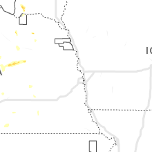
Missouri
| Local Time | Report Details |
|---|---|
| 3:45 PM CDT | Quarter sized hail reported near Hornersville, MO, 62.4 miles N of Memphis, TN, public reports quarter sized hail in hollywood... mo. |
| 3:59 PM CDT | Large tree branches down in senat in dunklin county MO, 67.9 miles N of Memphis, TN |
Colorado
| Local Time | Report Details |
|---|---|
| 3:15 PM MDT | Half Dollar sized hail reported near Limon, CO, 73.3 miles ESE of Denver, CO, falling at the time of report. |
| 3:22 PM MDT | Quarter sized hail reported near Limon, CO, 72.9 miles ESE of Denver, CO, report from mping: quarter (1.00 in.). |
| 3:25 PM MDT | Half Dollar sized hail reported near Limon, CO, 75.8 miles ESE of Denver, CO |
| 3:28 PM MDT | Quarter sized hail reported near Limon, CO, 75.1 miles ESE of Denver, CO, report via spotternetwork of quarter size... wind-driven hail west of limon. no estimate on wind speed provided. |
| 3:41 PM MDT | Ping Pong Ball sized hail reported near Limon, CO, 77.6 miles SW of Yuma, CO, hail still falling at the time of report. |
| 3:44 PM MDT | Quarter sized hail reported near Limon, CO, 77 miles SW of Yuma, CO, accumulating hail. up to 4 to 6 inches of hail just southeast of limon on highway 40/sh287. the largest hail was estimated to be quarter size. time estimated by radar. |
| 3:45 PM MDT | Tennis Ball sized hail reported near Limon, CO, 77 miles SW of Yuma, CO, corrects the time of the previous hail report from 3 ese limon. hail stone measured 2.60 inches in diameter three hours after the hail fell. |
| 3:47 PM MDT | Quarter sized hail reported near Monument, CO, 45.3 miles S of Denver, CO |
| 3:47 PM MDT | Quarter sized hail reported near Monument, CO, 45.9 miles SSE of Denver, CO |
| 3:57 PM MDT | Hen Egg sized hail reported near Genoa, CO, 74 miles SW of Yuma, CO, report via spotternetwork. |
| 4:04 PM MDT | Golf Ball sized hail reported near Hugo, CO, 76 miles SSW of Yuma, CO, report via spotternetwork. |
| 4:15 PM MDT | Golf Ball sized hail reported near Hugo, CO, 72.9 miles SSW of Yuma, CO, up to golf ball sized hail estimated. time estimated by radar. |
| 4:30 PM MDT | Hen Egg sized hail reported near Arriba, CO, 68.5 miles SSW of Yuma, CO, report via spotternetwork. time and location adjusted slightly south of sn report based on radar. |
| 5:54 PM MDT | Golf Ball sized hail reported near Seibert, CO, 63.2 miles S of Yuma, CO, trained spotter reports hail up to golf ball size. time estimated. |
| 6:45 PM MDT | Tennis Ball sized hail reported near Limon, CO, 77 miles SW of Yuma, CO, hail stone measured 2.60 inches in diameter three hours after the hail fell. |
| 8:25 PM MDT | Baseball sized hail reported near Springfield, CO, 102.2 miles WSW of Garden City, KS |
| 8:36 PM MDT | Baseball sized hail reported near Springfield, CO, 103.2 miles WSW of Garden City, KS |
| 8:40 PM MDT | Grapefruit sized hail reported near Springfield, CO, 102.7 miles WSW of Garden City, KS, it is closer to 3.75 inches. |
Nebraska
| Local Time | Report Details |
|---|---|
| 4:37 PM CDT | Quarter sized hail reported near Amherst, NE, 49.1 miles W of Grand Island, NE, report from local bar and grill. |
| 5:10 PM CDT | Quarter sized hail reported near Primrose, NE, 48.8 miles N of Grand Island, NE |
| 6:10 PM CDT | Quarter sized hail reported near Newman Grove, NE, 64 miles NNE of Grand Island, NE |
Maryland
| Local Time | Report Details |
|---|---|
| 6:14 PM EDT | Quarter sized hail reported near Marbury, MD, 57.9 miles SSW of Baltimore, MD |
| 6:33 PM EDT | Half Dollar sized hail reported near Port Tobacco, MD, 57.8 miles SSW of Baltimore, MD |
| 6:37 PM EDT | Quarter sized hail reported near La Plata, MD, 58 miles SSW of Baltimore, MD, q |
| 6:44 PM EDT | Trees down near the intersection of fairground road & bel alton newtown roa in charles county MD, 60.9 miles SSW of Baltimore, MD |
| 6:50 PM EDT | Quarter sized hail reported near La Plata, MD, 58.9 miles SSW of Baltimore, MD |
| 6:54 PM EDT | Quarter sized hail reported near Charlotte Hall, MD, 61.4 miles SSW of Baltimore, MD |
| 7:21 PM EDT | Multiple trees blew down on hurry road near bushwood roa in st. marys county MD, 64.8 miles S of Baltimore, MD |
Texas
| Local Time | Report Details |
|---|---|
| 5:40 PM CDT | Half Dollar sized hail reported near Fredericksburg, TX, 64.8 miles NNW of San Antonio, TX, picture sent of measured half dollar sized hail 3 nne fredericksburg. |
| 6:12 PM CDT | Grapefruit sized hail reported near Fredericksburg, TX, 60.6 miles NNW of San Antonio, TX, estimated 4 inch hail reported via twitter photo. there was an additional photo near this location with similar sized hail which corroborates this report. |
| 6:20 PM CDT | Half Dollar sized hail reported near Fredericksburg, TX, 64.5 miles NNW of San Antonio, TX, report from mping of half dollar hail (1.25 in.). |
| 6:29 PM CDT | Quarter sized hail reported near Fredericksburg, TX, 64.7 miles NNW of San Antonio, TX, video of estimated quarter size hail 4 w fredericksburg on us 290. |
| 6:30 PM CDT | Ping Pong Ball sized hail reported near West, TX, 55.8 miles NE of Killeen, TX, ping pong ball sized hail reported from social media picture. time estimated by radar. |
| 6:40 PM CDT | Half Dollar sized hail reported near Elm Mott, TX, 53.2 miles NE of Killeen, TX, social media report of quarters to half dollar sized hail in elm mott. time estimated by radar. |
| 6:55 PM CDT | Waco asos reports 51kt/59mph wind gust as of 6:55p in mclennan county TX, 44.2 miles NE of Killeen, TX |
| 7:00 PM CDT | Tree down in yard. time estimated both by radar and public repor in mclennan county TX, 42.7 miles NE of Killeen, TX |
| 7:18 PM CDT | Quarter sized hail reported near Waco, TX, 43.1 miles NE of Killeen, TX, broadcast media reports quarter sized hail falling at news station. time estimated by radar and report on social media. |
| 7:21 PM CDT | Hen Egg sized hail reported near Waco, TX, 42.6 miles ENE of Killeen, TX, 2 inch hail seen on social media near robinson. time estimated by radar. |
| 7:22 PM CDT | Ping Pong Ball sized hail reported near Lampasas, TX, 27.1 miles W of Killeen, TX, social media report of ping pong sized hail near lampasas. times estimated by radar. |
| 7:30 PM CDT | Golf Ball sized hail reported near Waco, TX, 43.7 miles NE of Killeen, TX, social media report of golf ball hail in robinson... tx. time given in report. |
| 7:31 PM CDT | Tea Cup sized hail reported near Lorena, TX, 35.6 miles ENE of Killeen, TX, social media picture of larger than baseball (approx. 3.25-3.5 inch) hail in lorena. time estimated by radar. |
| 7:35 PM CDT | Half Dollar sized hail reported near Lorena, TX, 40.6 miles ENE of Killeen, TX, report from mping: half dollar (1.25 in.). |
| 7:35 PM CDT | Quarter sized hail reported near Fredericksburg, TX, 63.5 miles NNW of San Antonio, TX, quarter sized hail reported on social media - noted they have had 4 round of hail. |
| 7:40 PM CDT | Golf Ball sized hail reported near Copperas Cove, TX, 14.2 miles NW of Killeen, TX, social media photo. |
| 7:56 PM CDT | Hen Egg sized hail reported near Tow, TX, 47 miles WSW of Killeen, TX, spotter reports 2.25 inch hail. |
| 8:10 PM CDT | Golf Ball sized hail reported near Lott, TX, 37 miles E of Killeen, TX, ham reports golf ball hail on cr 478 in durango. |
| 8:25 PM CDT | Quarter sized hail reported near Burnet, TX, 39.6 miles SW of Killeen, TX, media reports hail around a quarter via twitter video. |
| 9:15 PM CDT | Half Dollar sized hail reported near Leander, TX, 39.3 miles SSW of Killeen, TX, report from mping: half dollar (1.25 in.). |
| 9:17 PM CDT | Half Dollar sized hail reported near Leander, TX, 35.9 miles SSW of Killeen, TX, report from mping: half dollar (1.25 in.). |
| 9:39 PM CDT | Golf Ball sized hail reported near Cedar Park, TX, 43.7 miles S of Killeen, TX, spotter reports golf ball sized hail. |
| 9:42 PM CDT | Quarter sized hail reported near Junction, TX, 103.3 miles NE of Del Rio, TX, public reported quarter size hail near i-10 in the city of junction. |
| 10:05 PM CDT | Half Dollar sized hail reported near Austin, TX, 52.8 miles S of Killeen, TX, report from mping: half dollar (1.25 in.). |
| 10:14 PM CDT | Ping Pong Ball sized hail reported near Austin, TX, 53.5 miles S of Killeen, TX, spotter reports ping pong ball sized hail. |
| 10:45 PM CDT | Golf Ball sized hail reported near Junction, TX, 102.8 miles NE of Del Rio, TX |
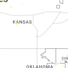
Kansas
| Local Time | Report Details |
|---|---|
| 8:50 PM CDT | Quarter sized hail reported near Grinnell, KS, 29.3 miles SE of Colby, KS, at least quarter size hail in grinnell at 850 pm cdt. tree leaves shredded. |
| 8:51 PM CDT | Quarter sized hail reported near Grinnell, KS, 29.3 miles SE of Colby, KS, report from mping: quarter (1.00 in.). |
| 8:55 PM CDT | Quarter sized hail reported near Grinnell, KS, 29.3 miles SE of Colby, KS, quarter size hail fell for 5-10 mins... enough to cover the ground. |
| 7:57 PM MDT | Hen Egg sized hail reported near Weskan, KS, 58.2 miles SW of Colby, KS, storm chaser report and photo via social media of 2.25 inch hail. |
| 8:59 PM CDT | Ping Pong Ball sized hail reported near Grinnell, KS, 29.3 miles SE of Colby, KS, report from mping: ping pong ball (1.50 in.). |
| 8:30 PM MDT | Quarter sized hail reported near Sharon Springs, KS, 44.7 miles WSW of Colby, KS, wallace county dispatch received numerous reports of pea to quarter size hail throughout northern portions of the county... particularly about 10 miles north of sharon |
| 9:44 PM MDT | Mesonet station cw6099 9 sse sharon springs. possible wet microburst with station recording 0.53 inches of rain falling within 10 minute in wallace county KS, 55.1 miles SW of Colby, KS |
| 10:50 PM CDT | Hen Egg sized hail reported near Oakley, KS, 24.5 miles SSE of Colby, KS, trained spotter report with photo via social media of hail up to 2 inches in diameter. |
Connect with Interactive Hail Maps